
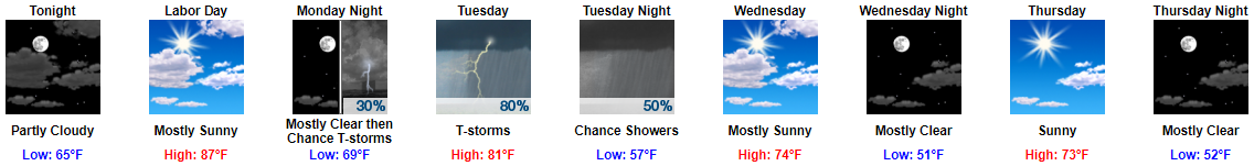
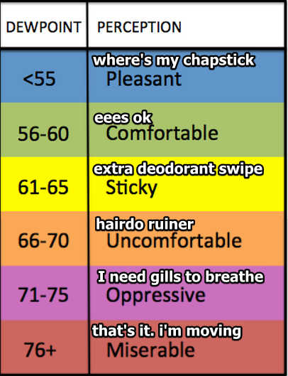
Monday (Labor Day) will be fantastic, even with dewpoints in the mid 60°s bringing sticky and uncomfortable humidity.
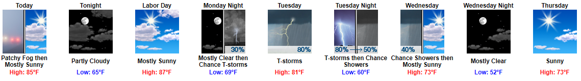
Rain & Storms Tuesday
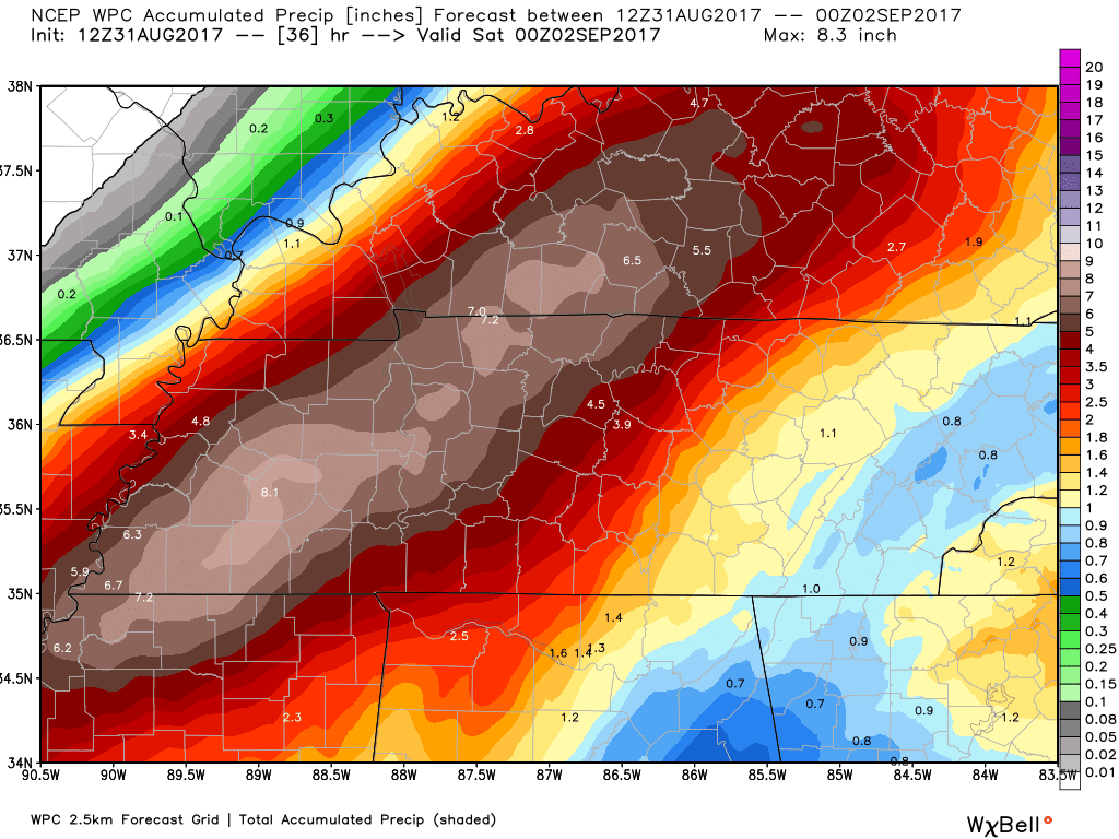
Rain should last most of Tuesday, clearing out Tuesday night. Most outdoor sports will suffer a rainout if we get 0.58″ (up from this morning’s 0.36″).
You must be logged in to post a comment.