
First and Foremost: Expect Forecast Revisions/Changes To This Forecast Tomorrow
Consult multiple, reliable sources of weather information.
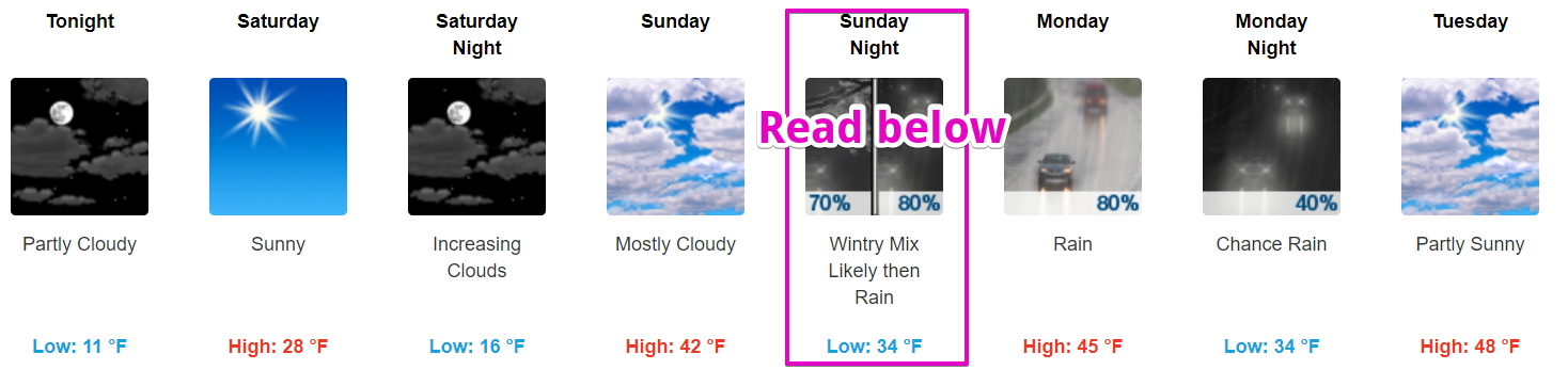
Rain Thursday
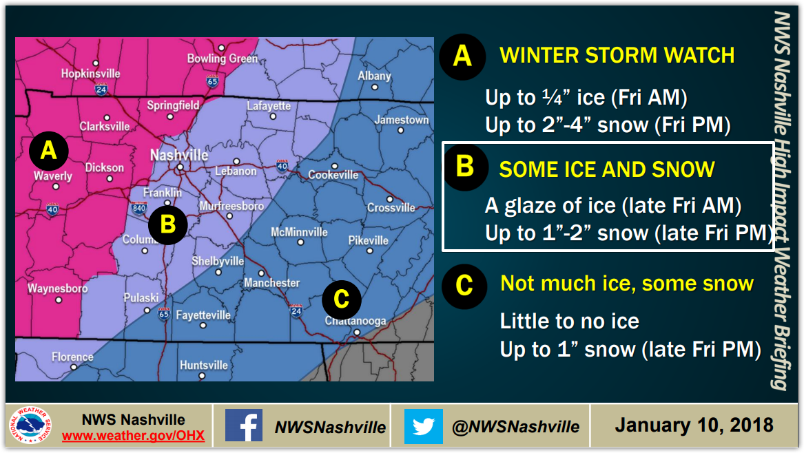
“Friday snow” will be hard to believe Thursday afternoon when it starts raining off and on and we are in the mid 60°s. Rain will be heavy at times, and last into Friday morning. Sometime Friday, rain should transition to sleet and/or freezing rain, and eventually snow.


You must be logged in to post a comment.