
The overnight low is 2°.
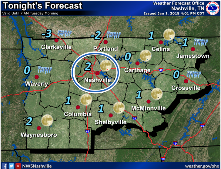
2° is expected shortly before dawn. Before then, 10° at 9 PM, 7° at midnight, 6° at 3 AM.
Note that’s the official forecast temp; locations around Davidson and Williamson Counties are often a few degrees colder.
Wind Chill Advisory
A Wind Chill Advisory is in effect beginning at 9 PM, lasting through noon tomorrow.
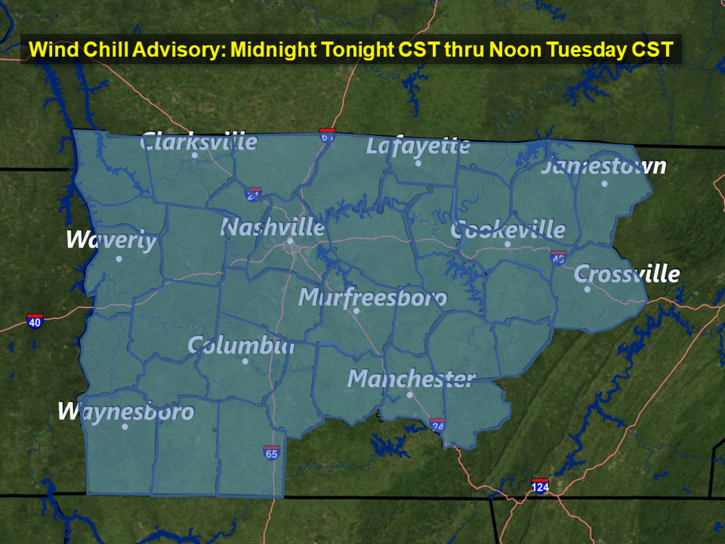
“Wind chill values will range from -5° to around -9° degrees below zero.” NWS-Nashville also commented wind chills should warm out of the advisory range by the late morning hours Tuesday.
Dry Week Ahead
This morning, NWS-Nashville listed a low snow chance for Friday; that’s gone now.
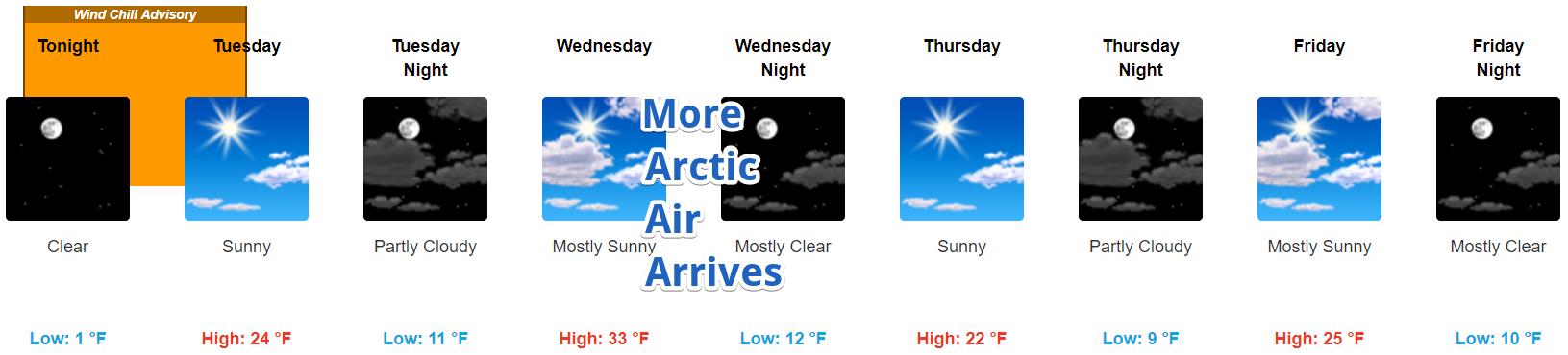
Next Weekend
Saturday looks OK. Rain chances increase Sunday. Snow is mentioned for the Plateau, not us.
Rain chances linger Monday. If precip hangs around into the evening, it may be cold enough for snow. Currently this looks light and uneventful, and probably just rain (per the “better” Euro model). Note forecast skill at 7 days is poor.

Categories: Forecast Blogs (Legacy)
You must be logged in to post a comment.