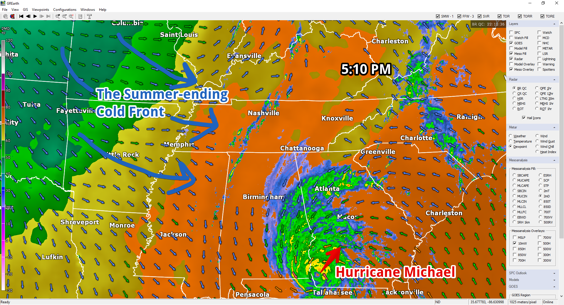
Tonight’s rush hour is greeted by a broken line of inconveniently timed downpours. A summer-ending cold front is the cause. Cooler and much drier air spills in here around and after midnight.

Tonight’s rush hour is greeted by a broken line of inconveniently timed downpours. A summer-ending cold front is the cause. Cooler and much drier air spills in here around and after midnight.

This is the last day of our summer airmass. Goodbye muggy dewpoints (near 70°)! With clouds, our high temp will only hit 84°.
Here’s the map at 6 AM. Notice all the warm air. But look to the left (west). That’s a cold front and it’s moving east.

Love this gif:
Showers and thunderstorms this afternoon should dissipate after sunset.
Monday morning fog possible, especially where rain was seen today.
More high humidity. Hot again Monday (high 88°) with afternoon random pop up rain/storms possible.
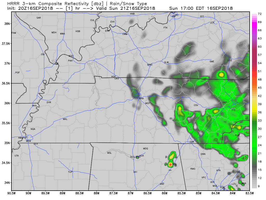
A few late afternoon/early evening rain and storms should develop in today’s hot and humid airmass. Exactly where is unknown. The HRRR model (below) thinks we’re among the rain/storm chosen in Middle Tennessee.

Summertime quality sticky and near-uncomfortable humidity returns this week.
High temps in the 80°s, upper 80°s for the last half of the week.
But will we still get cool, crisp mornings?

More humidity, more clouds, so with extra shade high only 83°. Pop up rain with maybe a thunderstorm tomorrow afternoon will scatter across Middle Tennessee. Here's the HRRR model at 3 PM, 4 PM, 5 PM, and 6 PM. Similar rain chances Tuesday afternoon. pic.twitter.com/fs8EMqMx6f

From NWS-Nashville:
A warm, above-average weather pattern will continue through next weekend. High temperatures in the low to mid 80s and overnight lows ranging from the low to upper 60s will be the result of predominant high pressure and southerly winds overhead. October looks to start warm for all and soggy for some.
A Flash Flood Watch is now in effect until 7 PM Monday.
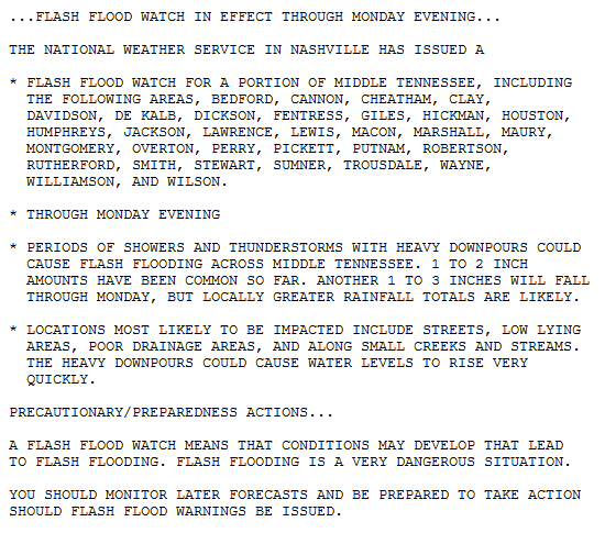
NWS-Nashville explains:
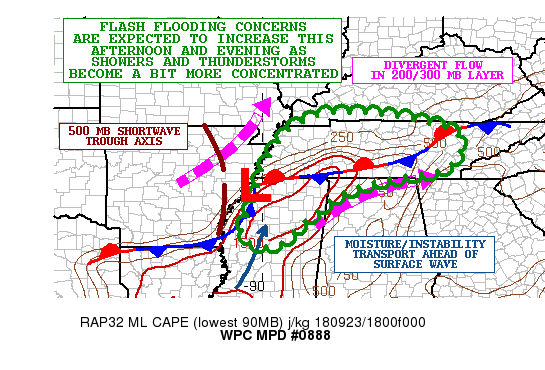
Models are indicating another batch of heavy rain and storms moving across the area tonight and tomorrow, and with the ground now wet and saturated flooding will become more likely with any additional rainfall.
Mid-level water vapor infrared imagery shows moisture streaming in from Arkansas and West Tennessee.
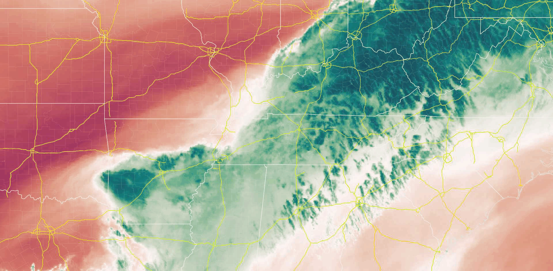
Radar looked like this as of 8:30 AM:
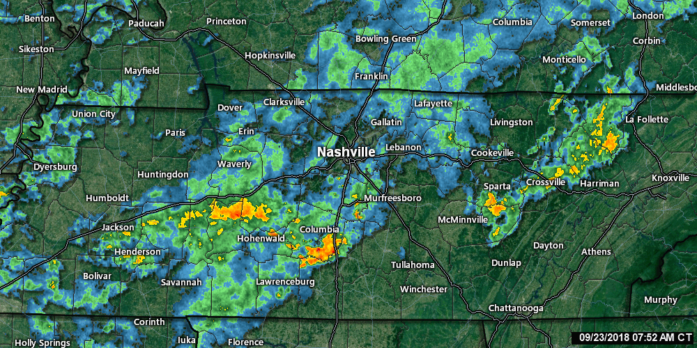
It’s going to rain more today.
This morning, in its Hazardous Weather Outlook, NWS-Nashville wrote “there is low confidence on the exact location of the heaviest rain, [but] training storms will increase the flooding risk.”
Clouds from Florence’s western edge produced afternoon light rain for a few of us.
A few more light showers are possible tonight and overnight as Florence lifts toward our northeast.
Here’s the HRRR model:
At sunrise, Tropical Depression Florence was centered in South Carolina with maximum sustained winds of 35 MPH. Its western edge extends into Nashville and Williamson County.
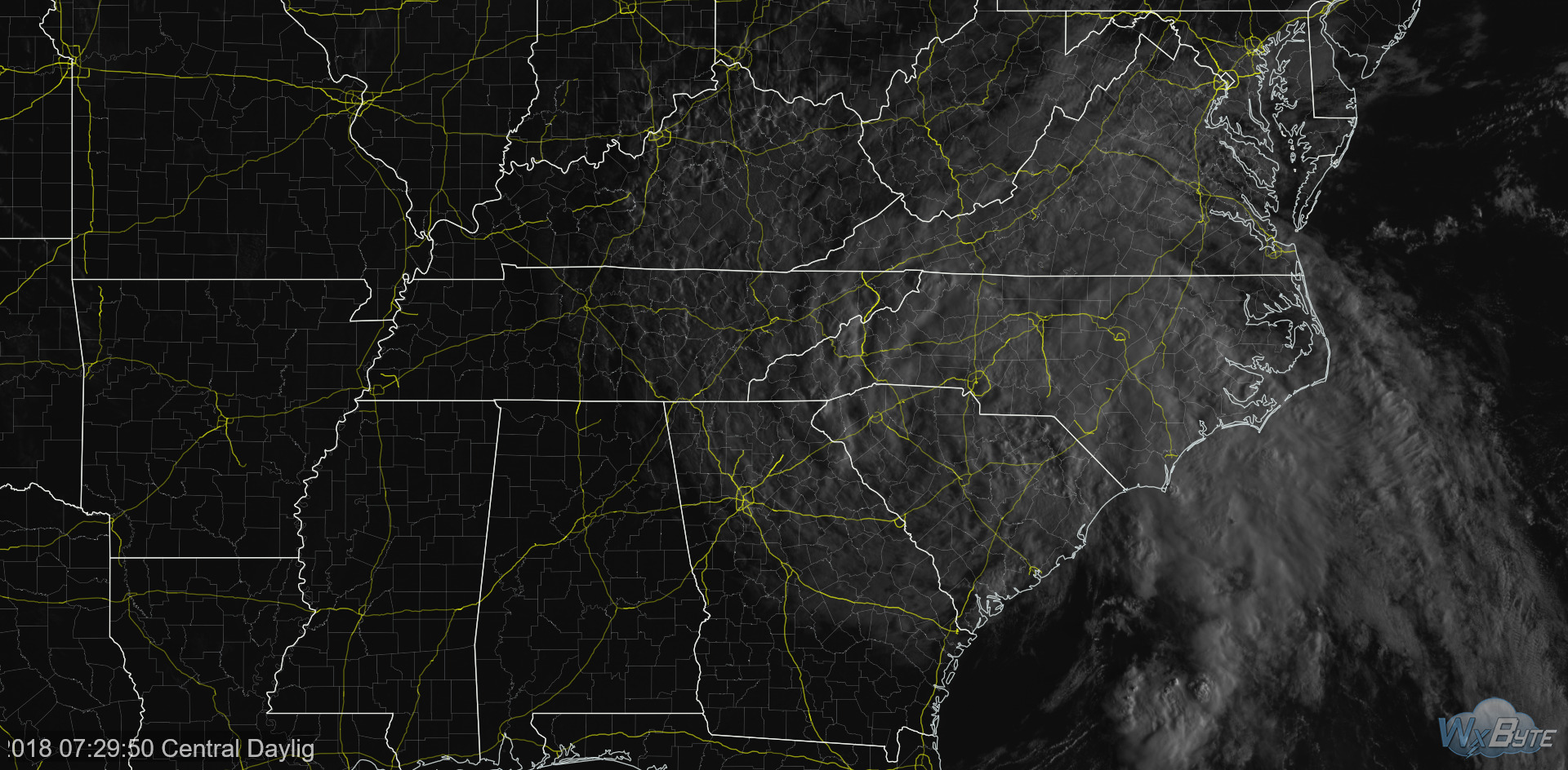
Today Florence should weaken more and hopefully Finally Move. It’s forecast to move north of Atlanta then north over East Tennessee today. We’ll be on its weaker west side, bringing us more clouds, winds, and possibly rain. The official forecast track:
You must be logged in to post a comment.