
Tornadoes were the topic one week ago. Today, snow chances. Don’t get excited.
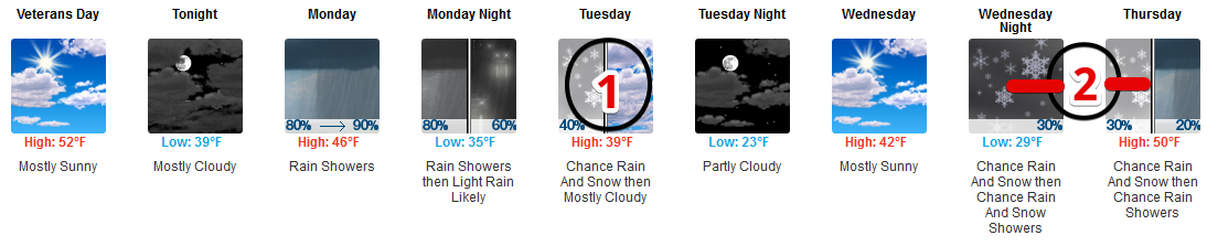
Rain Monday
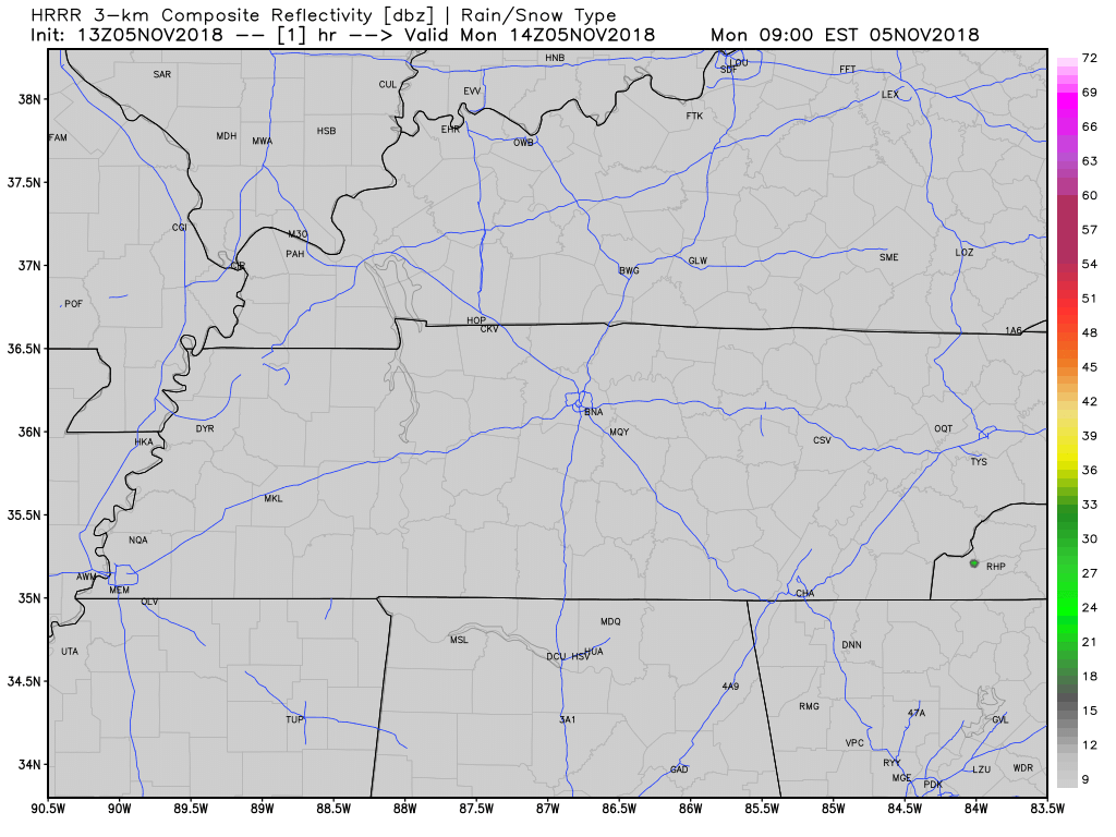
Rain is likely Monday morning.
ETA: after the Monday morning rush-hour, according to the extended HRRR model:

Tornadoes were the topic one week ago. Today, snow chances. Don’t get excited.
Rain is likely Monday morning.
ETA: after the Monday morning rush-hour, according to the extended HRRR model:
We’re pretty tired.
Nice weather for Election Day.
A new forecast will be written here sometime tomorrow morning.
Rain is likely late Thursday.
Freezing temps likely early Saturday and Sunday mornings.
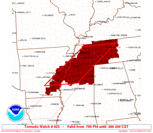
This Tornado Watch is in effect until 3 AM, although we think the storms will be long gone by 3 AM.
The tornado and damaging wind concern will exist in a long, main line of storms. That storm line will be to Nashville and Will Co as early as 9:30 PM, perhaps as late as midnight.
This morning my friend Melissa asked “when do I need to pay attention to this?”
Tonight, Melissa. Tonight.
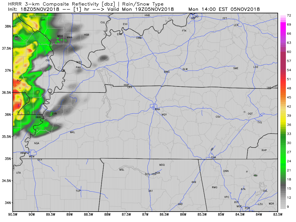
A line of strong to severe thunderstorms will form and move from northwest to southeast across Middle Tennessee tonight. All models show this. Below is one, the HRRR, one of my favorite weather models:
(If you read our forecast this morning, the new information on tomorrow night’s severe storm threat is in blue).
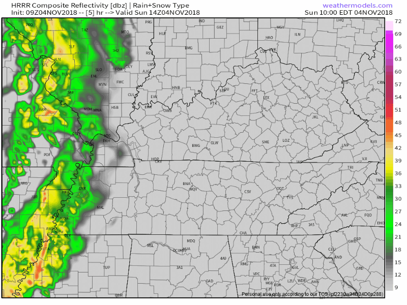
Official NashSevereWx Correspondents dispatched to Memphis this morning confirm the rain falling now is cold.
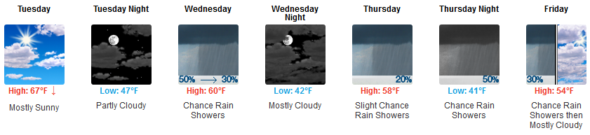
It’s going to get breezy this afternoon, even windy, with gusts up to 25 MPH.
High today 64°.
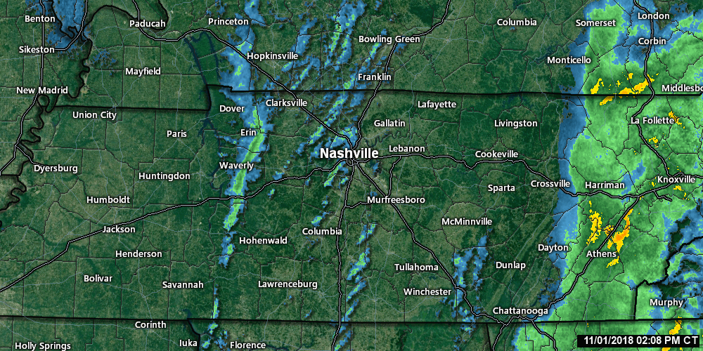
Afternoon rain is expected. It should cross the Tennessee River around lunchtime and arrive here around late afternoon, aka, around the time it’s getting dark. The HRRR model illustrates:

(If you read this morning’s blog, the text in blue is new)
Saturday was our last day of regular daylight because:
Sunup at 6:12 AM. Temp 48°. Afternoon high 65°.
Sundown at 4:48 PM. Four forty eight.
I don’t want to bury the lead about Monday night’s severe weather concern, but I will, because chronology prevents confusion.
Fog has been a pre-dawn problem in spots. It should lift around sunrise.
The cold front is pushing through this late afternoon, and with it, some light showers.
That green line of light rain to our west, seen below through 2:48 PM, marks the cold front.
Behind that, colder temps! The HRRR model illustrates the arrival of colder air through the night and overnight.
You must be logged in to post a comment.