Rainy, Windy Thursday + Music City Bowl & Colts at Titans Forecasts

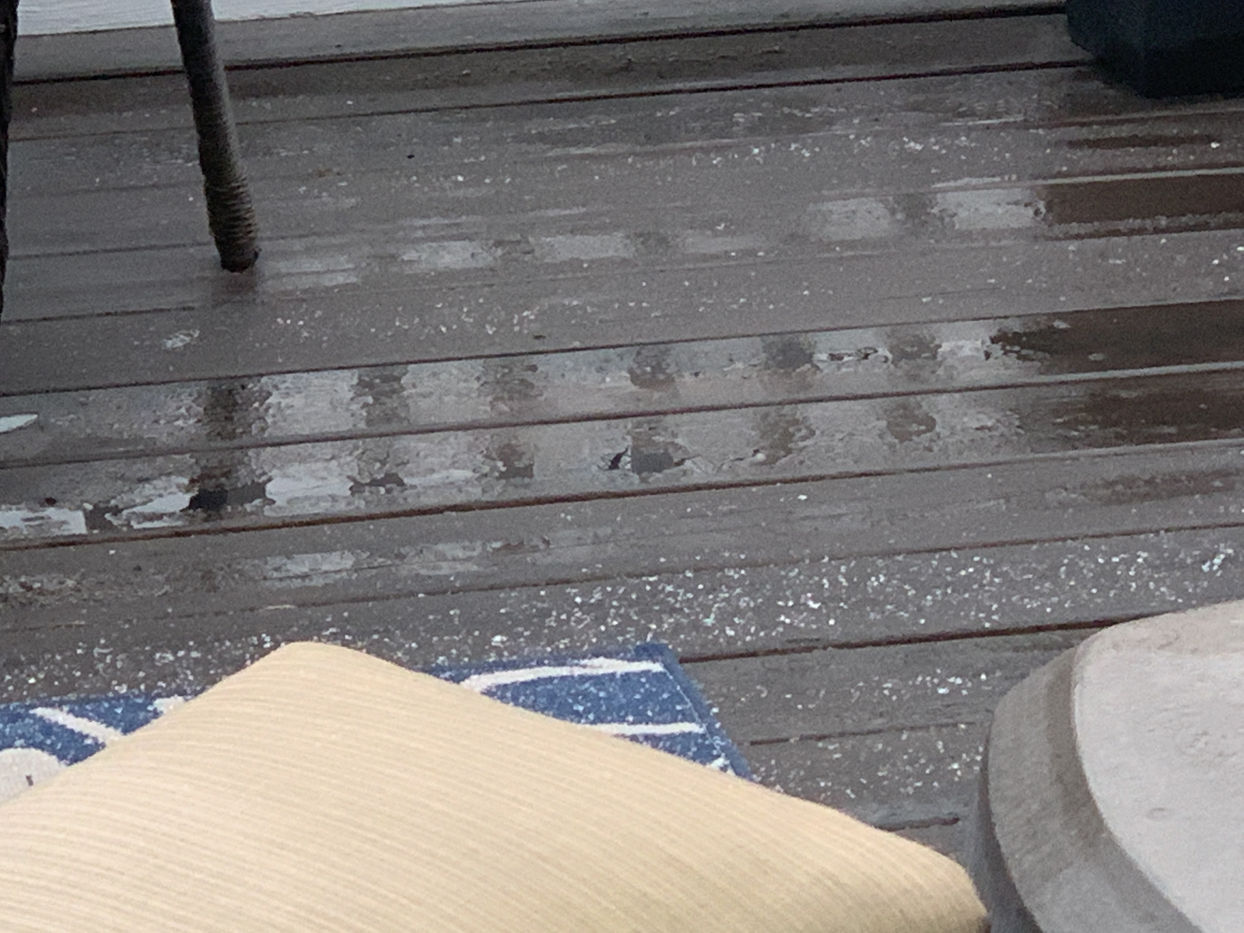
Merry Christmas! Some in Will Co got a White Christmas!

In this edition:

  • Nice Christmas & Boxing Day
  • Rain Thursday through Friday Morning: 1″ to 1.5″ Total
  • Music City Bowl & Colts/Titans Forecasts

Christmas & Boxing Days

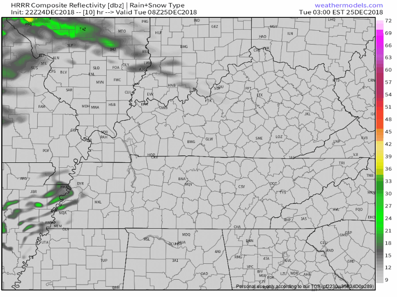
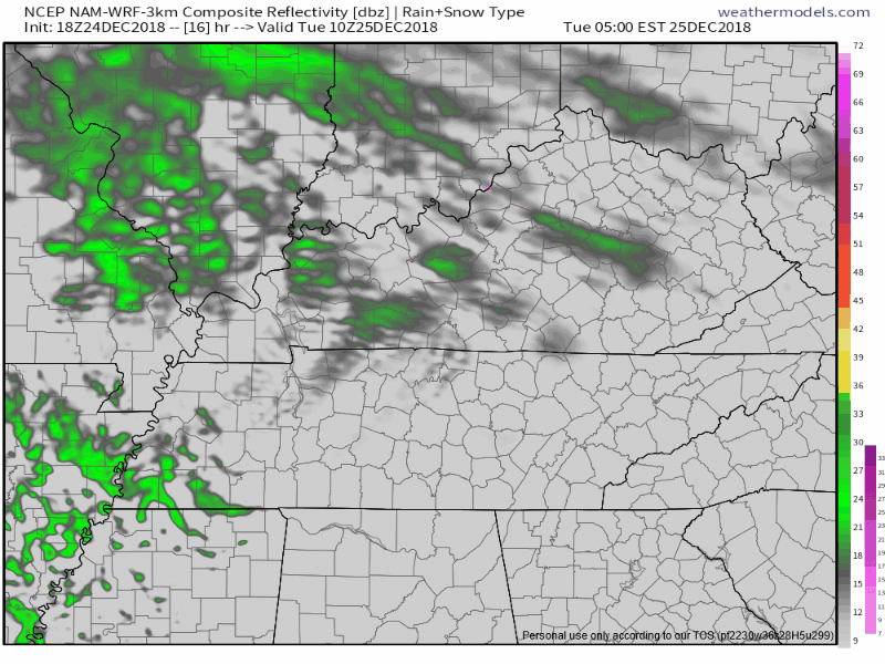
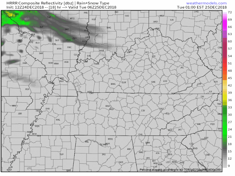
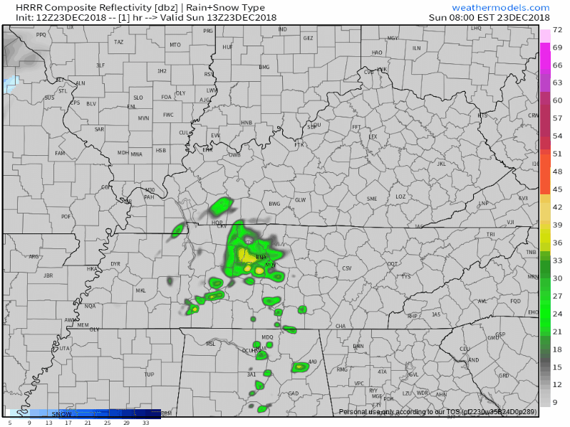
Sleet streaked through Williamson County this morning, but is long gone. Uneventful weather will follow today and tomorrow.

We may even see the sun. Satellite through 11 AM: read more

Few Light, Nuisance Christmas Showers. Rain Thursday. Music City Bowl & Colts/Titans Rain Chances.

  • Few Very Light, Scattered Christmas Showers
  • Thursday Night: Heavy Rain, Even a Few Weak Thunderstorms Possible
  • Music City Bowl: Kickoff Rain Possible
  • Colts at Titans: Probably Dry & Not Too Cold

Mostly Cloudy, Few Raindrops Christmas Day

A few light, mid-morning Christmas showers are possible.

So says the HRRR model:

NAM3 model agrees:

These won’t be a problem, just a nuisance. You’ll have plenty of time to be outside tomorrow. read more

Christmas Day, Rain Thursday, Music City Bowl, & Colts at Titans Forecasts

  • Rain Unlikely Christmas Day
  • Heavy Rain, Maybe Even Storms Thursday Night
  • Music City Bowl: Kickoff Rain?
  • Colts at Titans: Models Egg-Nogging

Cloudy – But Not Rainy – Christmas Day

A rain system is approaching from the west. It should fall apart completely when it arrives tomorrow. Just clouds for us, so says the HRRR model:

But the NAM3 model thinks enough rain will survive. If this model is right, Christmas Day will be light, drizzly, and off-and-on. read more

Freezing Fog Possible Early Tomorrow Morning, Christmas Forecast, and ICYMI, our 2018 Year-End Letter

Tonight, winds turn north. Wind chills will approach freezing.

Freezing Fog Possible Monday Morning

Temps should drop below freezing shortly after 3 AM and stay below freezing until 8 AM or so. Early morning patchy fog may lay down a thin layer of ice on roads where fog settles. If you’re up early Monday morning and see fog on the road, assume a thin layer of ice has formed. Any such hazard will end about an hour or two after sunrise when temps rise above freezing. read more

Rain Today, Freezing Fog Possible Monday Morning, & the 2018 #Festivus-Themed Year-End Letter

Off and on rain will continue this morning into early afternoon. HRRR model (below) thinks rain will be gone by 3 PM:

Less than 0.20″ expected. High 47°, but tonight’s winds turn colder, and wind chills will approach freezing. read more

Next Rain Event: Late Wednesday thru Friday. Rain-To-Snow Friday Night? Ehhhhhh.

The first half of the work/school week looks pretty good.

The second half not so much.

Next Rain Event Late Wednesday – Thursday – Friday

Storms/Severe?

Flood?

Snow?

Keep reading.

Rain should start around or after midnight Wednesday night into the wee hours of Thursday morning. “Should.” read more

Bad Titans Weather, Great for Us! Thu-Fri Rain. Snow Chances Thru NYE (Excitement Level: Delay of Game Penalty)

Today our weather is better than New York’s weather and I hope our football team is also, you know, better than the Giants.

(Apologies to my mother in law, who loves Eli Manning, and frankly I respect the dude, my son ran into him last summer and Eli was pure class. May you lose, uninjured, Eli). read more

Blerg Alert! Details on Additional Precip Chances Today & Tonight, Overnight Refreezing Potential.

Most of Nashville and Will Co stayed just above freezing tonight. Those in far north Nashville, and anyone at elevation, saw icing.

Trees ice-glazed in Oak Hill. Elevation matters. pic.twitter.com/CzzfBH7avW read more

Splat Matters. Deets on the Winter Weather Advisory for Nashville, Wintry Mix for Will Co.

If we were about five degrees colder right now everyone would be:

But, we’re in the mid 30°s, embracing uncertainty as part of the social contract involved in, you know, living here and stuff. read more

Lunchtime Update on Rain/Mix/Snow Chances Tonight through Monday

After Will’s morning blog forecast and my Twitter review of model data, NWS-Nashville held a special briefing, the substance of which you’ll read below.

Wait, You Reviewed Model Data?

In 6 tweets, this morning I laid out all the model data on Twitter. You can read it here. read more