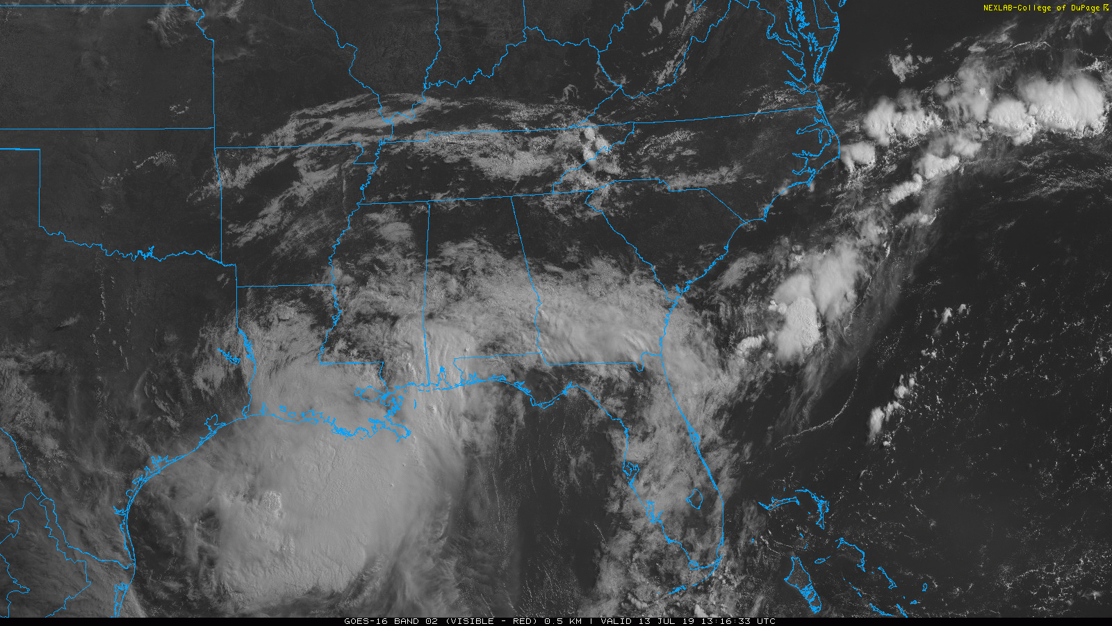
Barry is the big weather story.
WHAT BARRY IS DOING AND WHERE IT’S GOING
If you’re reading this Saturday afternoon, there may be updates to below National Hurricane Center (NHC) graphics, which you can find here.

Barry is the big weather story.
WHAT BARRY IS DOING AND WHERE IT’S GOING
If you’re reading this Saturday afternoon, there may be updates to below National Hurricane Center (NHC) graphics, which you can find here.

I’d rather have a storm on radar than a storm on a model. I just would.
Seeing storms on models is like being a skinny 8th grade kid wondering if I’m going to get a date to the 8th grade dance. (Spoiler: it did not go well, many years ago).

More storms
are incoming this morning; we’re live tweeting them again.
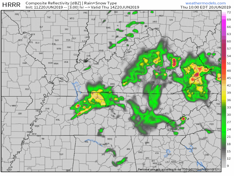
Damaging winds are the main concern. Storms should intensify at least a little as they cross into Tennessee from Kentucky.
At 853 PM.
No more severe weather expected tonight.
Just some light rain.
My fave photo of the night:
@NashSevereWx @NWSNashville @FOXNashville @WKRN pic.twitter.com/CgtEwG5Bq9
— David Howe (@DHdeeder) June 22, 2019
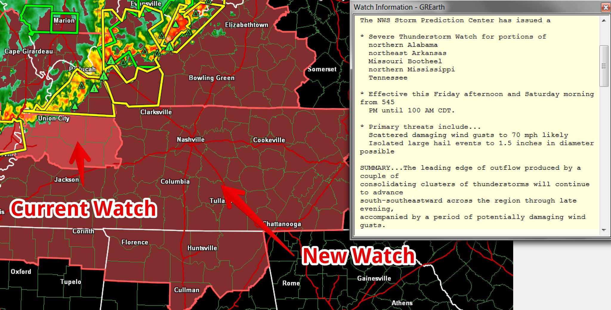
A Watch means conditions are favorable for severe thunderstorms.
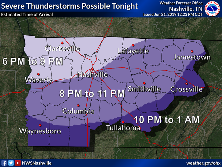
A storm system is expected tonight, coming in a large line down I-24 from Kentucky.
Do not get hung up on Williamson County’s exclusion. A second Watch may be needed, to include Will Co., if storms stay severe tonight as they cross the KY/TN line.
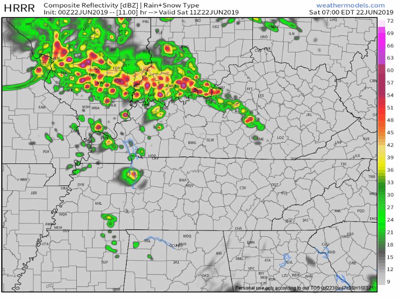
That was quite the evening of severe storms last night.
North Nashville storms before 8 AM should drift north and out of our area.
Later this morning,
further development in west TN and persistent [model] guidance suggests that more scattered [storms] will continue from mid morning through the early afternoon…especially for locations along and north of I-40. This will be monitored over the next few hours, but the severe threat should generally remain low. . . . Most of us will dry out by mid afternoon and early evening, remaining dry through the first half of Friday. (NWS-Nashville).
Yesterday’s storms did not move.
“No movement” storms are common in the summer. Mid and upper level winds that move storms have gone north.
So the storm’s entire life — and all its rain — gets one spot.
June returns Tuesday.
Humidity increases – although still pretty comfy – but the high climbs to 90°.
A few earlier model runs had light rain trying to sneak in here Tuesday afternoon.
Like this one:
Less humidity Friday. High only 83°!
Today and tonight, low pressure will be spinning over the Bourbon trail.
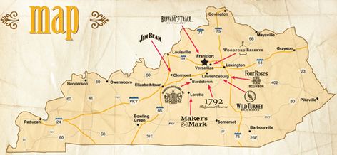
Because winds spin counterclockwise around a low, showers developed by the low should rotate into Middle Tennessee, including us (Nashville and Will Co) later this afternoon or tonight.
They’re adjusting to their summer schedules and I’m filling in the cracks.
Our interns are not at home playing Fortnite all summer. They have paying jobs! A work ethic. There is hope for this generation, gramps. It’s not all smartphones and side-eyes.
You must be logged in to post a comment.