Today’s depressing cloud blanket turns rainy and maybe stormy tomorrow, you came to the right place for details.
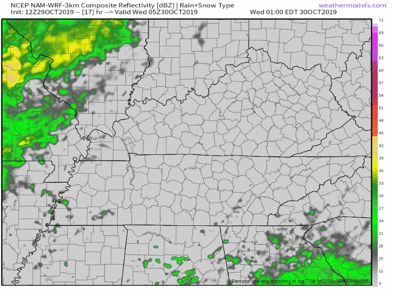
Rain Wave #1: Timing
The NAM3 model thinks light rain while we sleep then heavier rain begins around 11 AM and ends around 4 PM or 5 PM:

Today’s depressing cloud blanket turns rainy and maybe stormy tomorrow, you came to the right place for details.
The NAM3 model thinks light rain while we sleep then heavier rain begins around 11 AM and ends around 4 PM or 5 PM:
. . . but who sees clearly round the horizon, who can number unseen shrubs, coyotes, birds and streams before you come around the bend, who can discern the future.

There are only clues.
The first drops fall sometime during the day Wednesday because a frontal boundary gets stuck nearby with energy riding up it. Perhaps a half inch of rain midday Wednesday.
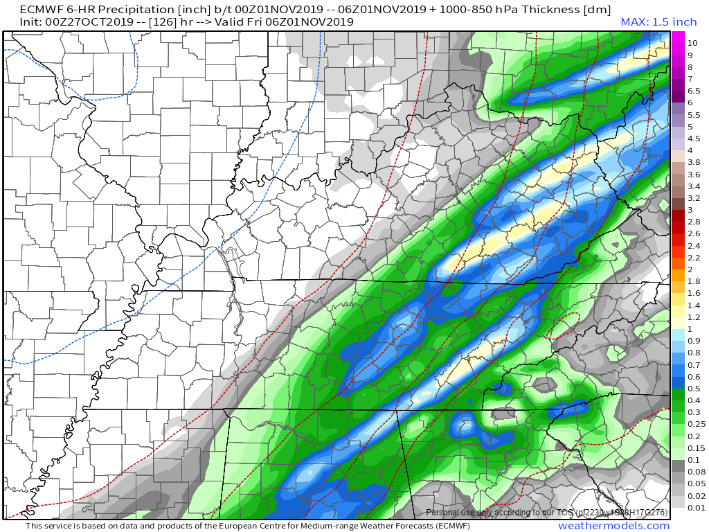
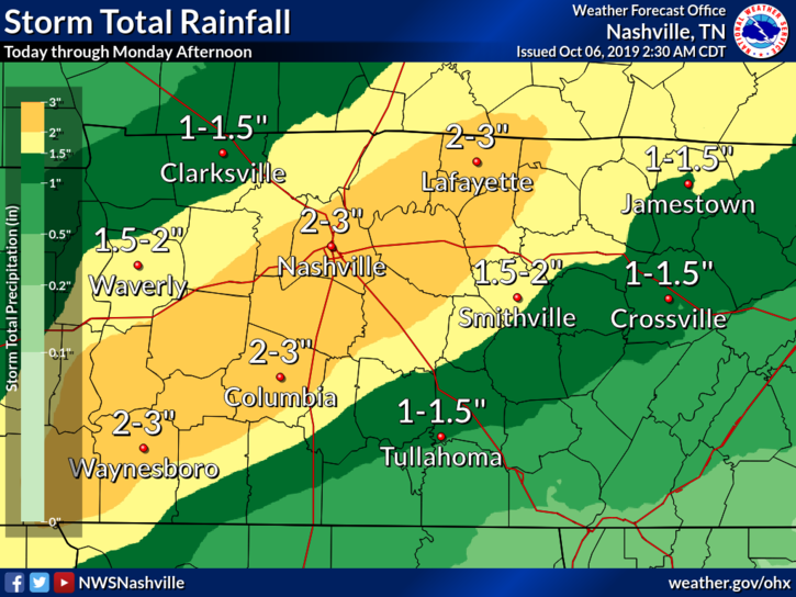
Pleasant today and Thursday with normal-for-October temps for the next 7 days. Then imagine a kinda chilly soaking rain event starting Friday (night?) and lasting into Saturday and maybe even into Sunday, gross.
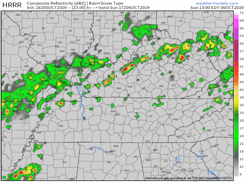
Overnight tonight into Monday morning, heavy rain, carrying potent tornado, hail, and damaging wind risks, will spread east from eastern Oklahoma into NW Arkansas.
This system is moving our way but will weaken substantially by the time it arrives Monday.

Low lying areas got frost early Sunday morning. Some almost freezing; I’m no privacy violator but I think Nick lives in Will Co:
38° was the official BNA low.
Today is real and spectacular.
High 70°, nice + 1° for those of you following along Twitter yesterday (maturity level: questionable but acceptable on Twitter’s somewhat anonymous forum).

But first, a rain lament.
Two days I ago I tweeted about last night’s rain:
Here’s me this morning checking rainfall totals from last night.

Rainfall overperformed.
0.30″ at BNA wasn’t too far off from forecast, but some community observers saw 0.40″ or (much) more:
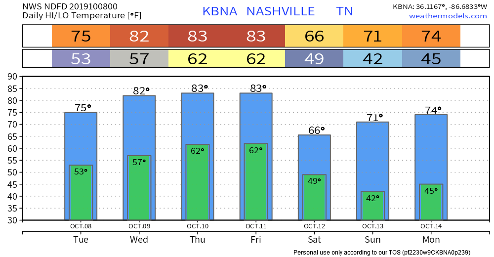

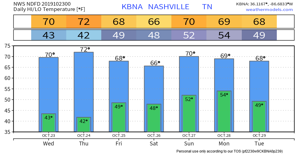
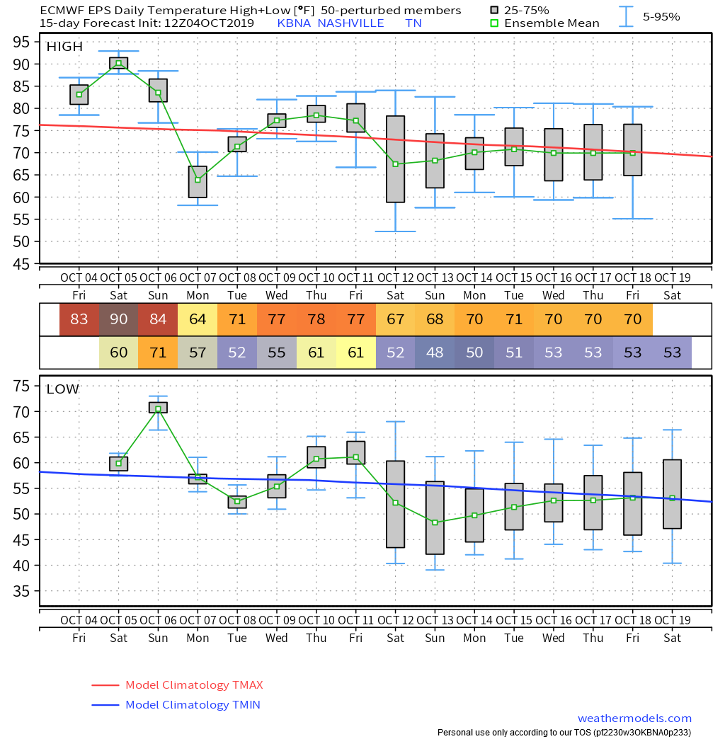
IDK if I’m ready for lows the 40s this weekend. I hate the cold. At least we’ll get highs in the 80s Wed-Fri.
Clouds slow to roll out today. Pretty nice week ahead. Until the weekend anyway.
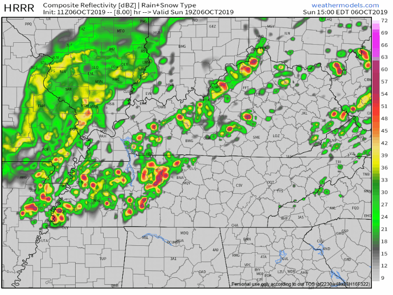
Most of this rain will fall between 7 PM Sunday and 7 AM Monday.
Rain should be mostly/completely over by lunchtime Monday.
Humid air will be swept away, as dewpoints dive from the upper 60°s to lower 50°s in about 12 hours.
This broke the old October 5 record, 92° set way back in 2018. (We tweeted a high of 94° earlier today, then we made it to 95° at 4:26 PM).
[T]oday was the 99th day of 90+ degree days. Yes, we’ll pull up just short of 100 90+ degree days and we also never got to 100 degrees on the mercury. I guess that’s little saving grace with all of the records we have broken in the last month.
Saturday’s high is 90°, two degrees shy of the October 5 record from 2018. Humidity will increase through the day.
Kinda summery Saturday night ahead of our first real rain event in weeks. Few models even want to pop off a few showers, IDK, maybe that’ll happen but nah. Will check this again in the AM but I’m unimpressed.
You must be logged in to post a comment.