No Snow For You. An Explanation.

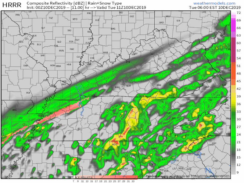
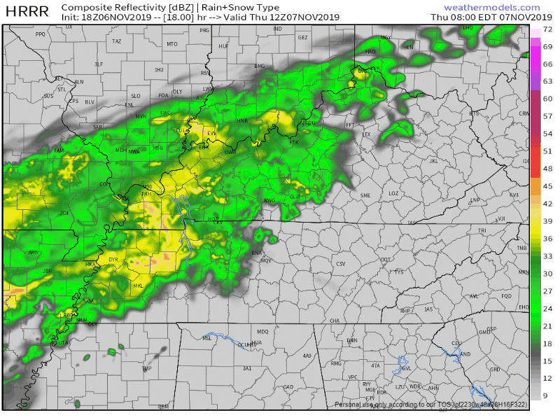
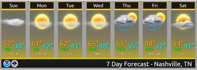
Today snow fell at 10,000 feet and 5,000 feet and even at 2,000 feet but before it could reach us on earth along came the Dry Air Monster. He ate it all up.

Here’s how the Dry Air Monster operates.

Suppose you’re standing at a sink holding a hand towel and a shot glass of water. Put the hand towel between the shot glass and the sink. Then pour the water onto the towel. The water is absorbed into the towel. The water never makes it into the sink. read more

Snooooowwww! Splat . . . Melt? A Deep Dive.

Read this entire post to be well informed. If you don’t want to read the whole thing, probably better off not reading it at all.

It starts as off and on rain Tuesday morning.

HRRR model, 0z run.

Rain, sleet, and snow mix in Tuesday morning. read more

Rain Transitioning to Snow Tuesday, Accumulation/Impacts Possible, Forecast Confidence Low.

Why Another Blog Today?

New model data arrived. NWS-Nashville made maps you need to see for Tuesday. Forecast is evolving. Snow forecast is trending upwards but forecast confidence remains low.

All quotes from NWS-Nashville. read more

Snow Falling? Maybe. Snow Sticking? We Don’t Think So.

Winds 28 MPH today, high 53°, perfect for kite enthusiasts.

Clouds increase this afternoon. A light shower is possible late this afternoon/early tonight.

Tonight temps drop into the 40°s with wind chills in the 30°s. read more

Rain & Storms Round Here.

Step out the front door like a ghost into a fog where no one notices the contrast between rain and birds.

And in between the moon and you, the angels get a better view of the crumbling difference between models wrong and right. read more

Rain Potential Today, Friday, & Definitely Saturday. About that snow chance Sunday night/Monday (nah).

PREPARE FOR LIGHT RAIN LATE THIS AFTERNOON/TONIGHT

Timing: mid/late afternoon into the evening.

Confidence is not great. Not totally sure it’ll make it to us but it probably will. Uncertainty courtesy of the Dry Air Monster who gotta eat. read more

Friday’s Soaker, Turkey Rain?

Tonight, rain should miss us.

Models may be off a bit so don’t be surprised if your windshield gets wet tonight. Wednesday is quiet.

Next Rain Event Friday – Saturday

Rain could start as early as Thursday night but the Euro model thinks it’ll start Friday morning. read more

Rain Thursday, Winter Coat Cold Friday Into Saturday Morning (hard freeze possible), About Snow Chances Monday Night Into Tuesday

Today was the last good day of weather this week. And probably for a while. Tho Sunday looks OK.

RAIN THURSDAY

Should start around Thursday around 7 AM and end around 7 PM. Steady and light. No storms or worries.

About a half inch. This much usually rains out outdoor sportsball activities. read more

If you hear it may snow Thursday night read this before forming an opinion/reaction/party/panic. Also, it’s freezing fog szn.

Dry and warming each day thru Wednesday so let’s get to the weather news.

RANT / IT’S NOT WEATHER BUT WHATEVER, HELLO DARKNESS MY OLD FRIEND.

Sunset today 4:49 PM, tomorrow 4:48 PM, getting earlier each day through November until just before Christmas. Coming soon: read more

Trick or Treat Day Very Cold Forecast, feat. the D.A.M. & A Welcome to November Freeze Watch

Afternoon rain today is winding down, all rain should be gone before dark. No storm worries today, we’re good.

But Thursday October goes out like a total jerk.

Declining Temps

At 12:01 AM we’ll reach our high temp for Thursday, low 60s. Temps will gradually drop through the day. 50s when you wake up. Low 40s by lunch. 30s Thursday night. read more