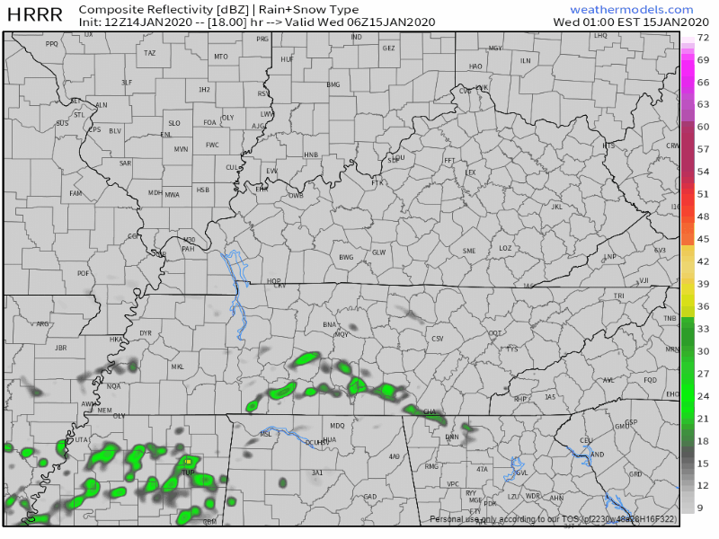
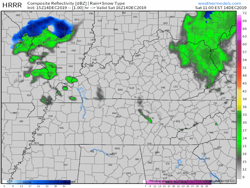
The HRRR model predicts storms Wednesday morning around the AM commute, around 5-7 AM:
Other models think morning rain and storms are possible, but prefer to keep them south and east of us. ETAs may vary.

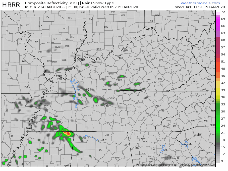
The HRRR model predicts storms Wednesday morning around the AM commute, around 5-7 AM:
Other models think morning rain and storms are possible, but prefer to keep them south and east of us. ETAs may vary.
It has been quite the busy morning at our three locations around Williamson county. We’ve had computers reboot mid livestream, staggering wind and rain, and internet that decided to take a break. But, most of us dodged damage with this line of storms.
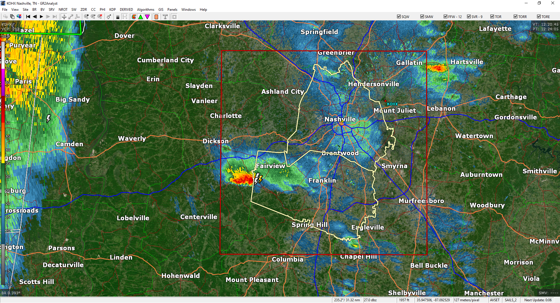
A Tornado Watch has been issued by the Storm Prediction Center, in coordination with our local NWS-Nashville office.
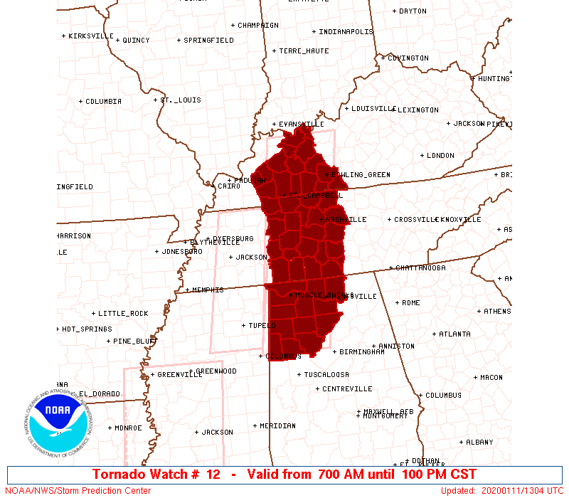
The Watch expires at 1 PM today.
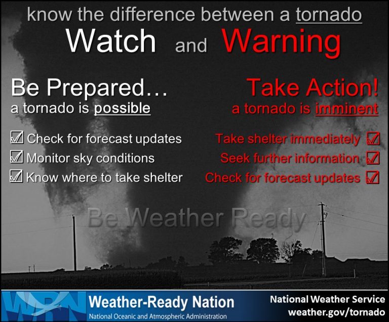
The Watch was issued to let everyone know an approaching storm line may pack 60+ MPH winds and/or spin up a tornado or two.
It’s stupid warm for second week of January but no one wore a skirt today. No one will wear one tomorrow. The wind’s been too strong. Modesty lives.
I saw on Twitter there’s a Wind Advisory for Friday night and Saturday. Winds may gust 30 MPH, 40 MPH, maybe as much as 50 MPH. Those Advisories talk about trees and power but when I see them Hashtag pants, make your daddy proud.
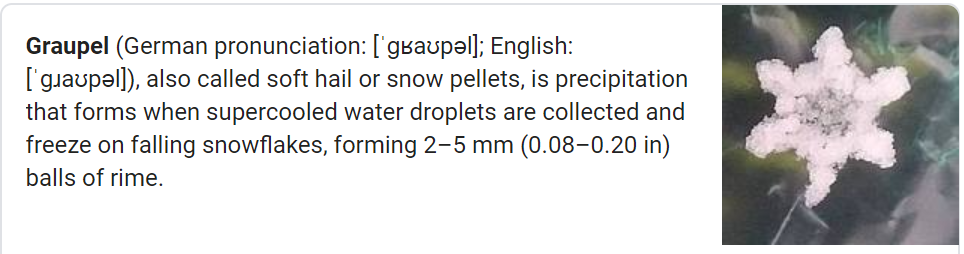
Graupel, a sleetlike winter Sonic ice haily thing, fell today.
Precip/graupel was heavier NE of us, but it’s all moving out. Splat:Melt.
Cold tonight/overnight into Sunday morning. Low near freezing, will feel colder than that.
1″ to 2″ of rain today. Widespread flash flooding not expected. But area creeks, streams usually prone to flooding may be up tonight and Monday morning. *Looks at Mill Creek in Nolensville*
No Christmas or Day After Christmas rain.
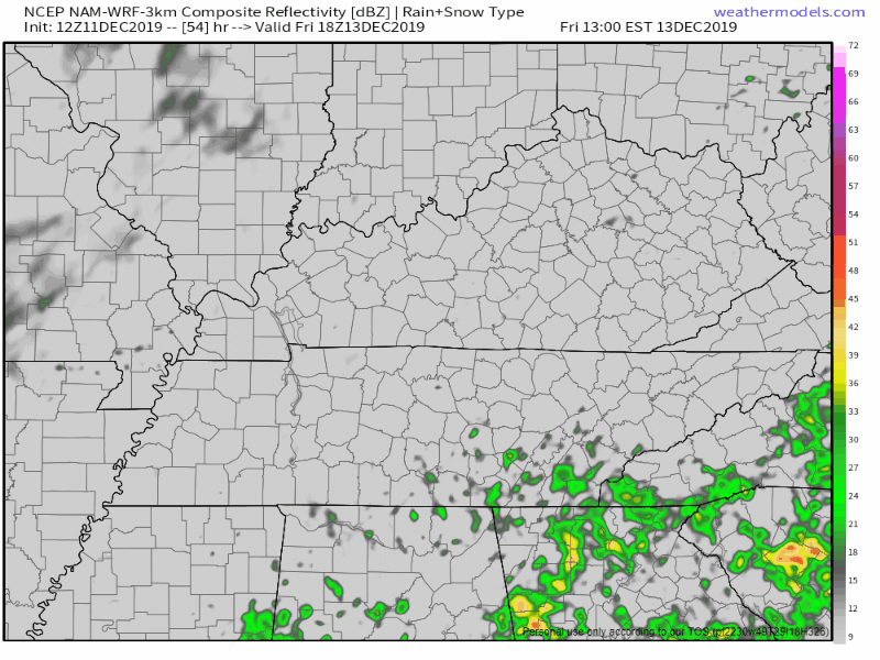
Rain possible Friday but I’m unimpressed. NAM3 model shows a few weak inconsequential rainers:
Euro shows a few light rainshowers in spots:
This should not deter your Friday outdoor plans.
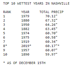
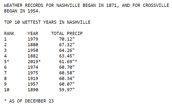
2019 is already the 8th wettest year on record (since 1871).
By tomorrow night we should claim the 5th spot.
Training rain is repeated areas of rain. Heavy rain is the train cars. Trains follow the tracks.
Light off and on showers today. HRRR model:
Not a washout, rain under 0.1″.
Fog between midnight and 6 AM in the “usual spots” near bodies of water and low lying areas. Low 37° with a dewpoint 35°, so freezing fog isn’t expected right now, but it’s close. Fog should mix out by sunrise.
45 today, 27 Thursday morning, up to 53 Thursday afternoon, all clear/sunny.
We’re 15.41″ above normal for rain this year. Superwet February 2019 is the main reason for that.
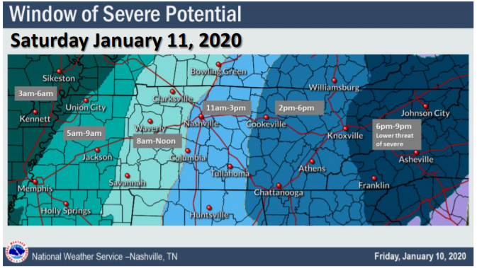
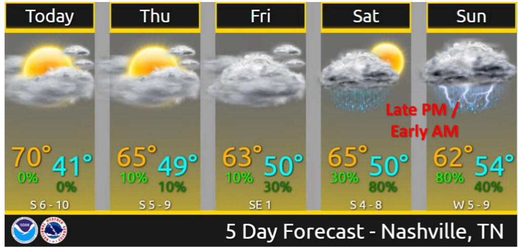
Rain window opens Thursday night and closes Saturday afternoon. Off and on mostly. Cold too, lows mid/upper 30s, highs around 50. Rain is most likely Friday afternoon and Saturday morning, but it could fall at any time during that window.
You must be logged in to post a comment.