
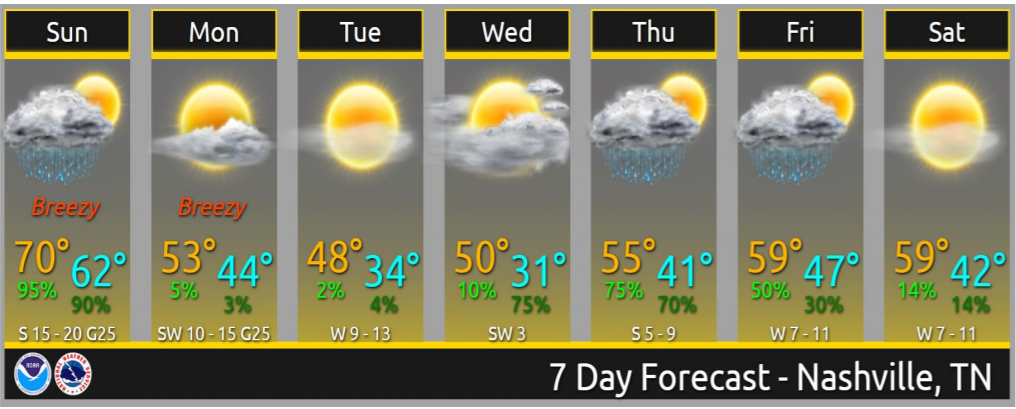
1″ to 2″ of rain today. Widespread flash flooding not expected. But area creeks, streams usually prone to flooding may be up tonight and Monday morning. *Looks at Mill Creek in Nolensville*
1.71″ is unlikely but if we got it we would move from 5th to 4th all time wettest years. The list:
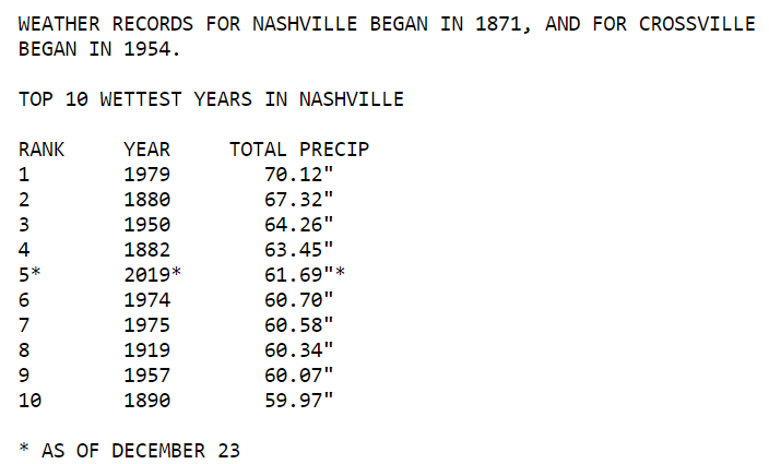
List from 12/23. Since then we got 0.05″. Current YTD rain is 61.74″. We need 1.71″ to tie 1882 and 1.72″ to break it. We may do it.
Rain Timing
Early morning rain left. Expect a mid morning break. More rain before/around lunch, then another break later this afternoon. Heaviest rain tonight. Ending early Monday morning.
Storm Timing
Late this afternoon a line of heavy rain and storms will form. The line will speed east and across Nashville and Will Co tonight. The line will contain a low-probability tornado/wind potential.
HRRR and NAM3 models think 8 PM to 10 PM ETA.
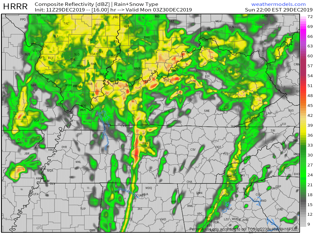
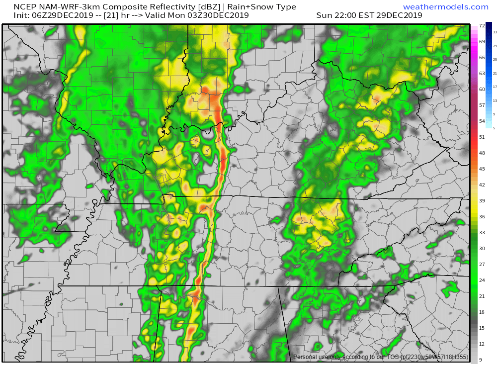
Storms may arrive earlier. HRRR suggests so. So this ETA may change. Will update on Twitter.
Storm Hazards & Probabilities
This is for late afternoon but more likely tonight.
2% probability of a tornado happening somewhere within 25 miles of you.
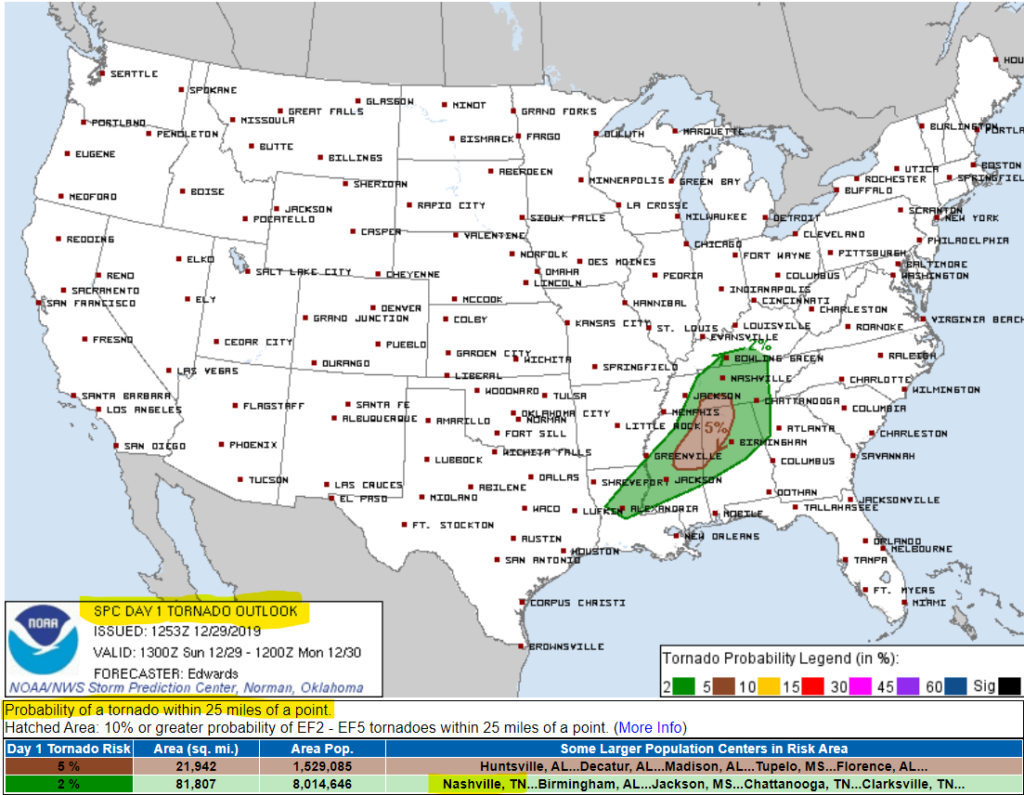
15% Will Co, 5% Nashville probability of a severe thunderstorm with 58+ MPH winds happening somewhere within 25 miles of you:
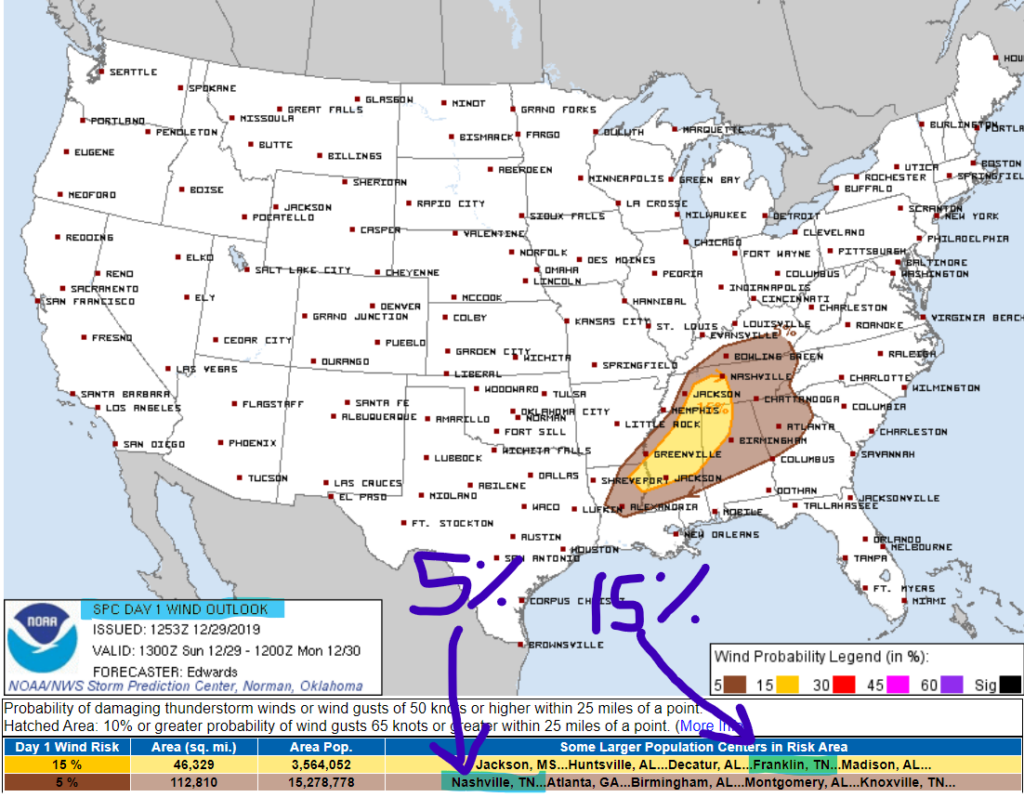
Hail not expected.
Anxiety level low. SPC will update these outlooks today, look to our Twitter for updates/changing probabilities.
Storms: Nerdy Discussion
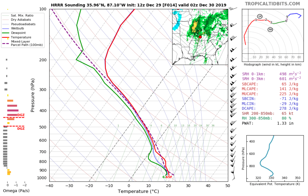
Forecast soundings are predictable.
HRRR model thinks severe ingredients line up in a hurry, just before the line hits. Surface based CAPE weaksauce 65 j/kg, MUCAPE is also weak. Shear screaming 500-600 m2s2. Winds aloft would destroy cloud tops, rather than rotate them. A sandcastle destroyed by a toddler’s backhand. Hence the bigger straight line wind threat and smaller tornado threat.
Predictable because NAM3 shows a classic cold season tornado-possible setup. Not long ago NAM3 was laughed at. Overdramatic. Apocalypse always. Now NAM3 isn’t just laughed at, it’s unsupported. Model scientists stopped updating it. It’s left to rot/decay. It’s a bad model, but still in use because it does a few things well at high resolution, and there aren’t many high res models. Like a car with 210,000 miles that still gets you places.
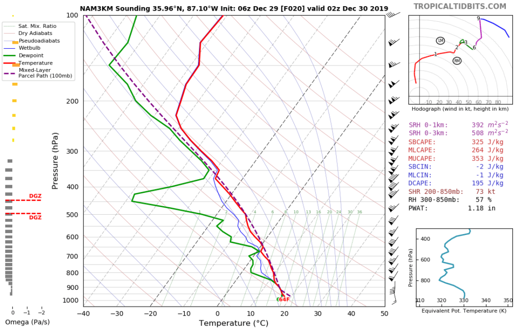
The whole setup looks meh. CAPE insufficient. Reminder: doesn’t take much CAPE to spin up EF-0 to EF-2 tornadoes in the winter. So, we’ll be watching and tweeting as usual.
Colder Monday
New Year’s Eve looks nice, but cold, just as you’d expect. No rain. Next rain event Thursday.
Make 2020 Flood Free.
Categories: Forecast Blogs (Legacy)
You must be logged in to post a comment.