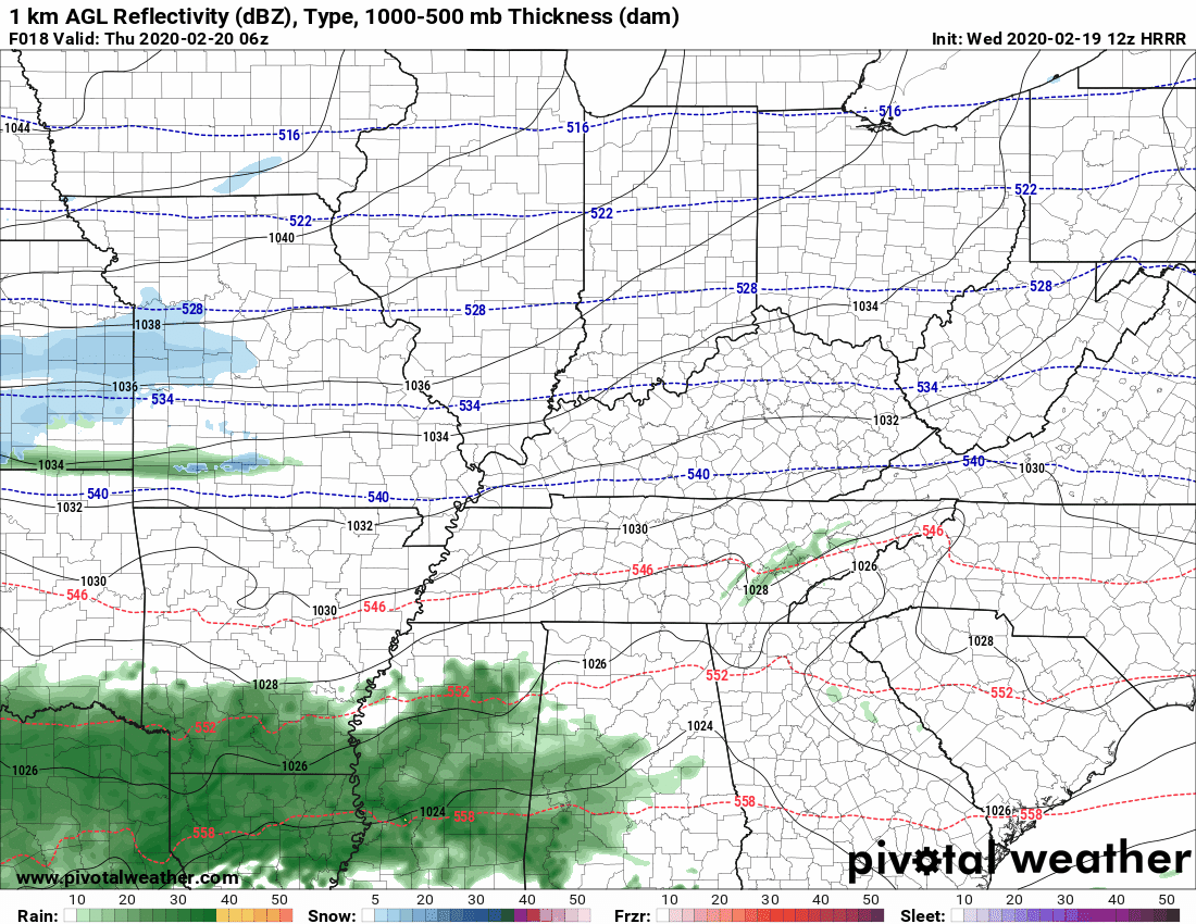
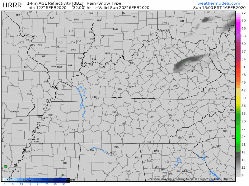
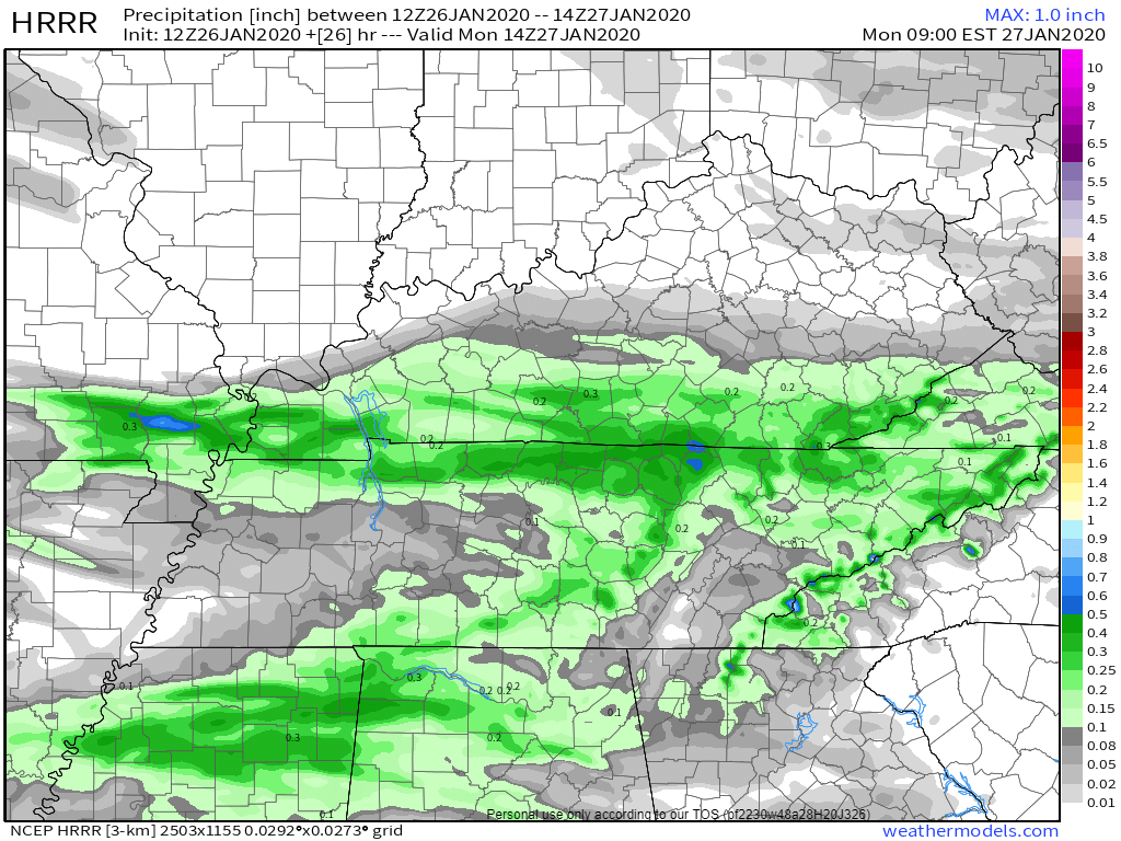
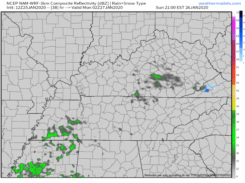
No Worries Flurries Possible Wednesday

Light rain overnight. Gone before rush hour. Monday morning low 42°. 51° Monday afternoon.

Cold rain Wednesday morning could fall as a rain/sleet/snow mix, then splat/melt. The Euro model (below) is the warmest of the models, predicting mostly – if not exclusively – rain. read more

Feelz Blerg.

Still gross Sunday morning (34°), bit warmer Sunday afternoon (51°) but still cloudy. Then light rain Sunday night.

NAM3 model Sunday night.

We do the mornings 30°s, afternoons mid/upper 40° thing next week. Precip possible but iffy Tuesday night into Wednesday (low water content) and again Friday (as usual models vary substantially). read more

Wakey Wakey Wind Chills 19° Sunday, 10° Monday. & 6 Other Weather Things (feat. Fewer Words!)

  1. Rain should end shortly after lunch.
HRRR model thinks rain ends around 2-3 PM.

2. Winds gusting to 30-35 MPH this morning should relax this afternoon.

3. Cold front tonight. You need a jacket. Wind chills will drop below freezing around 9 PM.

HRRR model wind chills tonight into Sunday morning.

4. It’s going to stay cold. Wake up wind chill 19° Sunday morning. Wind chills in the 20°s all day Sunday. Monday will be worse, wake up to 10° wind chill, with wind chills again only the 20°s all day Monday. read more

Be thunderstorm-aware today.

One weather model, the HRRR, thinks heavy rain and thunderstorms will arrive around 4 PM (give or take a few hours).

The HRRR model thinks these storms may be strong or severe, however, this model may be overstating the severity of the storms (below see HRRR model which expects 1,161 j/kg of surface based CAPE to fuel a pretty big storm or two; this high amount of storm fuel seems unrealistic given the cloud cover, so HRRR may be predicting the storms to be worse than they’ll actually be). read more

More Storms Possible Wednesday Morning. Another Roller Coaster Week Ahead. Cold End to January . . .

The HRRR model predicts storms Wednesday morning around the AM commute, around 5-7 AM:

Other models think morning rain and storms are possible, but prefer to keep them south and east of us. ETAs may vary. read more

Stormy Start to a Saturday

Quick recap

It has been quite the busy morning at our three locations around Williamson county. We’ve had computers reboot mid livestream, staggering wind and rain, and internet that decided to take a break. But, most of us dodged damage with this line of storms. read more

Tornado Watch Until 1 PM

A Tornado Watch has been issued by the Storm Prediction Center, in coordination with our local NWS-Nashville office.

The Watch expires at 1 PM today.

The Watch was issued to let everyone know an approaching storm line may pack 60+ MPH winds and/or spin up a tornado or two. read more

Saturday’s Storm: a diary, an essay, and some graphics.

Someone’s Diary: The Wind

It’s stupid warm for second week of January but no one wore a skirt today. No one will wear one tomorrow. The wind’s been too strong. Modesty lives.

I saw on Twitter there’s a Wind Advisory for Friday night and Saturday. Winds may gust 30 MPH, 40 MPH, maybe as much as 50 MPH. Those Advisories talk about trees and power but when I see them Hashtag pants, make your daddy proud. read more

Another Heavy Rain Event Friday-Saturday.

Graupel, a sleetlike winter Sonic ice haily thing, fell today.

Precip/graupel was heavier NE of us, but it’s all moving out. Splat:Melt.

Cold tonight/overnight into Sunday morning. Low near freezing, will feel colder than that. read more

Rain Today, Heavy at Times, Storms Tonight, Severe Possible.

1″ to 2″ of rain today. Widespread flash flooding not expected. But area creeks, streams usually prone to flooding may be up tonight and Monday morning. *Looks at Mill Creek in Nolensville* read more