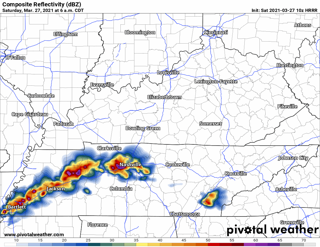
Embracing uncertainty is hard, y’all. The HRRR model was hot garbage last night. It timed the morning line well but completely missed on overnight rain. It thought there would be a lot of it, and there was none of it.

Embracing uncertainty is hard, y’all. The HRRR model was hot garbage last night. It timed the morning line well but completely missed on overnight rain. It thought there would be a lot of it, and there was none of it.
Most of Will Co is under a Flash Flood Warning this morning.
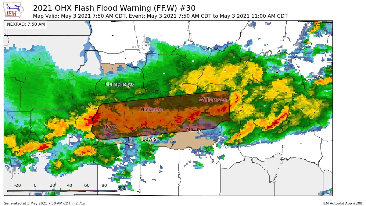
Another 1″ to 2″ is expected as rain “trains” over the area. Training rain is like a train, it runs over the same tracks. Those in the Flash Flood Warning box above are the tracks.
11 years ago today the 2010 Flood was showing itself. 1 year ago tomorrow, the derecho.
For the next two nights you’ll need to have your NOAA weather radio and Wake Me Up app (StormWatchPlus) ready. You’ll need them tonight and Monday night.
No rain today.
Rain Sunday. Not enough to cancel plans but if you’re outside all day you’ll get wet.
Light rain arrives around lunchtime/Nashville SC kickoff. Then more light rain later Sunday afternoon. See below HRRR model. Some models have it earlier, others later than that.
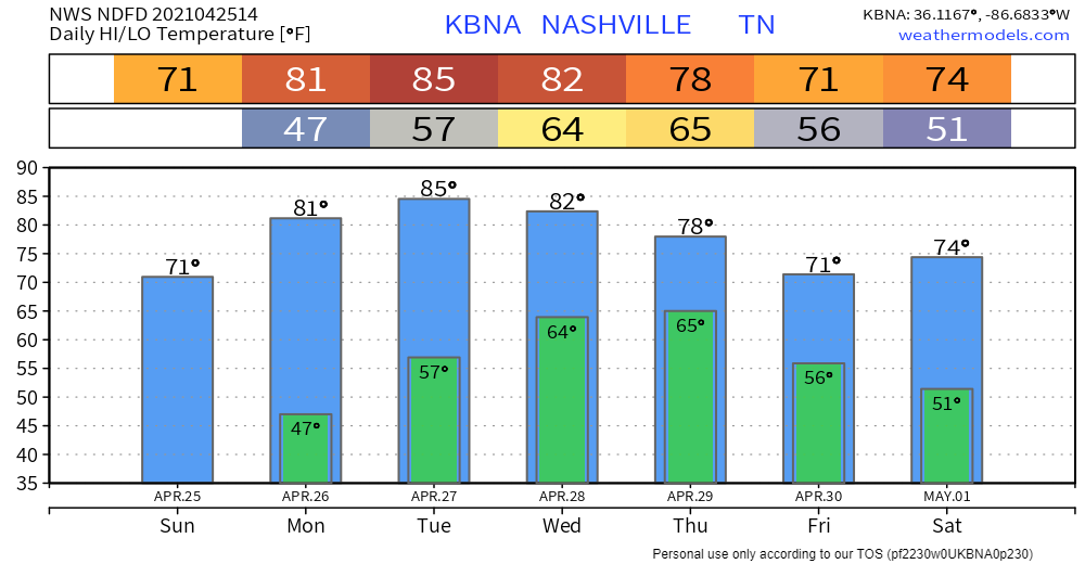
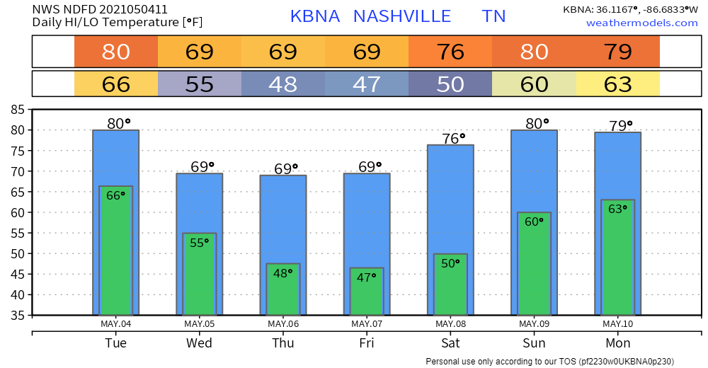
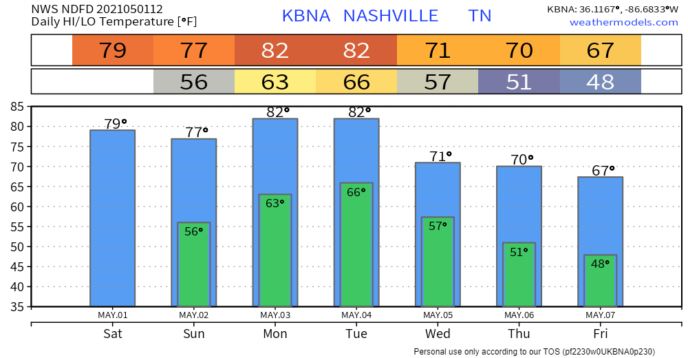
Yes that’s 85° Tuesday. Smooth feet.
Not exactly sure when the next rain event will be but general idea is Thursday afternoon/evening.
GFS thinks showers hang out off to our northwest Wednesday and wait, wait, wait, before finally arriving Thursday afternoon.

Rain will enter Middle Tennessee late Tuesday night.
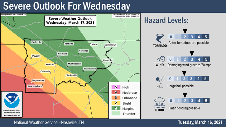
The HRRR model thinks the first drops will fall around 7 PM Tuesday night. Then a break in the rain. Then the heaviest rain arrives Wednesday, probably after midnight Tuesday night through sunrise Wednesday morning. The HRRR model (right now, at least, see below) thinks that heaviest rain goes just southeast of Davidson and Williamson Counties:
As I write this Andrew is on YouTube Live covering two Severe Thunderstorm Warnings. Will is on the tweeter, tweeting about them. These are hail storms. Lightning frequent and intense. Severe straight line winds are possible but there is no reason for early morning tornado concerns.
Nashville. Williamson County. Saturday morning. A weary community awakes.
A warm front arrives. Behind it, a waterlogged atmosphere.
HRRR Model
7 AM, rain begins. Will Co first. First rain drops south of I-40. Soon the tattered rain curtain covers both counties.
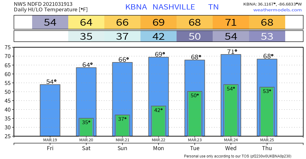
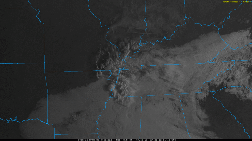
Chilly (maybe sprinkly at times) today until clouds clear. Image below from 9:21 AM. Clearing line may not arrive until late this afternoon. Therefore only 54°. Cold north wind.
Close to freezing around dawn Saturday and Sunday mornings. Then we warm up.
I am supposed to be at the gym.
I’m not because the forecast changed.

Earlier, there was question about whether a warm front would get far enough north “providing ample moisture for storms to feed on.”
You must be logged in to post a comment.