New data arrived over the past few hours. Below see forecast changes.
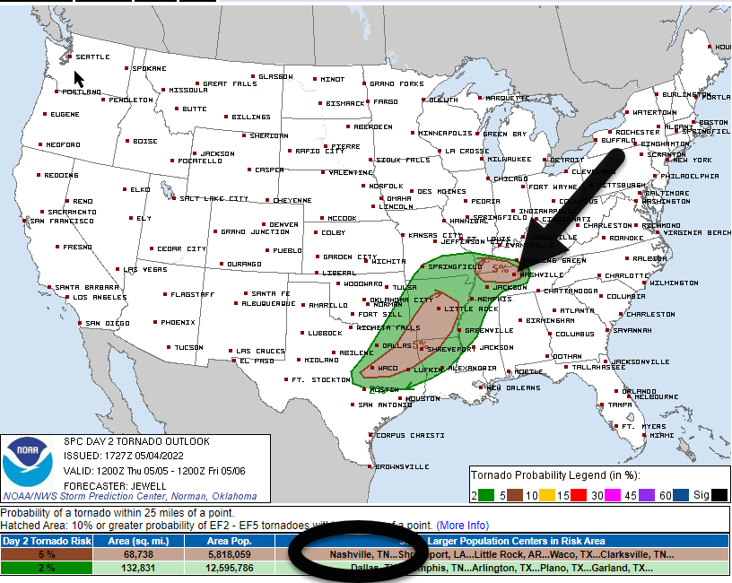
During lunch SPC introduced tornado, hail, and damaging straight line wind risks for Thursday afternoon/early evening.
The probability of a tornado within 25 miles of you is 5%.

New data arrived over the past few hours. Below see forecast changes.
During lunch SPC introduced tornado, hail, and damaging straight line wind risks for Thursday afternoon/early evening.
The probability of a tornado within 25 miles of you is 5%.
NAM3 and HRRR models think storms will fire up mid afternoon Thursday in Middle Tennessee. Both models include storms in Davidson and Williamson Counties. One model thinks another line of storms will arrive Friday morning after AM rush hour. I am not sold on the timing of any of this. Never tell me the odds!
Humidity is way up today compared to yesterday. So is storm fuel/instability.
Storms may develop in Middle Tennessee later this afternoon into the early evening hours.
Exactly when varies by model and model run.
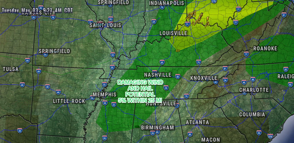
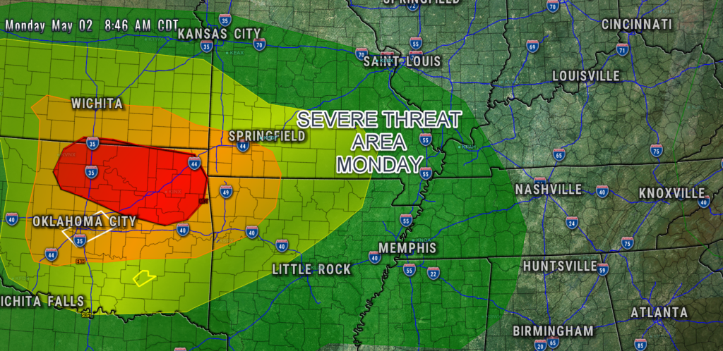
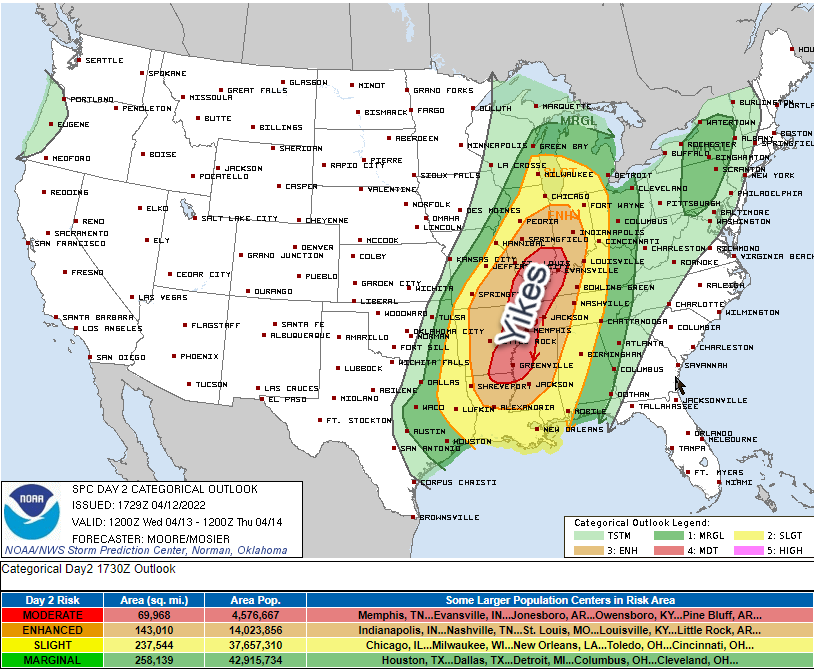
Severe weather is west of us today:
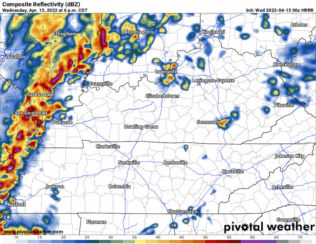
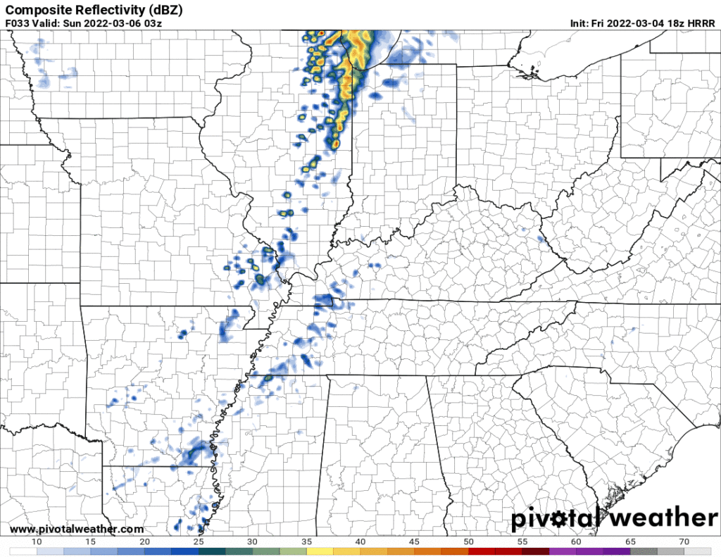
We’ll still get storms tonight. HRRR model (below) ETA 10-11 PM, event lasting a few hours. CAPE and shear both low so no severe. Lightning, maybe, but not a lot.
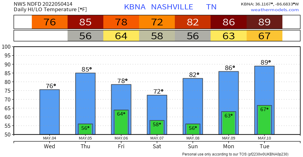
Rain possible every day this week beginning Monday.
HRRR has rain Monday night.
It may miss us to the south.
More rain may sneak in Tuesday morning, here’s the HRRR before it hits the end of its range at 7 AM. Looks like a mid/ late morning ETA.

Quick References:
Weather changes constantly.
Follow @NashSevereWx on Twitter for any changes to this forecast.
Live coverage during tornado and severe thunderstorm warnings:
Look good.
Support the mission.

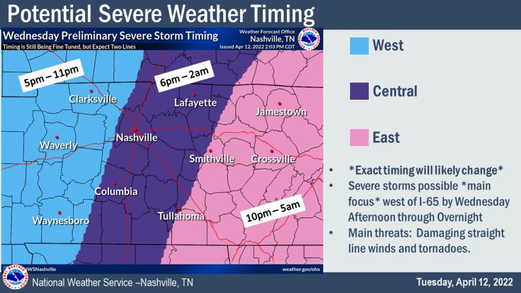
3. TIMING. A squall line is going to come speeding through here probably early evening Wednesday night. “7-8 PM” is NWS-Nashville’s thought which seems about right to me (HRRR model agrees, below) tho that ETA could wiggle earlier or later than that, so look for an update (changes?) tonight and tomorrow.
WHAT
Tornado, damaging straight line winds, and large hail.
A low probability of a high impact event.
In the form of small, rotating supercells spread widely around the evening. So wide we might not even see rain.

LADIES & GENTLEMEN THE WKND
A few showers may sneak Saturday night into Sunday morning, no big deal. Just for some of us tho. Here’s the HRRR showing coverage and intensity. Meh.
Showers and a few storms will stretch out in a line Sunday but the line may stay northwest of us as shown below by the Euro.

Obviously this is a difficult day for many of us, the two year tornado anniversary. In 2020 we wrote a retrospective, last year I wrote a personal note on the one year anniversary, today we invite you to what Riley Eillis wrote about her friends who were lost in Nashville that night.
You must be logged in to post a comment.