
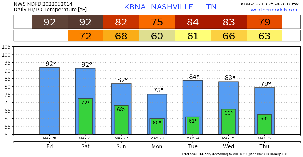
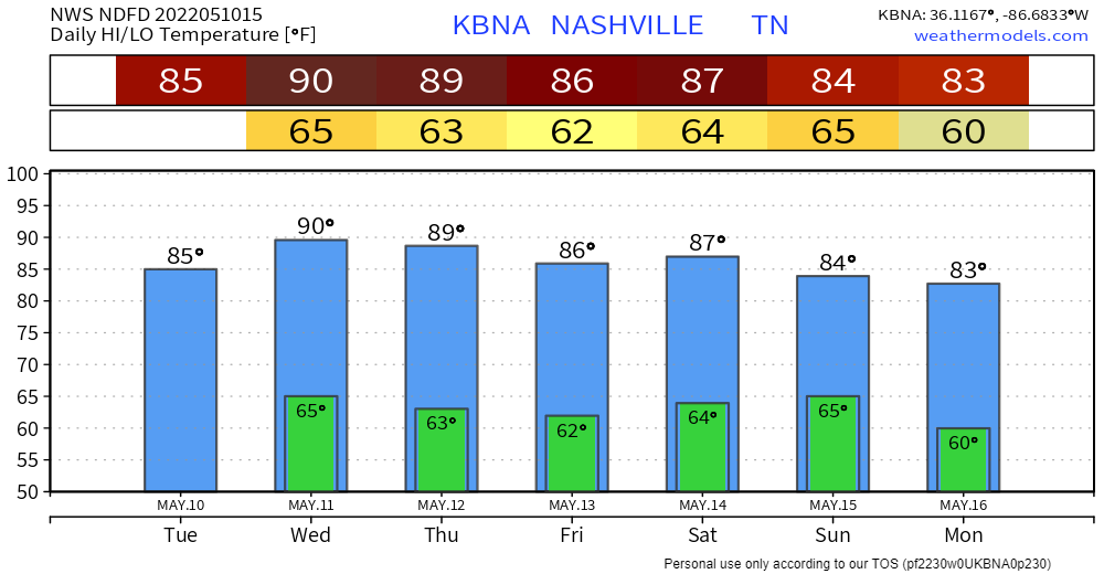
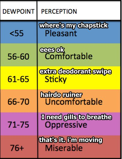
Winds up to 30 MPH today. Humidity May-typical, Sticky/Extra Deodorant Swipe range today and Saturday:

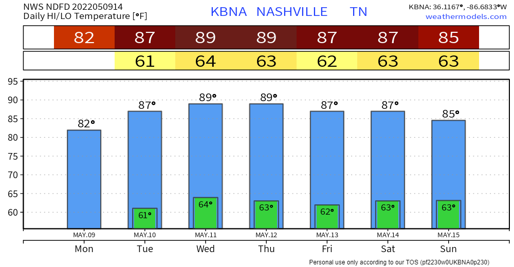
Sweaty / Boaty today and Saturday, hot under that cap and gown:
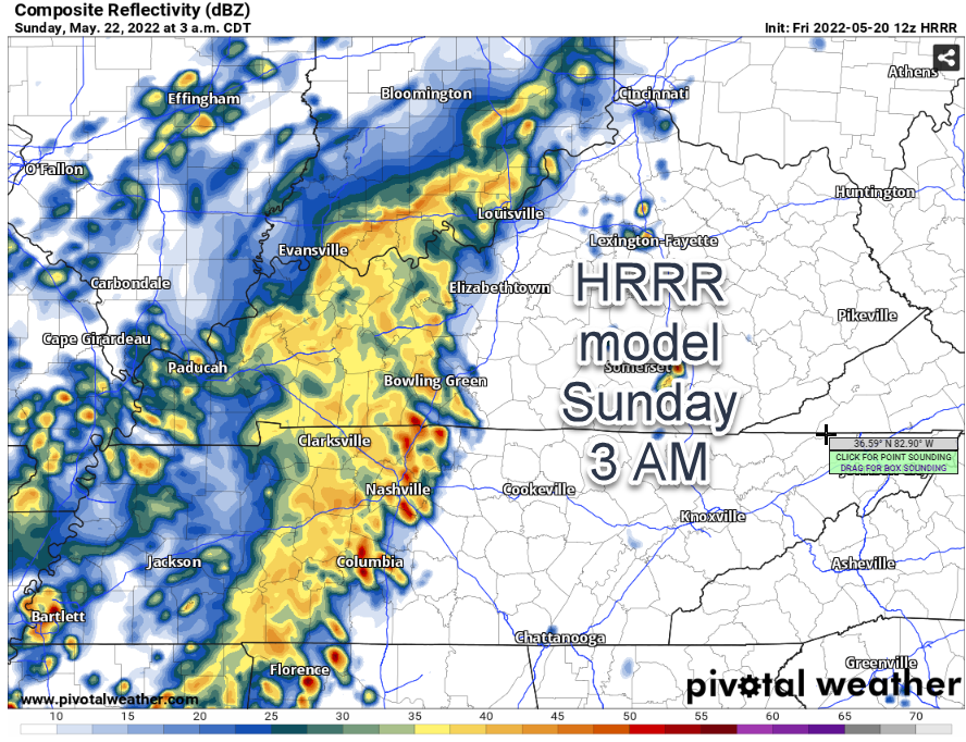
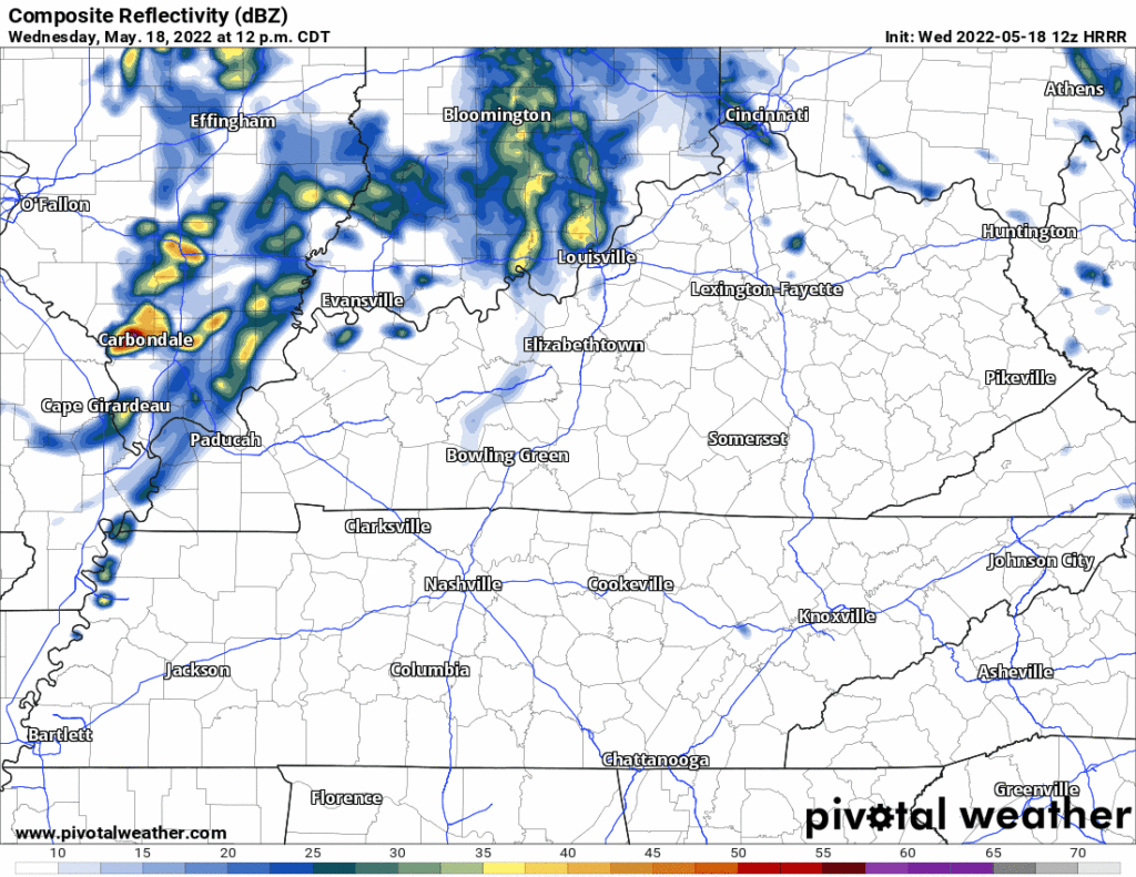
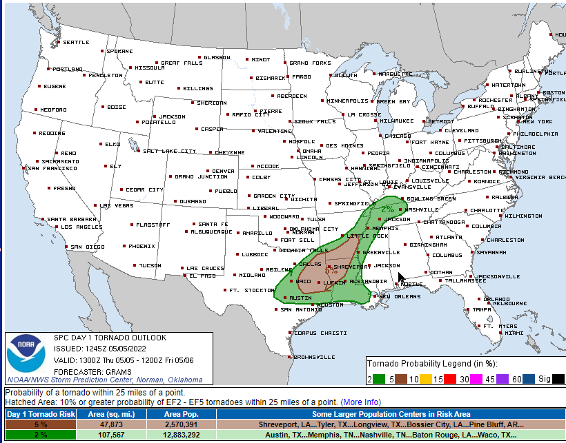
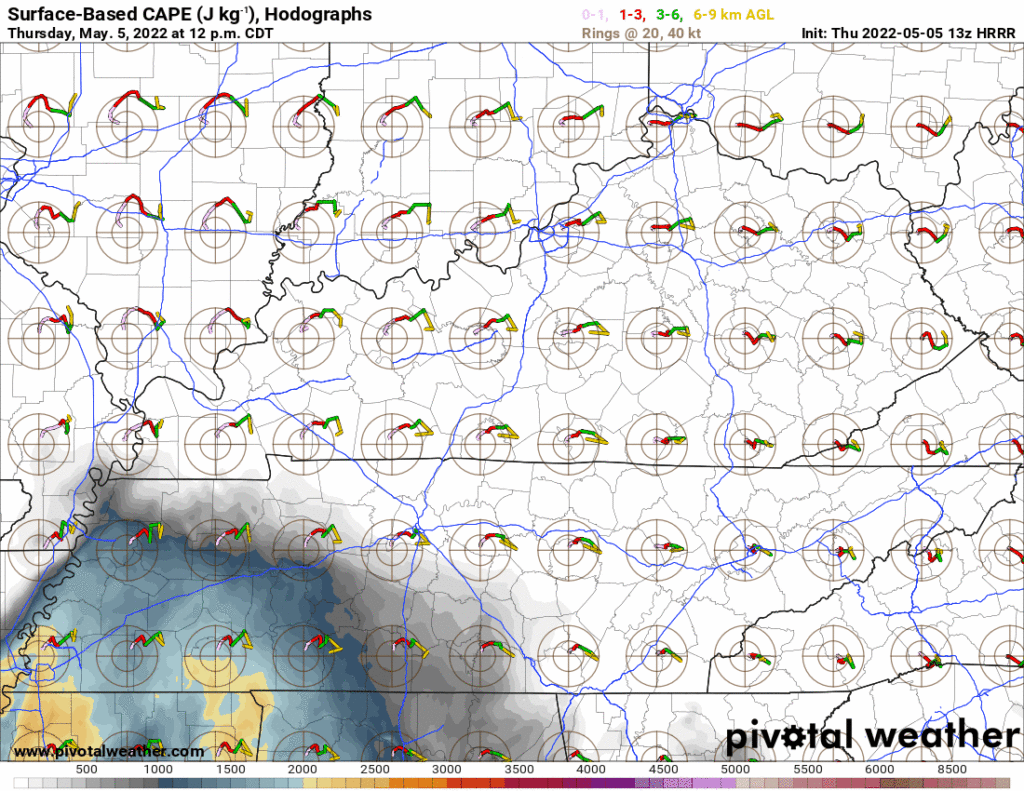
Rain/Storms may sneak in here Saturday late afternoon – early evening. 12z HRRR thinks so:


You must be logged in to post a comment.