Search Results for:

Clear and Cool Today and Tomorrow, Complicated Weekend Ahead
Cool and Clear Today
High-pressure is working its way into Williamson and Davidson Counties this afternoon. That is evident by the 10-15 mph winds and the clearing skies we are seeing. Afternoon high temperatures will reach the upper 40s. All in all, the only weather impact on your day will the wind, which could gust to 30 mph.
Rain Through Sunset, Clearing For the Weekend, Wet Start on Monday
Can We Just Make the Rain Stop Already?
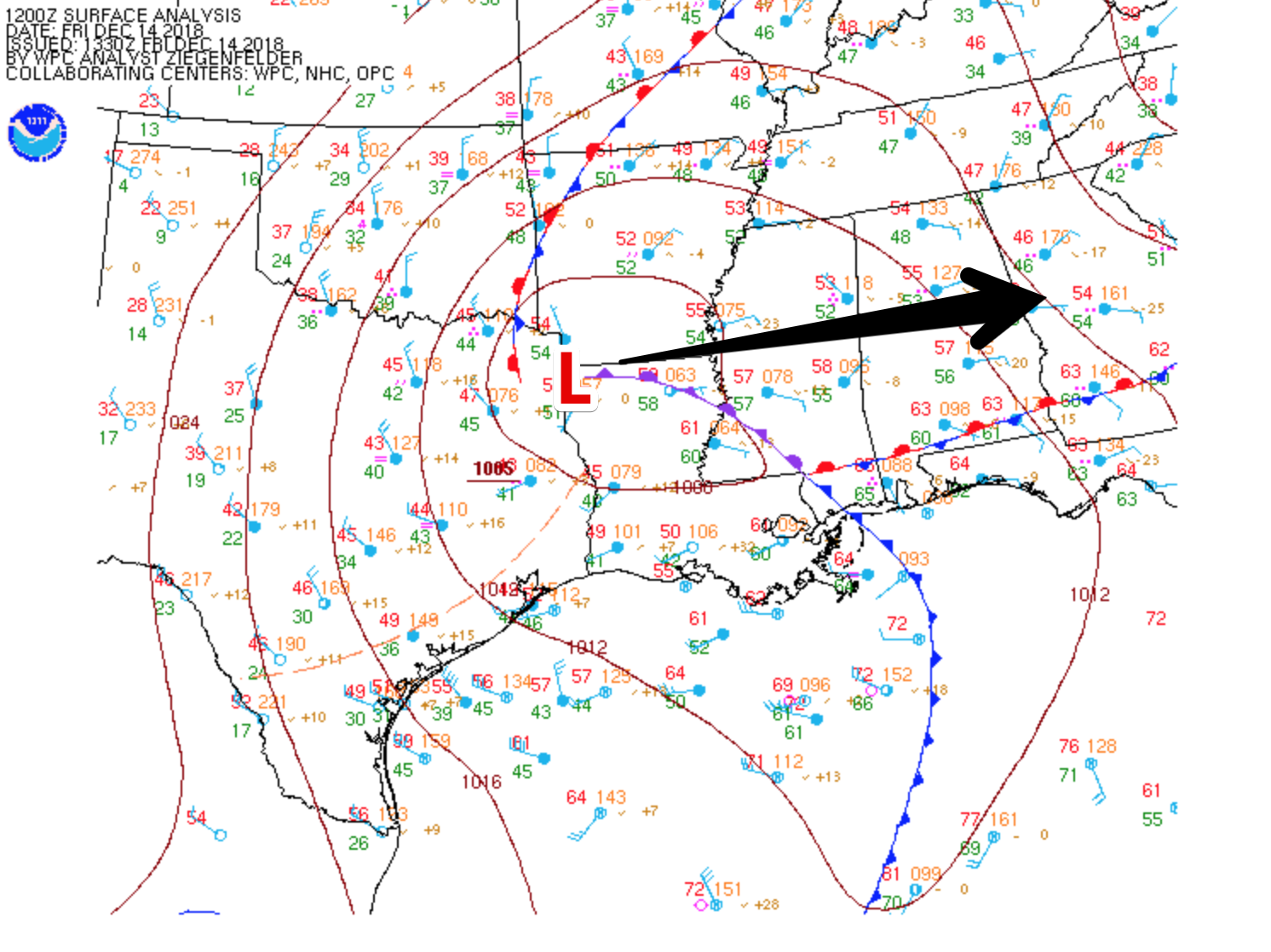
Rain is the story of the day across middle Tennessee as the low-pressure system we have been talking about for the past couple of days makes it’s way through. The center of the low will track right over southern Tennessee today, though rain chances will become limited due to a more northerly track than what was expected.
Rain Today and Friday, Fantastic Weekend Ahead
Keep and Umbrella on Hand
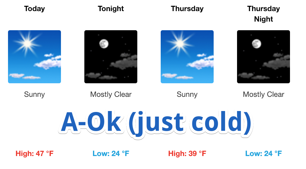
The forecast high today is 47°.
A few showers were spotted around Nashville this morning, a pre-cursor to what we are expecting this afternoon. Rain will gradually move into Williamson and Davidson Counties from the southwest, encompassing all of the area right around dinner time. Keep an umbrella handy in the meantime. Isolated showers will continue in advance of the main event. HRRR Model illustrates how it may pan out.
Cooler Tomorrow, Colts/Titans Forecast, Rainy NYE, Meh-be A Snow Chance Next Week
Dry Today, Cold Front Tomorrow, Music City Bowl looks OK, New Years? Ehh.
Today
Enjoy this calm weather while we have it. Despite clouds hanging around, we’ve managed to reach the upper 50s. After the sun sets, mother nature will be setting the stage for our next weather maker. A surface low-pressure system will move across the Great Plains and into the mid-west, pushing a cold front towards the Nashville area.
Clearing This Afternoon, Dry Christmas Eve and a Mostly Dry Christmas, Then Looking Beyond…
Clearing Today
The rain is on its way out.
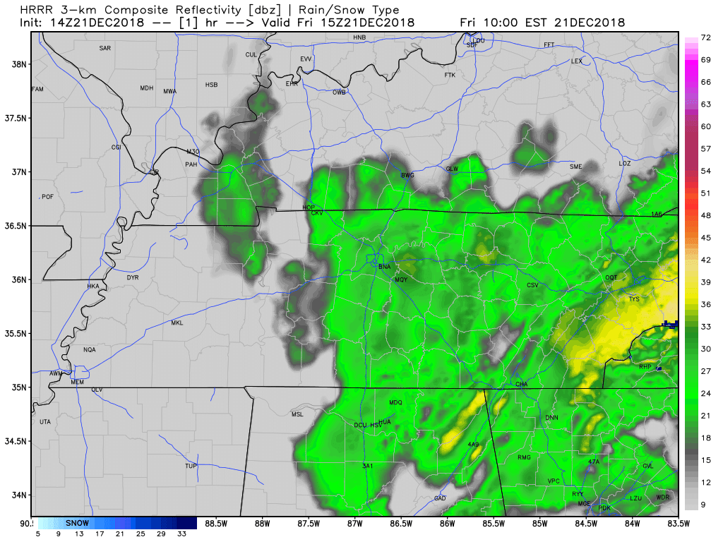
Below is the HRRR’s thinking on today. Notice it has all rain out by 3 PM.
On and off showers will continue through the morning hours and will eventually taper off from west to east as the upper-level low moves north. Additional rain totals could amount up to a quarter inch at most.
Here Comes the Rain, Forecast Models Look Ahead To Christmas
Dry Start to the Work Week, Ending Wet and Cold, Snow Unlikely Late Friday

Wet Couple of Days Ahead, Drying By Sunday
Wet Day Ahead
Outdoor plans are going to be difficult today as a surface low pressure system tracks off to our south. Moisture will become amplified as the afternoon hours progress.
Here is what the HRRR thinks will happen today. Notice the pockets of heavier rain towards sunset; we may hear a rumble of thunder to two. We are not expecting anything in the way of severe weather.