
Can We Just Make the Rain Stop Already?

Rain is the story of the day across middle Tennessee as the low-pressure system we have been talking about for the past couple of days makes it’s way through. The center of the low will track right over southern Tennessee today, though rain chances will become limited due to a more northerly track than what was expected.
What does that mean? Scattered showers through sunset.
High-resolution models (such as the HRRR below) also show a dry slot developing on the southwest side of the low through the afternoon hours that will inhibit rainfall totals. In this morning’s AFD, the NWS agrees.
“Leaned toward HRRR model for light shwr coverage and pops thru remainder of the afternoon hrs.” -NWS Nashville
And here it is below…
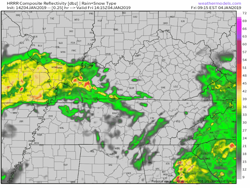
Look for rainfall totals today to amount to around a quarter inch. Afternoon high near 55º. Winds 5 to 10 mph, nothing major.
Stellar Weekend Ahead

All wet weather will clear out by tomorrow morning. Clouds will give way to a bright, sunny day with a high in the mid-50s, which is several degrees above average.
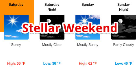
Sunday will be even warmer, just with a few clouds building in ahead of Monday’s cold front. Afternoon temperatures on Sunday will be about 10º above average.

Next Weather Maker | Editor’s Note… BOOOOOO
Wet weather will return Monday with the arrival of another cold front. Timing has been pushed up a bit, so expect rain to begin Monday late morning/afternoon and come to an end by Tuesday morning. We’ll keep an eye on it.
Beyond that event, middle Tennessee looks dry through next weekend! Enjoy the sun this weekend!

Categories: Forecast Blogs (Legacy)
You must be logged in to post a comment.