Evening Storms, Better Rain Chances This Week

Current Radar

Tonight: Any Remaining Storms Dissipate, Humid – 9PM 83°

The heat advisory continues through 8PM tonight. Afternoon storms will continue into the evening, until the sun sets. That’s when the valve shuts off and we dry out. Temperatures will “cool” into the 80s, but with ample humidity, it will still feel a bit uncomfortable outside. read more

Evening Storms, Then More HOT.

Current Radar

Tonight: Leftover Storms, Still Humid – 9PM 86°

A few frog stranglers/severe storms have popped up across the area this afternoon. For updated warning information visit @NashSevereWx on Twitter, and send any storm reports to #tSpotter.

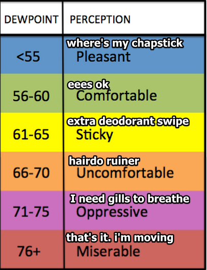
Remaining storms will dissipate by mid evening, leaving partly to mostly cloudy skies behind. Humid air will stick around, but at least the temps will be a bit cooler following the rain.

Saturday: Heat Advisory Continues, Hot and Humid – Wake Up 76° High 95°

HEAT ADVISORY REMAINS IN EFFECT UNTIL 8 PM CDT SATURDAY... * HEAT INDEX VALUES...105 TO 110 DEGREES EACH AFTERNOON. * IMPACTS...PROLONGED EXPOSURE OUTSIDE MAY CAUSE HEAT RELATED   ILLNESSES SUCH AS HEAT EXHAUSTION OR HEAT STROKE. OVERNIGHT   LOW TEMPERATURES WILL PROVIDE LITTLE RELIEF FROM THE HEAT. PRECAUTIONARY/PREPAREDNESS ACTIONS... A HEAT ADVISORY MEANS THAT A PERIOD OF HOT TEMPERATURES IS EXPECTED. THE COMBINATION OF HOT TEMPERATURES AND HIGH HUMIDITY WILL COMBINE TO CREATE A SITUATION IN WHICH HEAT ILLNESSES ARE POSSIBLE. DRINK PLENTY OF FLUIDS...STAY IN AN AIR-CONDITIONED ROOM...STAY OUT OF THE SUN...AND CHECK UP ON RELATIVES AND NEIGHBORS. TAKE EXTRA PRECAUTIONS...IF YOU WORK OR SPEND TIME OUTSIDE. WHEN POSSIBLE...RESCHEDULE STRENUOUS ACTIVITIES TO EARLY MORNING OR EVENING. KNOW THE SIGNS AND SYMPTOMS OF HEAT EXHAUSTION AND HEAT STROKE. WEAR LIGHT WEIGHT AND LOOSE FITTING CLOTHING WHEN POSSIBLE AND DRINK PLENTY OF WATER. read more

More Heat on the Way, Slight Chance of Afternoon Showers

Current Radar

Tonight: Still Pretty Hot, Clear Skies

Expecting for mostly clear skies through the overnight hours. Still have a small chance of some pop-up showers developing, but since they haven’t so far, our chances have diminished. Stick with us on Twitter @NashSevereWx for the most up to date information. We will let you know if we see any rain/storms developing. read more

Heat Continues On, Rain Dissipating Into the Evening

Current Radar

Tonight: Rain Clearing – Temps Stay Warm Thru the Night

And just like that those afternoon showers decided to rain on our parade. We still could see a few more pop-up storms in and around the Nashville area through the remainder of the afternoon. Main concerns with these are heavy rainfall and damaging wind gusts. read more

Rain Diminishes Tonight, And The Heat is On

Current Radar

Tonight: PM Storms Diminish, Muggy and Warm – 9PM 84°

Any afternoon storm development will be shutting down by sunset. Expect warm and muggy conditions this evening with temps in the mid 80s by 9PM. Abundant moisture in the air makes it more difficult to cool down, so your post-workday lounge on the porch may not be as comfortable as other nights. Even your camera phone feels the moisture-laden, soupy air. read more

A Series of Ridiculously Hot Days

Current Radar

Tonight: Slight Chance of Showers – Temps Into the Mid-70s

Any lingering shower from this afternoon shouldn’t last much into the evening after sunset. Partly cloudy skies should follow through the night.

The NAM 4 shows us getting some scattered showers during the late overnight hours (after midnight) but seems to be the only model with this thinking. Worth the mention, but we will wait to see what the HRRR has to say about that happening later this afternoon. read more

Hot Week Ahead, It’s My Turn to Write the Blog; Therefore, a Rant

Current Radar

Y’all. Sharknado4 comes out in 2 weeks. 

Sharknado is a lot of fun. Best viewed with friends, responsibly consumed alcoholic beverages, and crazy-low expectations.
Highs Monday through Sunday: 95°, 95°, 94°, 96°, 96°, 95°, 95°. Although the GFS model has a few late week temps over 100°, the GFS model has joined the “It’ll be hot, but not that hot” movement started by the Euro model this afternoon. Maybe not over 100°. But still….
The heat & humidity combo is the bigger deal. Afternoon dewpoints will hover around 70° all week. According to this unofficial chart, we’ll end up somewhere between ruined hairdos and needing fish lungs.

read more

Hot Week Ahead

Current Radar

 Looks like the “hard G” is winning. Gif as in “gift.” I was in the “soft G” camp, until I read this:

I would agree with its creator. pic.twitter.com/wKdd5sqZKV read more

Drying Out This Evening, Then Continued HOT

Current Radar

Tonight: Drying Out, Cooler – 9PM 80°

As a trough slides east of our area towards the Plateau, we will dry out for any evening plans. Don’t forget, tonight is a night of music and barbecue at Nashville’s Rib and Jazz Festival downtown in Cumberland Park! Mmm…barbecue. read more

Rain Possible Tonight, Hot and Humid Weekend Ahead

Current Radar

Tonight: Chance of Storms – 9PM 81°

IMG_9474

Thunderstorms have formed to our northwest today in response to an approaching cold front. The latest high resolution models have these storms holding together long enough to make it into our area this evening/overnight: read more