Current Radar
Tonight: PM Storms Diminish, Muggy and Warm – 9PM 84°

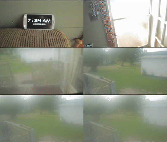
Any afternoon storm development will be shutting down by sunset. Expect warm and muggy conditions this evening with temps in the mid 80s by 9PM. Abundant moisture in the air makes it more difficult to cool down, so your post-workday lounge on the porch may not be as comfortable as other nights. Even your camera phone feels the moisture-laden, soupy air.

Wednesday: Just Plain HOT – Wake Up 74° High 95°

It’s highly unlikely we see any rain on Wednesday, but don’t be caught off guard by a summertime pop-up shower. The atmosphere will still be filled with lots of moisture and heat, which when forced together, combines to generate thunderstorm energy. However, Wednesday looks like most of these rain chances remain south and west of our area.
Temperatures and the “feels like” readings will be the main story. Full fledged sunshine and a high pressure dome building in will result in a strengthening heat wave here and across the mid-section of the country. We are not alone. Take a look at all of the heat advisories, watches, and excessive heat warnings on this map:

We are not forecast to reach “advisory or warning” criteria temperatures at this time, but you’ll do best to limit your time spent outdoors the next several days.
Extended Outlook: Oppressively Hot
Again, don’t be surprised to see a pop-up shower in and around the area due to the amount of heat and humidity present. However, it appears high pressure will suppress most rain chances until the weekend, and especially next week, when rain chances return more steadily.
Allergy Report: 5-Day Pollen.com Forecast
This website supplements @NashSevereWx on Twitter, which you can find here.
Categories: Forecast Blogs (Legacy)


You must be logged in to post a comment.