Positive lightning strikes near Franklin sure to rattle homes and upset local dogs. No other hazards. 439 PM

Positive lightning strikes near Franklin sure to rattle homes and upset local dogs. No other hazards. 439 PM
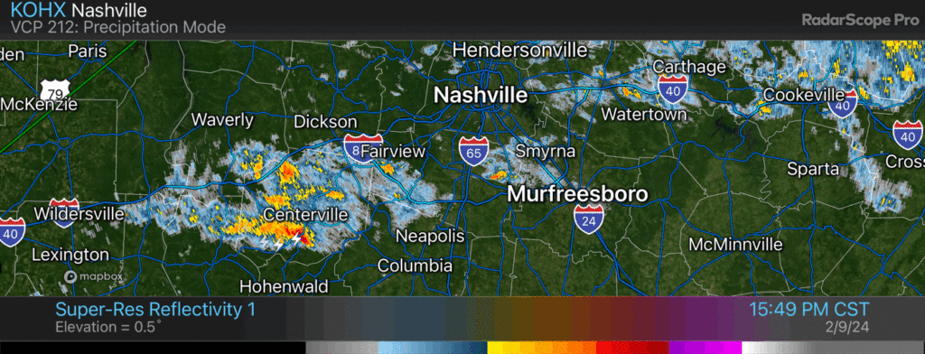
Another thunderstorm rumbling thru tossing lightning and downpours / 422 PM
Thunderstorm working across Will Co should stay south of I-40 / 1142 AM
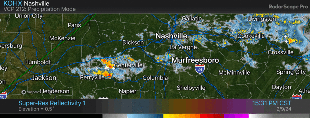
Lightning storm coming into Fairview and Fernvale. Bellevue/Warner Parks/Brentwood next. 11:26 am
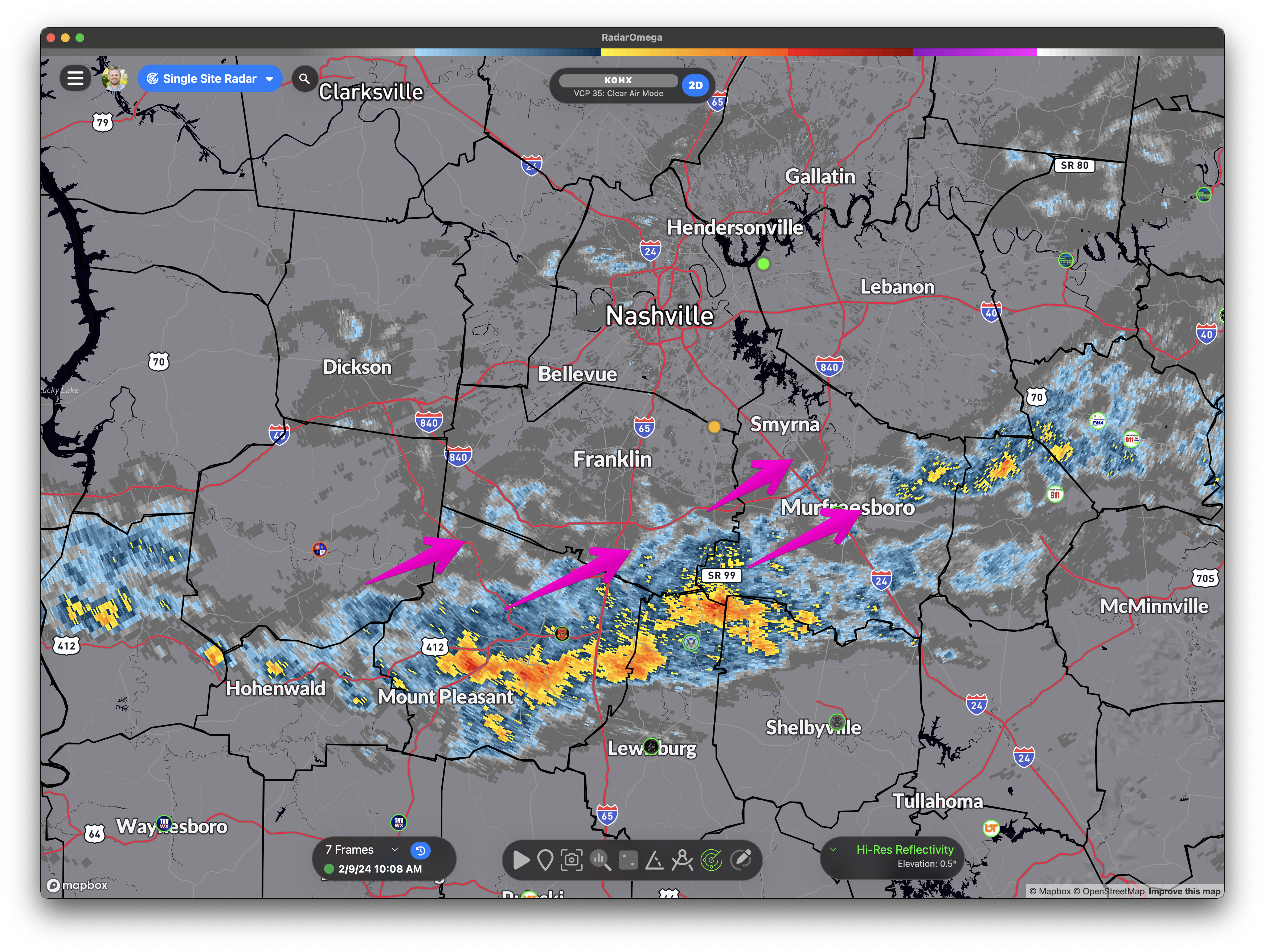
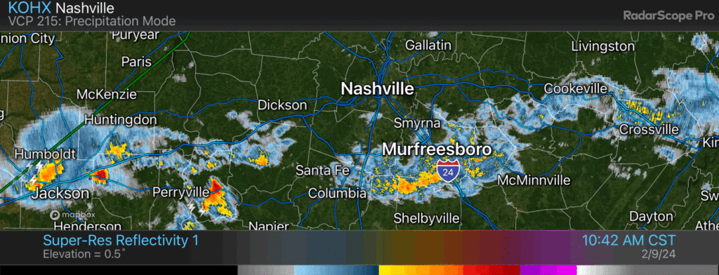
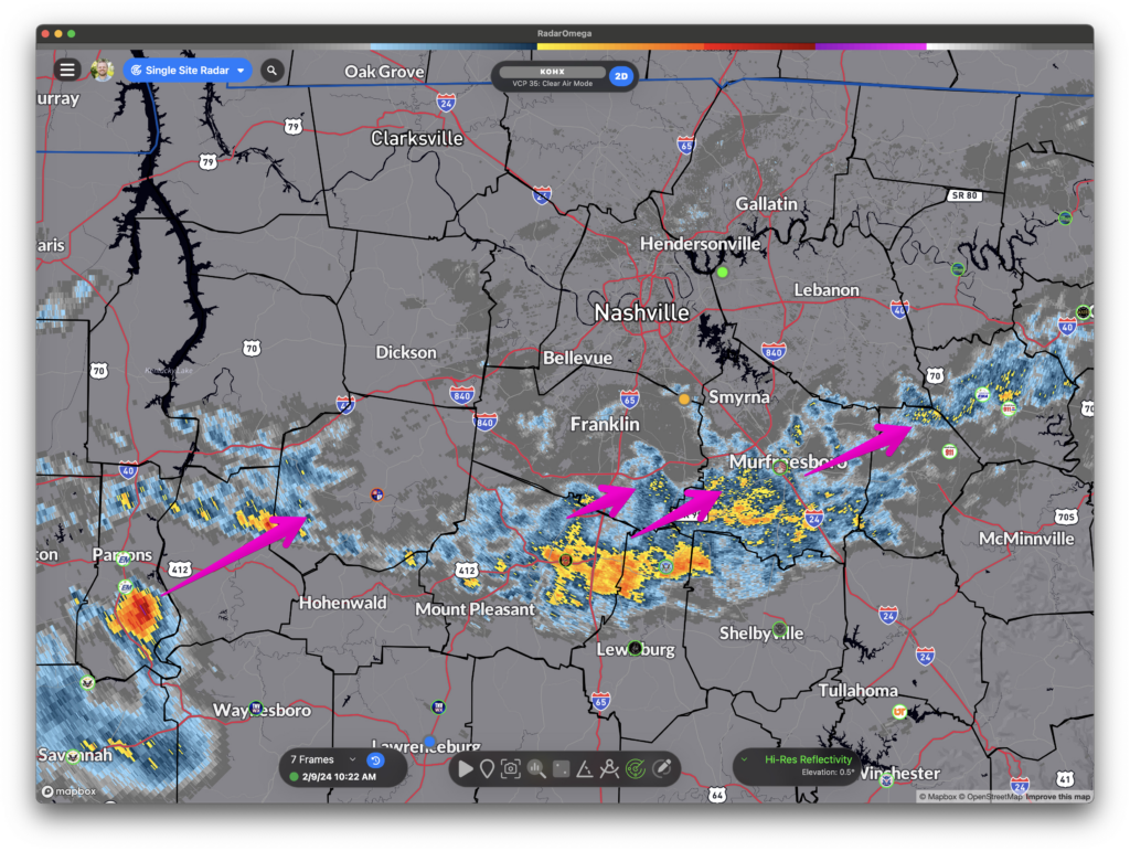
Radar Update 10:22 am: Heavier rain missing us juuuuust off to the SE. Sneaky cell headed our way tho from the SW. Off/On showers continue through the day, some brief moderate/heavy rain possible.
Besides a few showers, fairly nice, but windy day. Today was our last nice-day weather wise for a hot minute.
Rain chances ramp up tomorrow and stick around for the weekend.
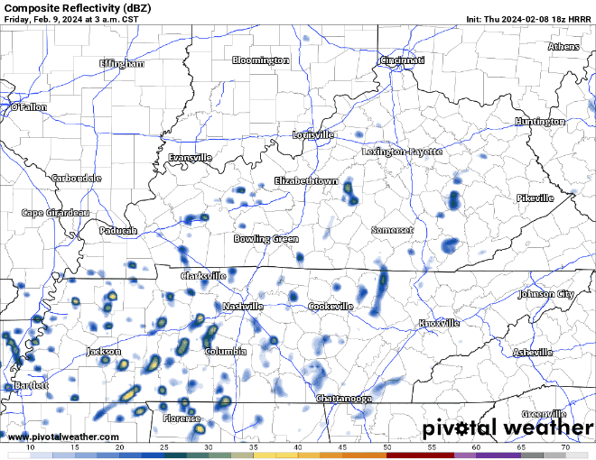
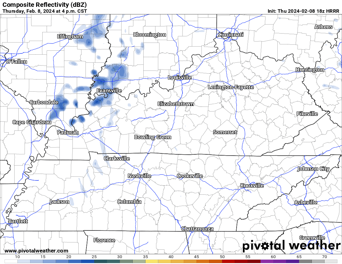
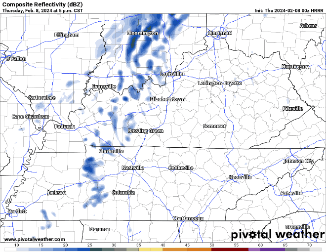
HRRR model (above) shows the sporadic nature of the showers/non-severe t-storms throughout Friday.
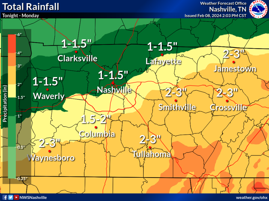
Rain off and on through the weekend. Drizzly, then downpours, then jack squat, off/on, creating difficulties for planners. No severe weather. Golfers pack a poncho. Good luck dodging the dripping. HRRR model attached. Drought continues to lose its grip. More info tonight when Elan logs on. (BTW, we are still working to crush bugs on this new platform. Please keep sending bug probs, we have a large squishing shoe. Future is bright, giddyup).
We had a wonderful day today, but unfortunately all good things must come to an end.
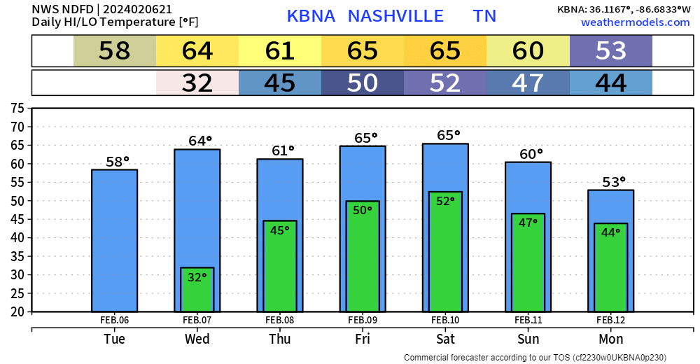
At least the first half of Thursday will be nice, but rain chances start to creep in as we hit the PM hours and stick around for the weekend.
We didn’t quite make it to 60° today, but with plenty of sun we still had a beautiful day.
Wednesday will be even warmer, with high temps in the mid 60s with plenty of sun.

First half of Thursday will be nice, with high temperatures returning to the low 60s.
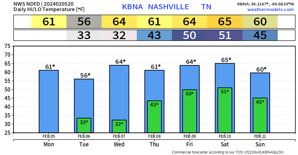
High temperatures running 10-15 degrees above average this week + dry until Thursday PM =
Remarkable start to the month.

All quiet until Thursday PM.
“A series of shortwave troughs…will bring us several waves of rain and a few thunderstorms throughout the extended period.” – NWS Nashville
You must be logged in to post a comment.