
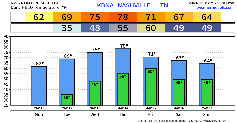
📅 Friday Rain, Storms. 🥶 Next Week. Blog deets ….
Temps ahead well above normal, but record highs safe.
Colder next week. Technically, still Winter. Spring never arrives on a gentle warm slope.

📅 Friday Rain, Storms. 🥶 Next Week. Blog deets ….
Temps ahead well above normal, but record highs safe.
Colder next week. Technically, still Winter. Spring never arrives on a gentle warm slope.
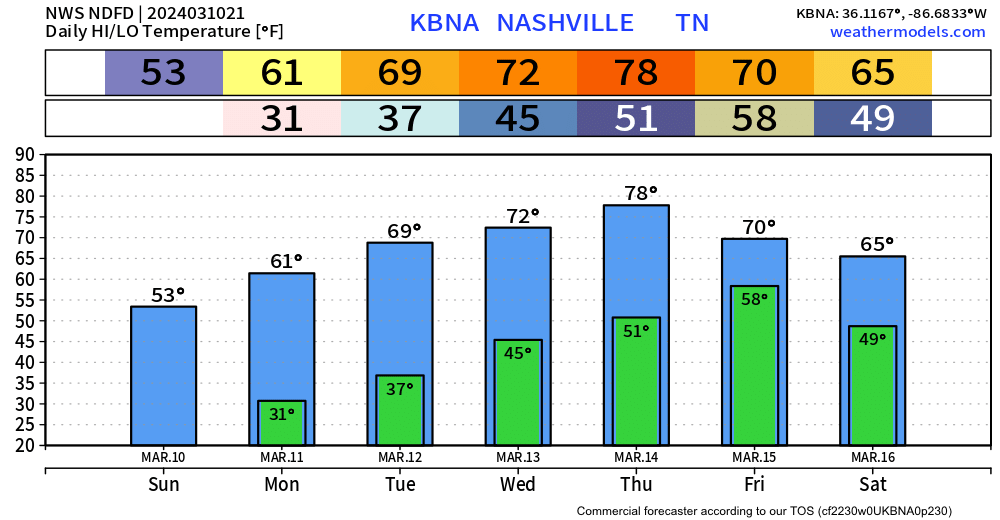
In this blog: Freezing 🧊 Fire 🔥 Rain/Storms ⛈. Deets….
Near freezing around sunrise Tue. Warming up this week.
These temps 15-17 degrees above normal. Not hot enough to break records.
Fire Weather. Meh. Worth mentioning I suppose.

Temps may fall to 32° just before sunrise at BNA, but lower temps are possible in outlying areas. Last night was a good example. Got down to 36° at BNA, but we had ice on our cars this morning out where we live, with a low of 30°. So, your mileage may vary again tonight. All that to say, cover yo plants.
Rain, storms Friday. Until then we good fam.
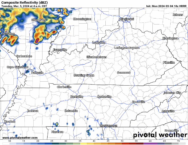
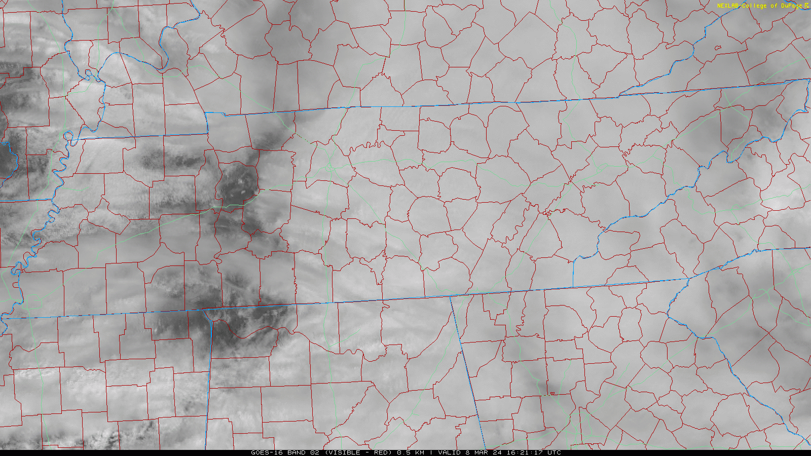
Showers this afternoon will clear out this evening, giving way to a precip-free first half of the week. HRRR through 10 pm:

Some chilly nights are expected tonight into Sunday morning and more so Sunday night into Monday morning. Expect scattered frost or even a light freeze either night, or both. I saw y’all at Lowe’s yesterday. Y’all who were buying flowers, tuck them in for the night. Remember, we’re not safe from freezes until about tax day around here.
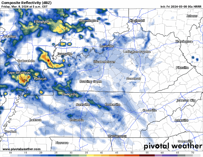
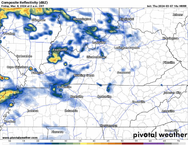
HRRR model update thinks most of the rain tonight/overnight will be gone by sunrise Sat. Few passing lunchtime showers possible.
Heaviest rain scoots just east of us. If the model is off by just 30-40 miles, we could be really soggy in the AM.
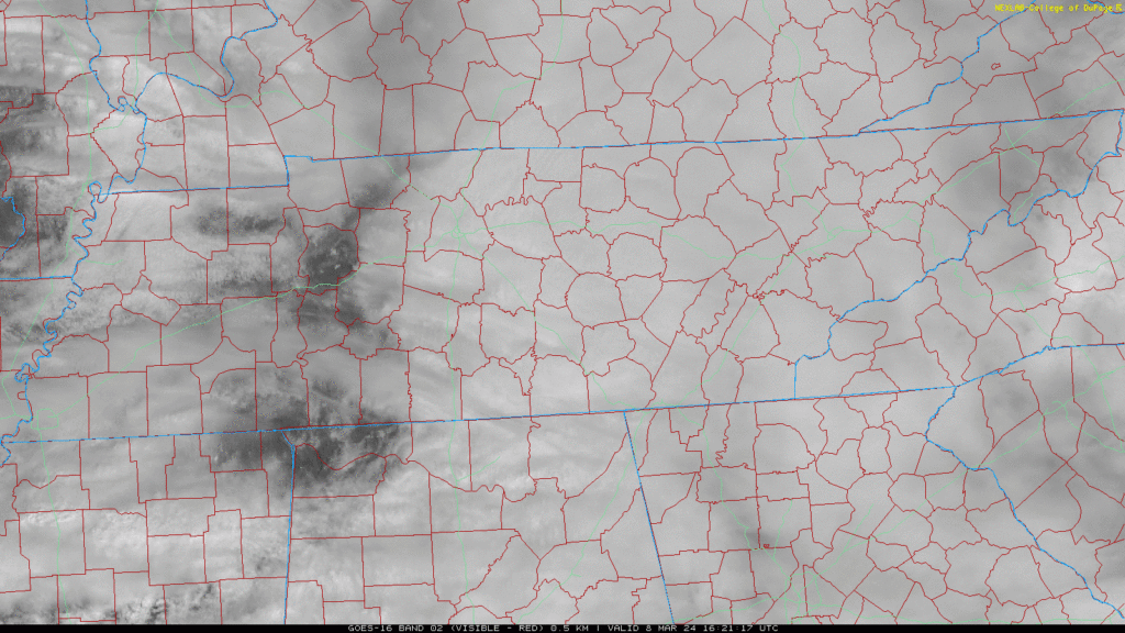
Today’s blog feat. sunshine south of I-40 that won’t last.
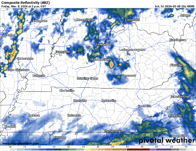
More light, off and on rain incoming tonight and Sat morning. Latest HRRR below, time stamp upper left:

Downpours Sat AM may ruin dry-required activities. 0.75″ average rainfall, enough to waterlog most fields. However, variance will be high so your results may vary.
Light rain this morning. Break this afternoon and early evening. More off and on heavier rain overnight and Sat AM. Totals about 0.75” on average.
Showers will begin Friday morning and continue on and off until around midday Saturday. HRRR model shown below.
Heaviest rain looks like it’ll fall overnight Friday.
No severe weather concerns for us, those probabilities are to our south and west.
Rain off & on begins Friday morning and continues to around lunch Saturday. HRRR model:
Rainfall totals will vary. HRRR has 0.3″ in some local spots, others 1″. Rainouts will be hit or miss.
You must be logged in to post a comment.