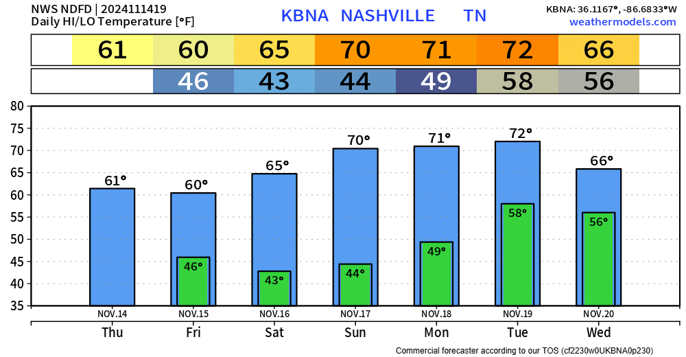
Dry and warm today and Monday. Highs in the low 70s, 12-15° above average.
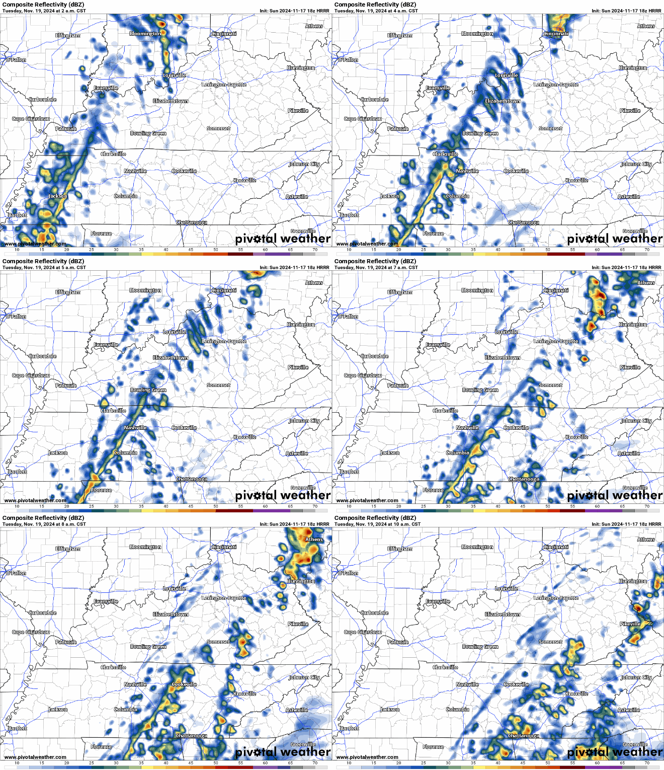
A thin line of showers is expected to move thru our area early Tuesday morning, providing us with a little rain, but not much else.

Dry and warm today and Monday. Highs in the low 70s, 12-15° above average.
A thin line of showers is expected to move thru our area early Tuesday morning, providing us with a little rain, but not much else.
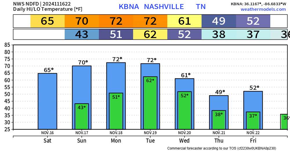
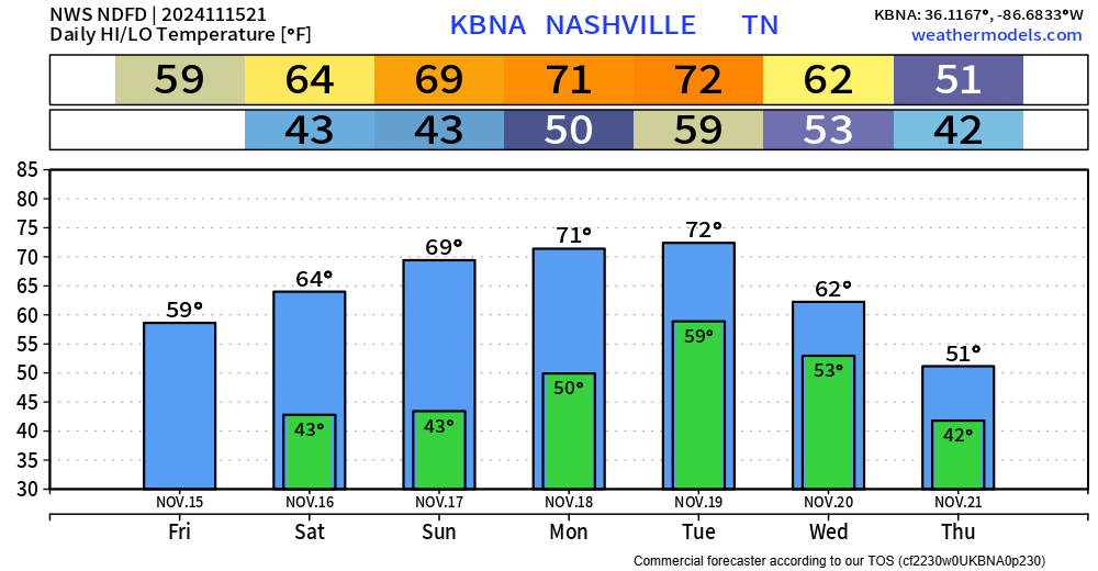
Nice and seasonally warm day today, even warmer on Sunday and Monday with highs reaching into the low 70s.
The low 70s stick with us on Tuesday, however rain chances will return.
For now, scattered showers (and maybe a rumble of thunder) will be possible, most likely during the first half of Tuesday. No shenanigans expected, rainfall totals will generally be light around 0.25 – 0.5″.
The cloud cover was stubborn today, keeping temps fairly cool, but at least we are dry.
We are in store for some great HS playoff football weather tonight. Temperatures near 50° for kickoff, getting into the upper 40s by the 4th quarter. For players, this is nice. For those in the stands, a jacket will be your friend.
The cold front that brought us some beneficial rain yesterday has cleared the area, leaving us with some cooler temps – unfortunately the cloud cover is being stubborn.
You can bet your bottom dollar.
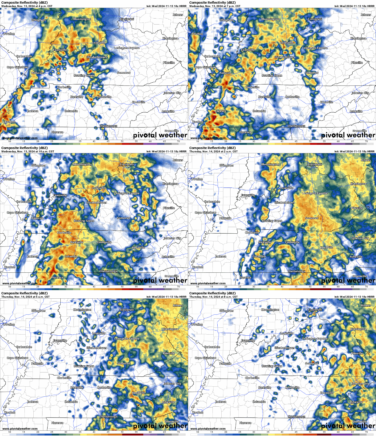
Most, if not all, of us have seen some showers today. While the majority of it has moved off to the north, we expect another round of more consistent heavy rain after dark tonight.
Right now, the ETA for the heavier rain looks ~ 8pm, give or take an hour or so. Model data could be wrong!

A very nice November day today, unfortunately the same cannot be said about tomorrow.
HRRR model (below) shows how most model thinks Wednesday plays out…
No severe weather expected! Maybe a rumble of thunder though. Good rain to sleep to.

Temps will be cool to start us off Tuesday morning but will warm up into the low 60s – around average for this time of year.
Surprisingly, the GFS and Euro both have solid agreement on how our mid-week rain chances will play out.

Some more scattered showers (maybe a rumble of thunder) continue to move thru the area this evening. Things should wind down over the next few hours, you can view the radar anytime on our website here: Radar | Nashville Severe Weather

At the time of this writing, rain is knocking on the door of both Davidson and Williamson Counties. See latest radar here.
The morning weather balloon in Nashville showed some pretty dry air in the mid-levels, which means the air will pick up some of the moisture the clouds will be putting down. Translation: scattered showers have been a little slower to get here.

–It’s going to rain this weekend. Off and on. Some downpours. Some dry spells.
–When exactly?
–Knowledge of exact timing would be great, but rain follows no schedule. /smug phrasemaking satisfaction smirk/.
You must be logged in to post a comment.