Current Radar
Happy Thanksgiving! Today…High of 68º
Today’s weather will be great. We’ll see mostly sunny skies and warm temps. Things begin changing tomorrow. Clouds and humidity will increase overnight.

Current Radar
Happy Thanksgiving! Today…High of 68º
Today’s weather will be great. We’ll see mostly sunny skies and warm temps. Things begin changing tomorrow. Clouds and humidity will increase overnight.
Current Radar
Happy Wednesday! Hope you’re mentally prepping for tomorrow’s food intake…
We’ve got another quiet, but pleasant, weather day ahead.
There will likely be a few more clouds around today, but no rain.
Current Radar
Temperatures will fall into the low 50°s this evening.
Skies will be partly cloudy with calm winds.
It’ll be cold again overnight as lows drop to the upper 30°s.
The high pressure that’s close to us today will scoot away by tomorrow, allowing for some more cloud cover and more moisture to start sneaking-in.
Current Radar
Today – Sunny High: 54°
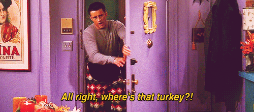
Since it is Monday I thought I should make this blog more fun by making it FRIENDS themed. Enjoy!
We will continue to stay under a cooler, drier air mass today with temperatures only reaching the low 50s this afternoon.
Current Radar
Today – Cooler! Brrrrr! High: 41°
The cold and dry air mass is settling in after the frontal passage yesterday. Temperatures are much cooler today only reaching the low 40s around our area. Dew points are in the teens throughout the day as northerly winds filter in cooler, drier air.
Current Radar
Good morning & happy Saturday!
While it’s dry for us this morning, a gnarly low pressure system just to the north has brought snow to Iowa, Illinois, Indiana and even as close as Missouri.
Current Radar
Friday – Pleasant High: 57°
It is Friday and a pleasant day is in store for us! Surface high pressure has conditions quiet for today.


Dew points will drop below 50° this afternoon under a sunny sky.
Current Radar
Expect cool, but pleasant, conditions this evening.
Skies will be clear by tonight, and that will send temperatures down to the mid 30°s overnight.
After a cold start tomorrow, highs will have a hard time getting out of the upper 50°s.
Current Radar
1.42″ fell in the Official Rain Can today. For 23 consecutive hours, winds gusted to at least 25 MPH. For 10 of those hours, winds gusted to at least 30 MPH. Top “official” wind gust: 44 MPH.
Current Radar
Strong southerly winds are calming down as the Wind Advisory becomes a memory. Overnight, we officially had a 44 MPH wind gust.


As you can see from the above radar, and the below satellite image, the rain is almost over and the clouds aren’t too far away from clearing out.
You must be logged in to post a comment.