Meh.

Satellite in the sky. We bathe in sun.

I can’t find anything meaningful in the models through the weekend. The Euro tosses a sad, lonely, ineffective shower at us Sunday morning but that looks like nothing. Next week a few systems approach from the west but are battling rain-eroding high pressure as they work east. So while next week looks maybe wet, it’s all too uncertain to comment further. Meh. read more

The Will Co Shamnado Promotion, You May Be Eligible For Federal Flood Assistance, Expect Rain Tonight.

NWS-Nashville promoted Sunday night’s near Page High School Shamnado to Tornado, an EF-0 of very little power.

Shamnadoes are more frequent than we think. Shamnadoes are most dangerous when they intersect us when we are most vulnerable, such as “during trapeze practice.” Severe Thunderstorm straight line winds are as damaging, many times more damaging, but a shamnado can tip or damage an unanchored mobile home, or send your vehicle’s wheels off the ground. read more

No Reason To Read This Unless You Want to Read About The Will Co Shamnado

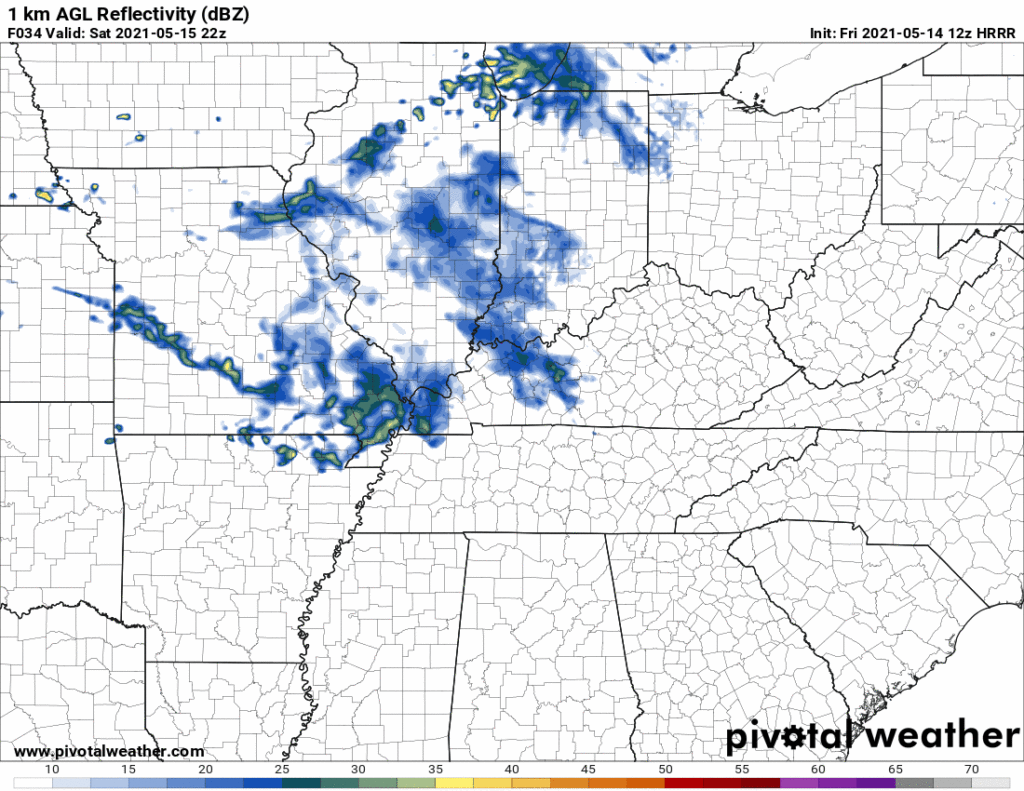
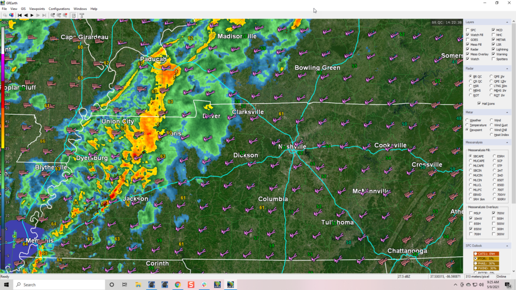
There was an almost-but-not-quite tornado yesterday in Will Co:

This was from the storm that got the Severe Thunderstorm Warning near Page HS in Will Co. There was rotation, briefly. Did it touch the ground, ehhh probably not. We talked to the NWS about it. We went out there and there was very little damage (a few trees, looked more like a severe thunderstorm). But was it a tornado? Ehhhhhhh nah. These are called “Shamnadoes.” They’re not quite tornadoes, they’re not exactly straight line winds, and they do no ratable damage that would classify them on the EF scale. They spin up superfast then fall apart just as fast. So, Shamnado. They’re “sham” tornadoes, a play on words, named after NWS-Nashville lead forecaster Sam Shamburger, who studies them. Great job by NWS on this, a Tornado Warning was unnecessary at the time, and in hindsight not issuing a tornado warning was a good decision. The Severe Thunderstorm Warning was exactly the thing to do. We’re blessed with excellent radar meteorologists here, making tough decisions about warning (or not), severe vs tornado. Good work, y’all. read more

Storms Possible This Evening, Rain Chances This Weekend Into Next Week

Two Tornadoes in Davidson County on Tuesday

Two tornadoes touched down in northern Davidson County on Tuesday morning, according to a damage survey by NWS-Nashville. The first along a W to E path just north of I-24/Joelton. The other along Lickton Pike/Old Springfield Pike/Hwy 41 just N of Goodlettsville. Both were EF-0. They both occurred within the tornado warning that had been issued and were from the same storm. The first tornado touched down, lifted, then touched down again as it moved east. read more