Warmer Temps On the Way + Weekend Rain?

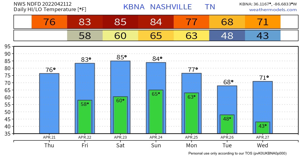
A cool morning turning into a pleasantly warm day. Super dry atmosphere = clear skies and lots of sunshine.

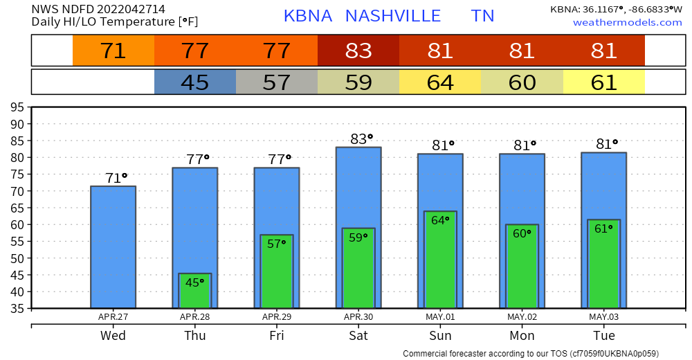
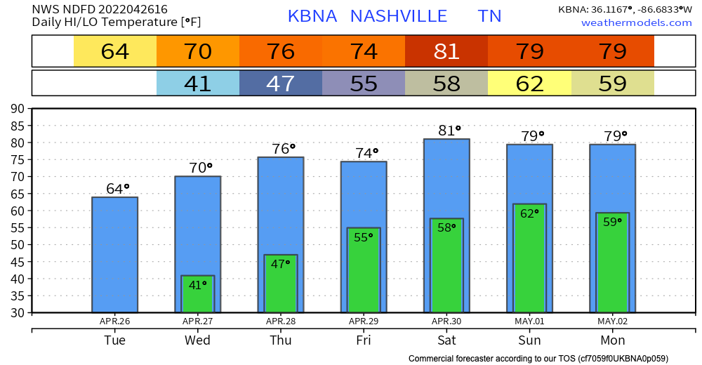
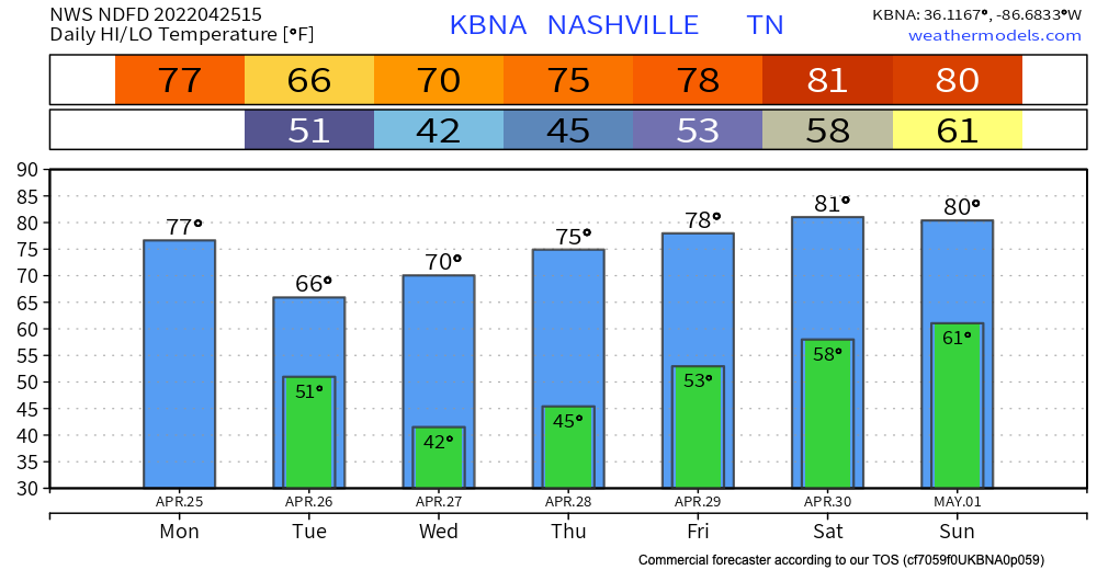
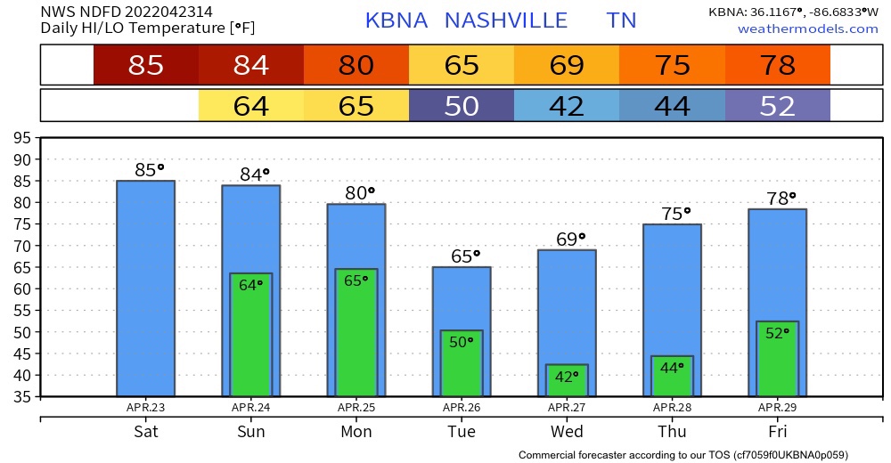
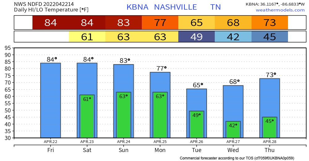
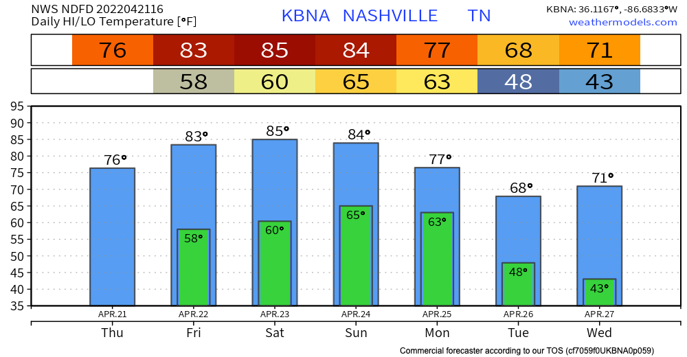
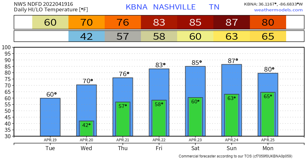
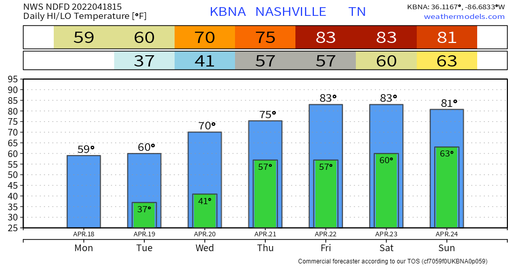
A surface ridge will bring us progressively warmer temps in the coming days. Highs in the 80s by the weekend. Well above average this time of year. Extra moisture will come with it. A little more cloud coverage and rain chances start to creep in over the weekend. read more

Cooler Temps Tonight; Unsettled Weather Coming

The cold front has moved past us, leaving us with much cooler temperatures this afternoon and evening. Temps drop into the lower 40s tonight. Maybe upper 30s in the outlying areas. Chilly air is back for a bit, but no freezing temperatures are in the forecast. read more

More Showers (Maybe Storms) Through Tonight; Cooler After This

A strong cold front has been causing us some rain and thunderstorms today.

0.33″ fell late thig morning into the lunch hours at the official observation site at BNA.

More rain is coming, for most of us anyway. read more

Sunny Close out to the Weekend, Rain Tomorrow

Sunshine remains in the forecast today. No rain. Enjoy!

Rain returns on Monday. It won’t be much, but it will be here. HRRR thinks wet stuff arrives late morning / just before lunch. Some of the showers could bring brief heavy downpours, but nothing severe is expected, and they won’t last all day. A second round of rain could develop in the evening Monday. See gif below: read more

She’s a Beauty!

No rain in the forecast at all this weekend. Just pure sunshine!!

Rain Monday

Rain should approach our area around lunchtime. The HRRR doesn’t think it’ll be much:

Rain is most likely during the afternoon and evening Monday. It’ll be off and on, ending some time late Monday night or early Tuesday morning. About 0.25″ to 0.35″ expected on average. A few storms may mix in Monday afternoon but that appears unlikely. Nothing severe, and no flooding concerns. read more

Warm Weekend!

We have an upper high hanging out that’s keeping us warm and dry this weekend! Temps will hit the lower 80s! Everybody say thank you upper high!

Next Week

Looking ahead to our next weather event Monday, we’ll have a cold front making its way through our area bringing cooler temps and some rain. The GFS shows us having a wet Monday. Keep in mind we’re a little far out to completely rely on the model’s timing/severity. read more

Possible Scattered Showers, then Warming Up!

Happy almost Friday! Showers have moved out, but it’s possible we might get a splash or two later.

Warm and sunny the rest of the weekend!

Our next weather event is shaping up to be Sunday night through Monday and even into Tuesday. Monday looks wet, but it’s a bit too far out to know the details yet. More to come in the coming blogs. read more

Showers Tonight; Warm + Dry After That

Happy hump day Middle Tennessee! Temps warm up to around 70 today. One thing we’re watching…Warm temps + dry + wind = fire weather concerns. However, with the rain we’ve had recently, we shouldn’t have any major issues. But, it’s something to keep in mind if you were planning to burn a brush pile today. read more

Showers Tomorrow Night, Then Warming Way Up

Mild temps and clear skies today… down in the low 40s tonight. No frost concerns this time. Probability of another spring frost event drops under 10% from this point on, per the NWS. Not impossible, but odds are low that we see another. read more

Someone Ordered A Frost Advisory

We’ll warm up this afternoon as skies clear a bit. Pleasantly cool today.

Tomorrow morning we get close to freezing.

NWS Blend of Models Wind Chill Values, Mon. 12pm – Wed. 1am

Lows tomorrow morning in the mid to low 30s. Patchy frost is possible. A Frost Advisory includes Davidson Co, not Williamson Co. Possibly (one of) the last frost(s) before the growing season. Stick with it and cover your plants! They will greatly appreciate it. read more