

Happy hump day Middle Tennessee! Temps warm up to around 70 today. One thing we’re watching…Warm temps + dry + wind = fire weather concerns. However, with the rain we’ve had recently, we shouldn’t have any major issues. But, it’s something to keep in mind if you were planning to burn a brush pile today.
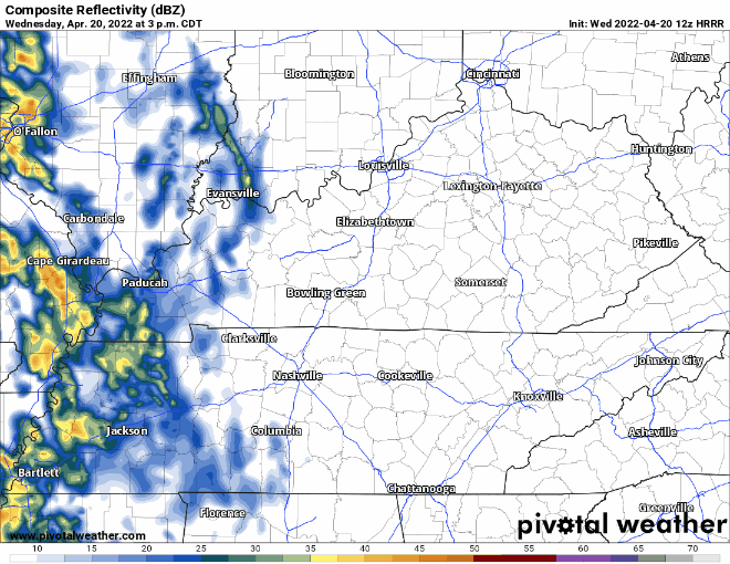
HRRR model below shows scattered showers tonight from late afternoon through midday tomorrow. Severe weather is not expected to tag along with this system. Expect scattered showers with a possible thunderstorm or downpour mixed in there.
After this rain moves out we are dry until the start of next week. The warming trend really starts to pick up today continuing into the weekend. This weekend will be perfect for any outdoor plans with sunny skies and warm warm temperatures.
Temps reach the mid to upper 80s by Sunday. Dew-points will stay in the 50s keeping us feeling dry and warm. A combo we don’t see a lot in the south. This weather may have you feeling like this:

Quick References:
Weather changes constantly.
Follow @NashSevereWx on Twitter for any changes to this forecast.
Live coverage during tornado and severe thunderstorm warnings:
Look good.
Support the mission.
We are 100% community supported. No ads. No subscription fees. Keep it free for everyone.
Categories: Forecast Blogs (Legacy)
You must be logged in to post a comment.