
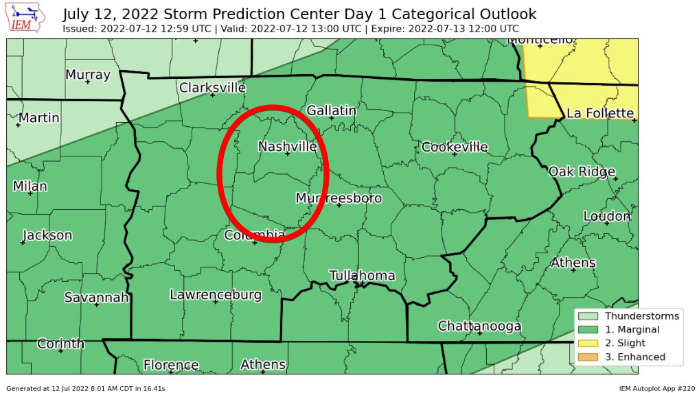
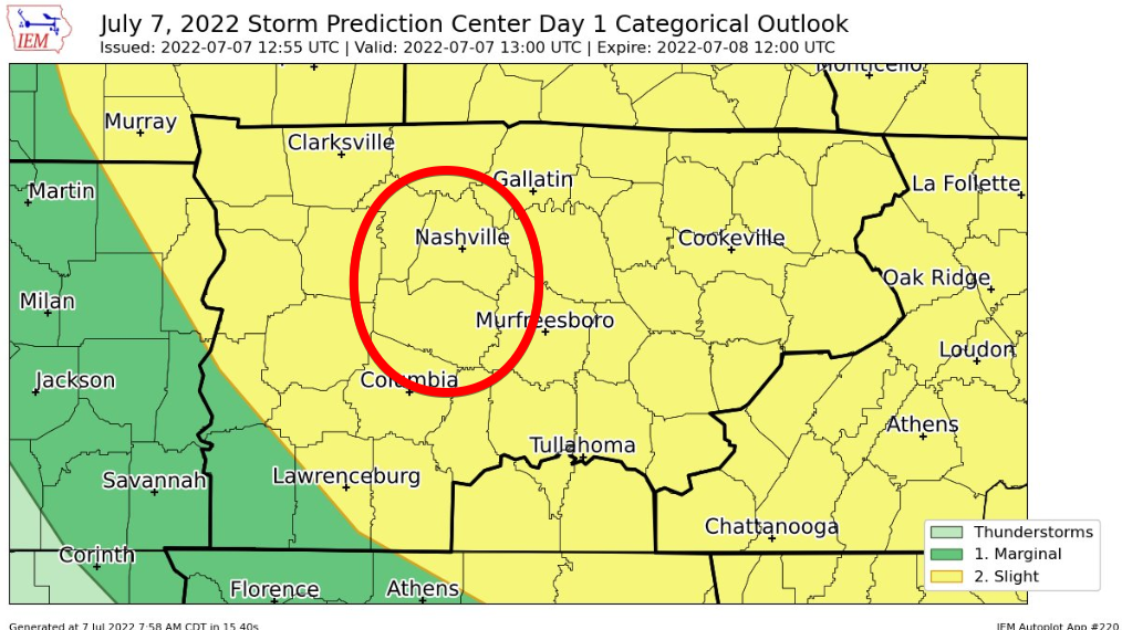
Yesterday’s forecast had wins (HRRR timing on Will Co storms, damaging straight line wind threat) and losses (SPC did not mention hail yet Will Co saw 1″ hail then that storm blew into Marshall Co and dropped 4″ hail on Chapel Hill).
Maybe Severe Storms, Maybe You Need A Fanorak
Before storms today, it will be hot. 94° for the high, paired with dewpoints in the low 70’s, giving us a heat index to 101°. Not as bad as last week, but still not comfortable.
Your day throughout the afternoon should be dry.
Heat & Humidity, Rain & Storm Chance Tuesday
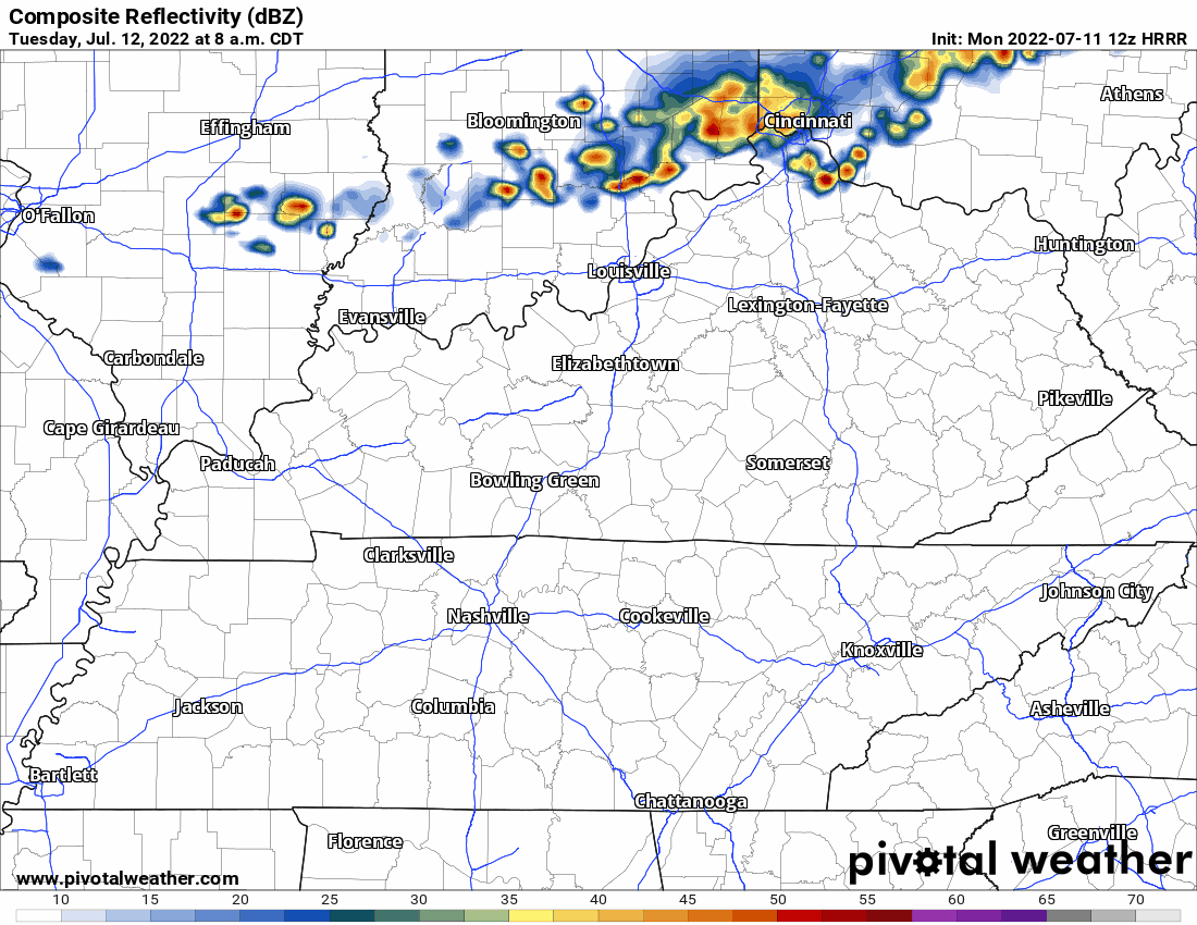
HRRR model thinks a line of rain and thunderstorms will swing out of KY Tuesday (tomorrow) afternoon but fizzle before they arrive here.
Then — right around sundown Tuesday — it thinks storms redevelop and roll off and on until wee hours Weds.
Begone, These Two Streaks: 70° Dews & Dry Grass Views, So You Know You’re All Right

Storms and showers east and south today, I think we stay dry. Humidity also dropping, ending the streak of sweat, in hopelessness and rage, 70° dewpoints delivering oppressive humidity. Dewps today “only” sticky/uncomfortable, mid to upper 60°s, yay? It’s not football weather but at least it snapped a 120 hour 70°+ dewpoint streakdepicted in blue below, a message straight to your soul:
“Cooled” Off But Not Really
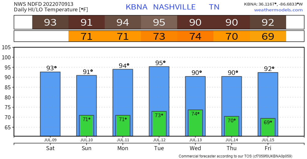
No more upper 90’s, but it will still be in the low 90’s with dewpoints in the mid 70’s, will equal heat index nearing 105°. Better? Yes. Noticeable? Eh.
Looks like we won’t be able to shake the 90’s for a while. Just like all the fashion trends that are still around.
Hoping The Wattery Bails Us Out One Last Time
Most of us have struck luck with the Wattery the past two days, bailing us out from the heat index getting to excessive territory. We just need one more day of that.
If not, temps will surge up into the upper 90’s, dewpoints in the mid 70’s = heat index pushing 110°, reason for the Excessive Heat Warning for today.
Excessive Heat Warning And Severe Storms – A Double Edged Sword + Drought Update
On one edge of the blade, you have super hot, uncomfortable temperature + dewpoint combo, but there is no severe weather. On the other edge, you get kinda hot, but then a shower/storm comes and cools you down. Maybe not the easiest choice. Good thing Mother Nature decides for you.
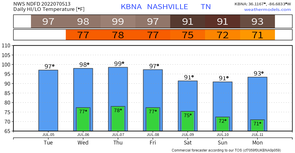
Excessive Heat Warning Thru Friday, Hopes of Getting Cooled Off By (Severe?) Storms
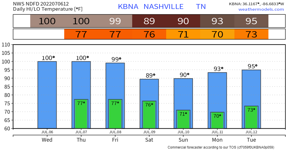
Since 1986, NWS Nashville has only ever issued an Excessive Heat Warning four times. Once in 2010, twice in 2011, and now again today. The only previous one that included Davidson and Williamson counties was in 2010, also on a Wednesday. Point being, this degree of heat and humidity is quite rare, and is dangerous.
Dangerous Heat + Dewpoint Combo Thru Friday, The Wattery Has Few Winning Tickets
It’s going to be downright hot. No other way to put it.
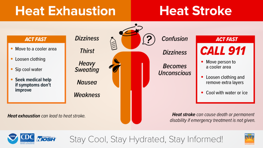
Take it easy if you have to be outside today. This heat will overwhelm you faster than you think, no matter how well you think you can handle it, similar to your crazy ex.
Probably Rain-Free But Hazy Fireworks Tonight, Heat Advisory Likely All Week
Besides probably sweating a lot, the 4th looks pretty good. Temps in the mid/upper 90’s, paired with dewpoints hovering around the 70° mark, will lead to heat index in the 100-105° range, which is cooler than the rest of this week will be…I might just stay inside and watch Joey Chestnut eat more hot dogs in 10 minutes than I ever have.
You must be logged in to post a comment.