Dry, Comfortable Week. Tropical System Rains Possible By Sunday.

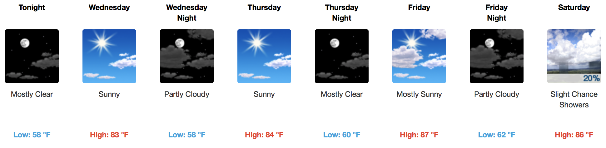
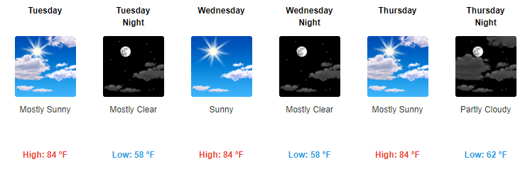
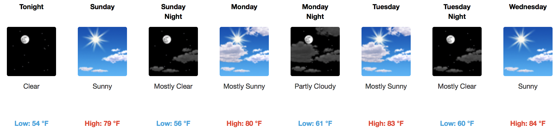
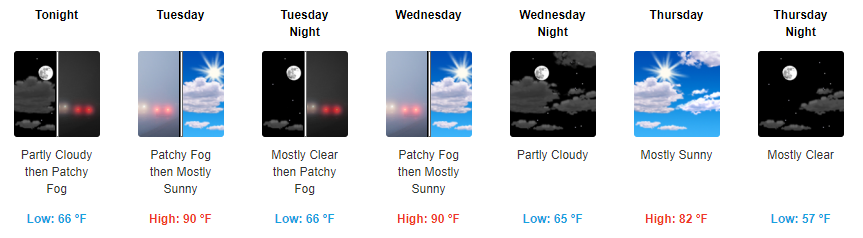
Tranquil Week, Tropics Advertising Activity Towards The Weekend…Maybe Bringing Us Rain

GOES 16 Visible Loop

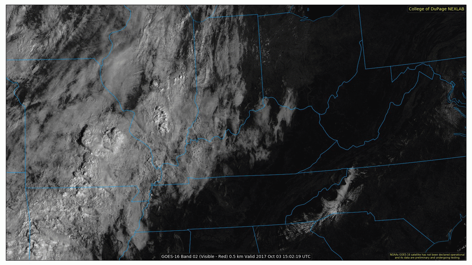
GOES 16 is busy this morning across the Mid-Mississippi Valley, as showers and a few storms are ongoing. An increase in moisture is evident over those areas, but high pressure holds strong for us here in Nashville. read more

Sunshine, Temps Creep Up Through the Week

Slightly Above Average Temps & Sunshine for the Entire Week

Temperatures Today/Tomorrow

[av_textblock av_uid=’av-tp8utb’]
[cjtoolbox name=’Treg DONT DELETE’]
[/av_textblock]

Starting tomorrow, our highs will jump into the low to mid 80s. Overnight temps this week will dip into the upper 50s to low 60s, so you may need a jacket in the evening and for the early AM commute. read more

October!

Testing streaming with some new equipment. Here’s Will (and Sam) on tonight’s sunset:

read more

Sunshine Ablaze, Temperatures Comfortable In the 70s!

Gorgeous Weekend In Store, Sunshine and “Room Temperature”

Temperatures Today/Tomorrow

[av_textblock av_uid=’av-woy64i’]
[cjtoolbox name=’Treg DONT DELETE’]
[/av_textblock]

Those little music notes will get close to the 80ºF mark today and Sunday, but nothing higher than that! A few fair weather cirrus clouds will traverse the Tennessee Valley, as seen on visible GOES 16 imagery this morning: read more

Sunshine, Sunshine, and More Sunshine

Chilly Mornings and Pretty Nice Days Ahead

High pressure will remain in control over the foreseeable future with no rain chances in sight. While temps won’t be completely fall-like, they will feel a bit nicer with highs in the low 80s and overnight temps in the 50s. Tomorrow will by far be the coolest day with highs in the upper 70s. read more

Seasonal Temperatures Carry Us Into October

Cold Front is Through, Cooler Temperatures Are In!

And the peasants rejoice. High temperatures all through the weekend will be in the upper 70s to near 80ºF, thanks to high pressure building in. Saturday may be the coolest of all days, as another weak (and dry) cold front moves through Friday night. read more

Cold Front Overnight Brings Much Cooler Temps Starting Tomorrow

Rest of the Week Through the Weekend Looks Cooler and Fall-Like

Starting tomorrow, expect for much cooler AND drier weather to return. Highs will stay in the upper 70s through the weekend with dew point temps backing down into the low-50s. It’s going to feel really nice. read more

Hot Today and Tomorrow, Then Fall-Like Pattern Ensues

Cooler Weather On the Way!

We only have tomorrow left in terms 90ºF afternoon temps…then it’s hello 70s! High pressure aloft continues to hold strong over the Mid-State, as we await a dry cold front passage Wed. night – Thurs. morning. read more

Sunshine and Warm Temps Continue

First Half of the Week – Sunny & Hot

Highs in the 90s. Dew point temps in the mid-60s. Sunshine during the daytime. And there really won’t be a whole lot of variation in our forecast for the first half of the week.

https://giphy.com/gifs/much-help-confused-3og0IM42WoeZ00VM7m read more

Dry Weather Ahead! Cooler Temps Thursday!!!

Heat and humidity will continue through Wednesday, but rain isn’t expected over the next 7 days.

A dry north wind is on the way thanks to Hurricane Maria.

Hurricane Maria will pass northward off the Mid-Atlantic coast by mid-week, then into the North Atlantic Ocean at the end of the week. We’re on the western side of it, and as a result we will receive a dry northerly surface wind. read more