
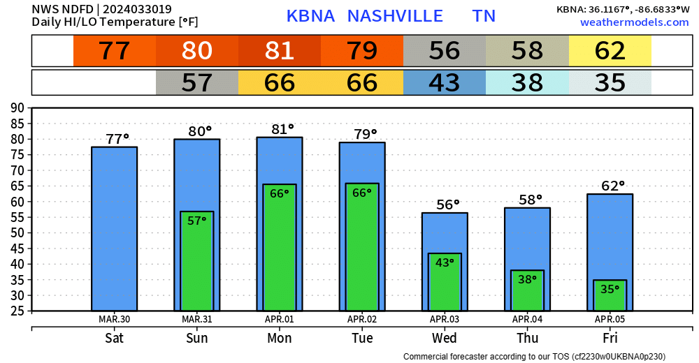
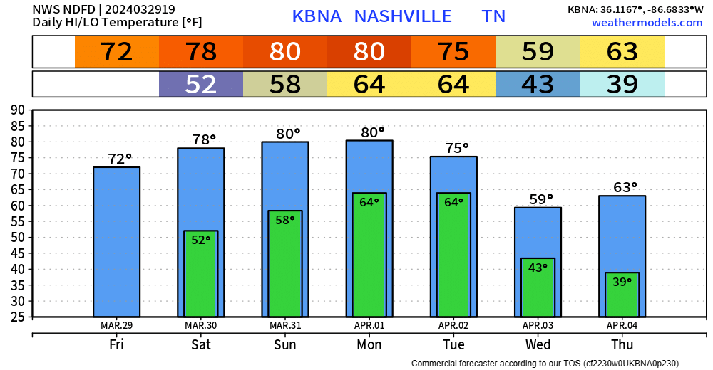
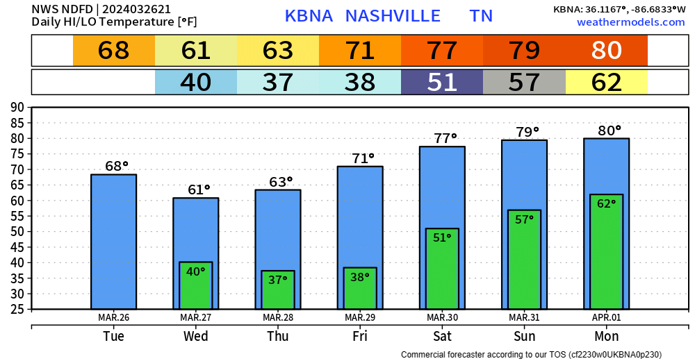
Today’s high temps have soared into the upper 70s, Easter Sunday and Monday will be similar temperature-wise. A few places may even surpass 80 degrees.
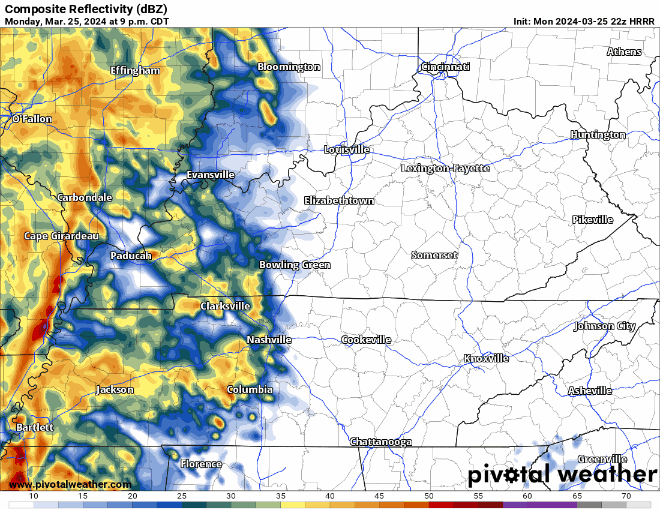
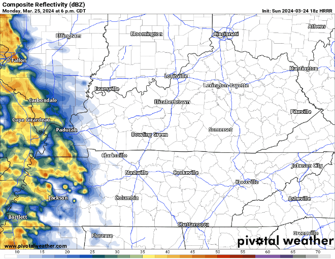
We should be dry through Monday, a few showers cannot be ruled out Monday morning, but majority of us will stay dry.
You must be logged in to post a comment.