

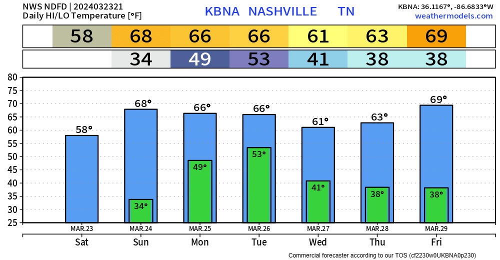
We’ll wake up Sunday morning with temps in the low 30s. Your backyard may get below freezing. We’ll be back in the upper 60s by the afternoon.
“Much of Middle Tennessee will experience an elevated fire danger tomorrow [Sunday] owing to increased wind speeds and very low RH values.” – NWS Nashville
Outdoor burning is discouraged tomorrow due to low relative humidity and gusty winds.
Monday during the day should be dry, but rain and storms are expected to arrive Monday night.
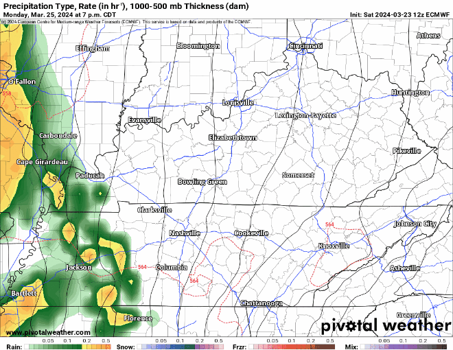
These on/off showers + non-severe storms lasting overnight Monday, lasting into Tuesday AM. No severe shenanigans are expected due to insufficient dew points and little to no CAPE (storm fuel). Can’t rule out some thunder tho.
Rain totals look between 1 – 2″ for this system.
After that system clears out, pretty quiet rest of the week. No other rain chances to discuss.
Categories: Featured Blog