
Today’s high temps have soared into the upper 70s, Easter Sunday and Monday will be similar temperature-wise. A few places may even surpass 80 degrees.
We should be dry through Monday, a few showers cannot be ruled out Monday morning, but majority of us will stay dry.
Main topic of discussion continues to be the potential for severe weather on Tuesday.
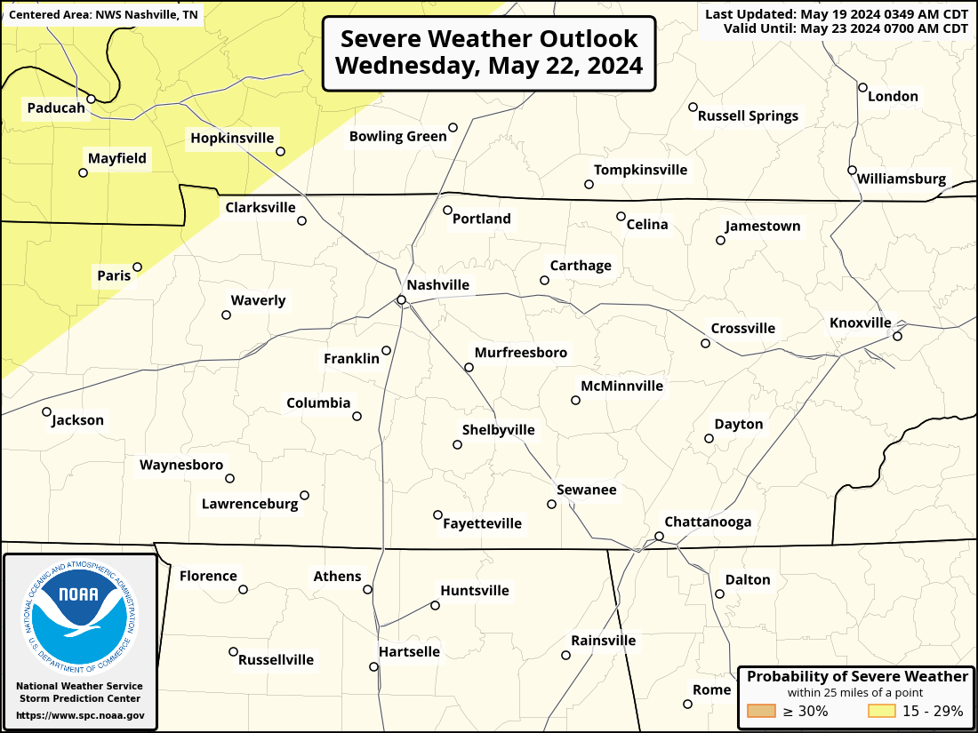
Although the area has shifted a bit east, both our counties are still outlooked with a 15% chance of severe weather within 25 miles.
We’re slowly learning more, but overall confidence remains low.
The most likely timing of the system appears to be Tuesday during the day right now. This could change!
“All modes of severe weather continue to look possible during the daylight hours for Middle Tennessee.” – NWS Nashville
A lot will change between now and Tuesday, continue to stay informed. Know your severe weather plan and be able to pinpoint your home/work on a map. We’ll dive into more details in the coming days.
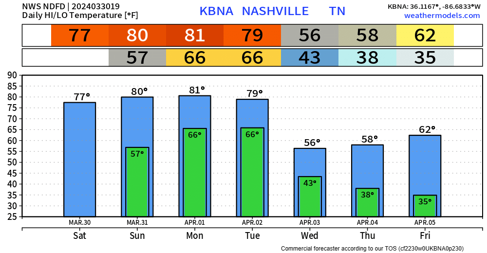
Wednesday we’ll clear out and cool down. Frost/freeze chances return towards the end of the week.
Categories: Featured Blog