
Lows will dip to around 40° tonight, a few places might see some frost but probably not.
Friday and the rest of Easter weekend will have some awesome weather.
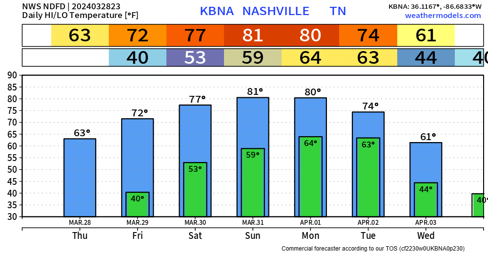
Friday and Saturday will have highs in the low to mid 70s, with Easter Sunday highs getting into the low 80s. Around 60° for any sunrise services. Monday a copy and paste of Sunday.
Tuesday is when things pick up.
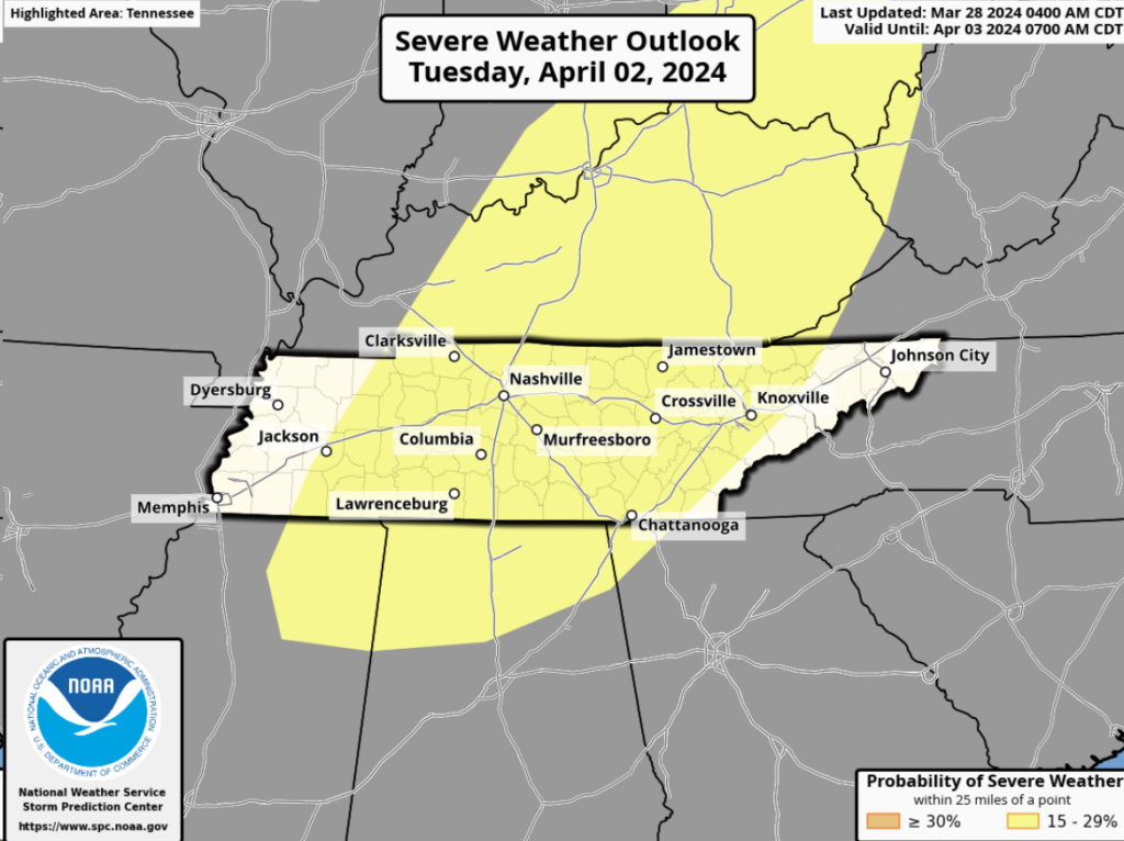
The Storm Prediction Center has outlooked all of middle Tennessee in a 15% chance of severe weather within 25 miles for Tuesday.
Right now, there are a lot more questions than answers.
“Ensembles are still struggling with the timing of this front with it coming through as early as Monday night and as late as Tuesday evening.” – NWS Nashville
The timing of the system will have a great influence on how much CAPE (storm fuel) there is. It is just too early to know.
No reason to sound the panic alarm or anything of that nature. Continue to stay informed on updates, as lots will change between now and then.
After that system moves out, we will cool down a bit.
Categories: Featured Blog