
Nice evening ahead of us before some rain chances Friday.
Some light showers are possible Friday morning, majority of the rain will come around Friday evening.
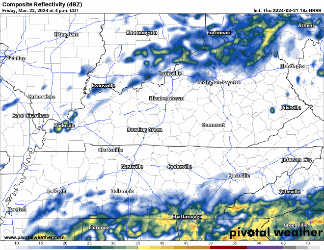
HRRR model (above) gives its best guess at what the radar will look like tomorrow (could be wrong!). Rain should start around ~ 5 or 6pm, +/- a couple hours, and last thru about midnight. Majority of it looks to stay to our SW, but we should get a couple hours of rain. Rainfall totals up to 0.5″, no thunderstorms expected.
Dry Saturday + Sunday. High temps in the low to mid 60s.
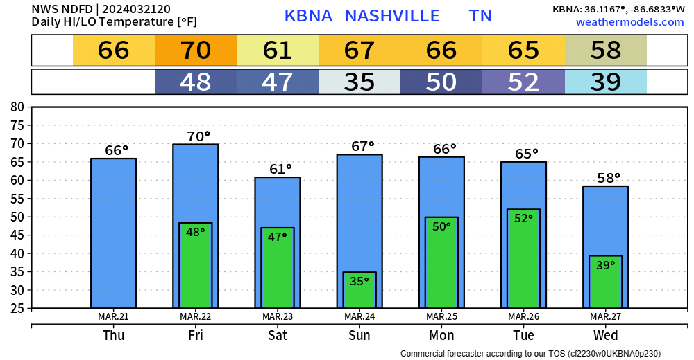
Another system rolls in Monday/Tuesday, looks more like a Tuesday deal right now.
“Although our severe potential would be low in such a scenario, there is a likelihood for strong winds Monday th[r]ough Tuesday, with the possibility of Wind Advisory critieria developing Monday night.” -NWS Nashville
For now, the severe threat looks to remain to our west, but this could change. We’ll keep y’all updated. Rainfall totals in excess of an inch look possible.
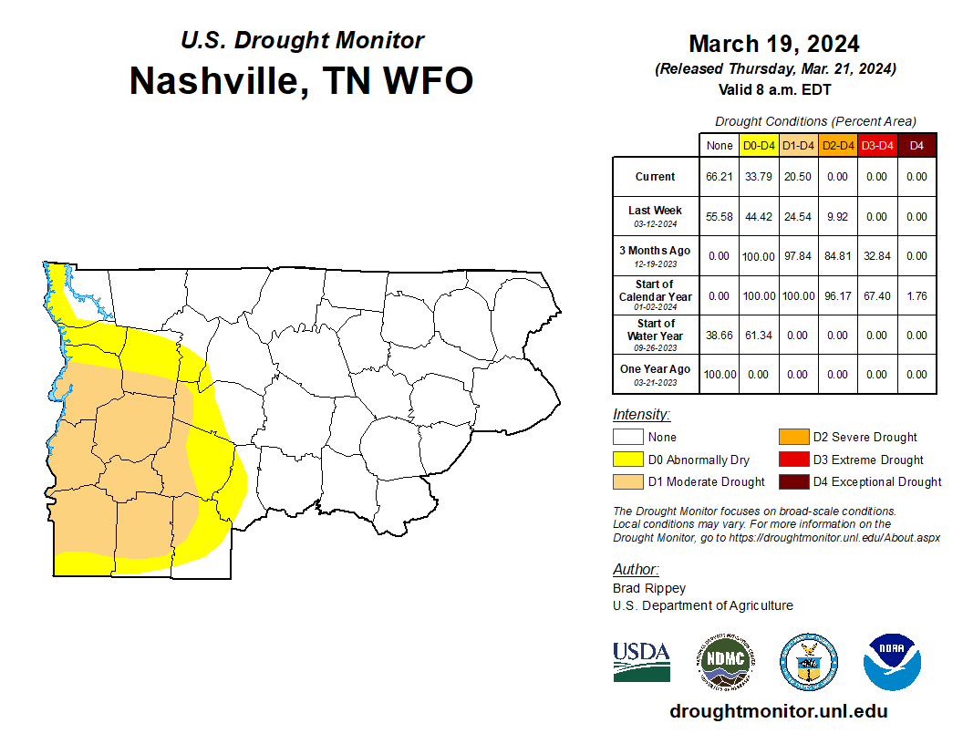
New drought monitor came out today and shows the majority of us removed from any drought category. Only western WillCo. and extreme SW Davidson Co. still included. Upcoming rain should continue to help us out.
Categories: Featured Blog