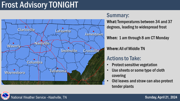
Good idea to cover up plants tonight, a Frost Advisory will be in effect from 4am thru 9am Saturday morning.
Lows are expected to get down into the low 30s, thankfully temps will quickly recover Saturday afternoon and make it into the low 60s.

Good idea to cover up plants tonight, a Frost Advisory will be in effect from 4am thru 9am Saturday morning.
Lows are expected to get down into the low 30s, thankfully temps will quickly recover Saturday afternoon and make it into the low 60s.
Temperatures will dip into the mid 30s tonight, which may bring some frost to the area. A few backyards may dip below the freezing mark.
Friday high temps will reach the upper 50s, but Friday night will have our coldest temperatures of the forecast, with temps in the low 30s. A few places may get down into the upper 20s. Good idea to cover up any loved plants.
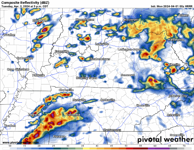
Pockets of on/off rain continue to move thru the area, coverage will decrease as we head into tonight. Still can’t rule out some more brief graupel/small hail aka Sonic ice in some of the showers.
The cold front has passed through, bringing in cooler air and signaling the end of our severe weather threat.
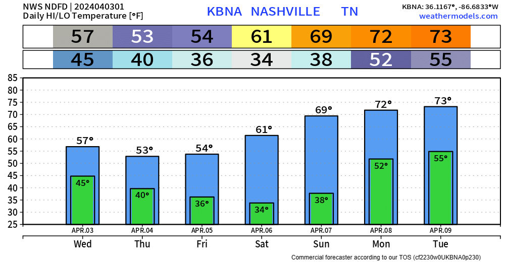
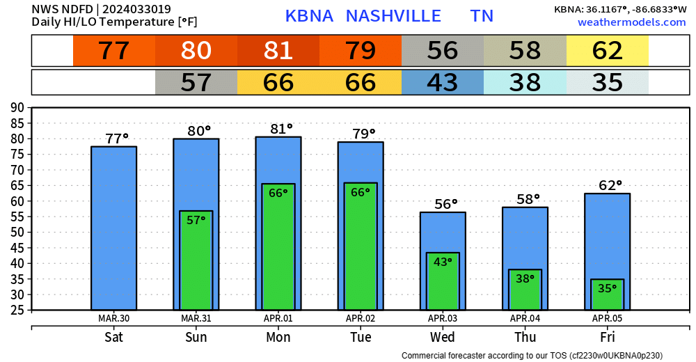
High temperatures Wednesday – Friday will be about 20° cooler than we experienced today. Gross.
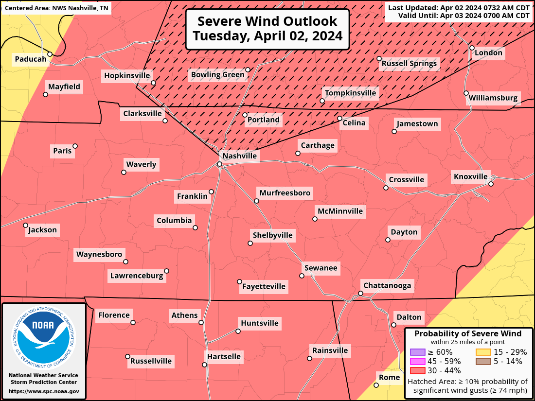
Our probabilities from the SPC remain unchanged for now. Within 25 miles of you, there is a 30% chance of damaging straight-line winds, a 30% chance of large hail and a 10% chance of a tornado, which could be strong (EF2+).

The Storm Prediction Center came out with their midday update for Tuesday and have upped our probabilities for severe weather tomorrow.

Both counties are outlooked with a:
These probabilities are subject to change.
Overnight, the Storm Prediction Center increased our probabilities for severe weather on Tuesday.

Both our counites have been outlooked with a:
These probabilities could change. The Storm Prediction will update these several more times between now and Tuesday afternoon.
Very nice Easter day going on.
Monday will be another warm and probably dry day. Overnight Monday we could see a few showers/storms, but the majority of the activity should stay to our north.
Our main focus continues to be the threat of severe weather Tuesday.
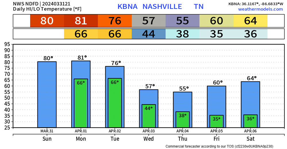
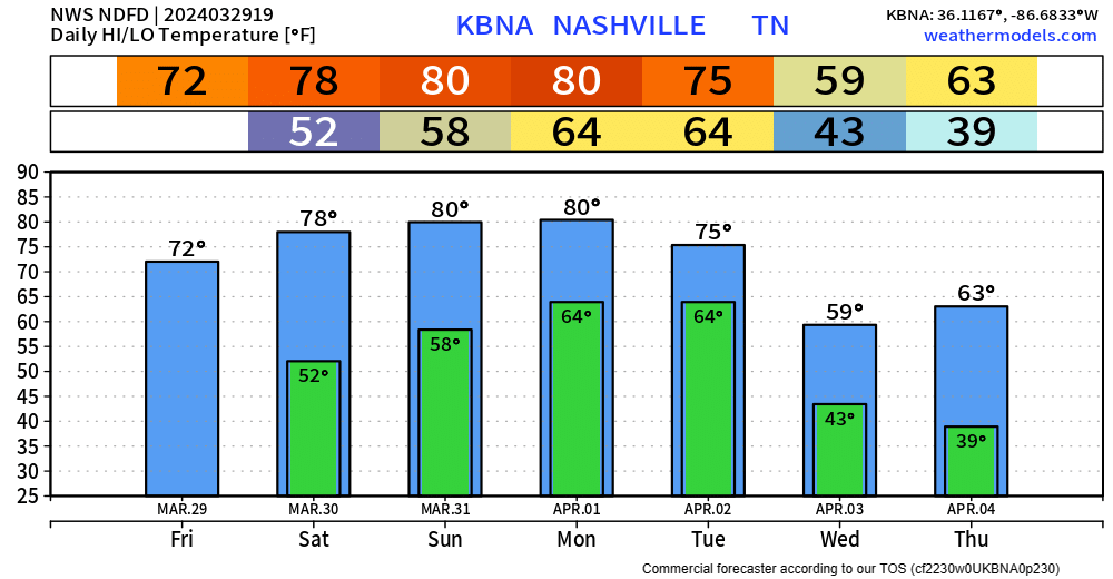
Today’s high temps have soared into the upper 70s, Easter Sunday and Monday will be similar temperature-wise. A few places may even surpass 80 degrees.
We should be dry through Monday, a few showers cannot be ruled out Monday morning, but majority of us will stay dry.
Wonderful weather today and the rest of the weekend.
No rain expected thru Sunday, and we’ll likely stay dry Monday as well. Highs nearing 80° Saturday – Monday. Great weather for all the outdoor activities, egg hunting.
You must be logged in to post a comment.