
Some rain, at times heavy with lightning moving thru this morning.
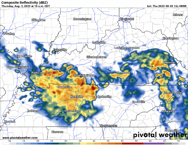
HRRR model (above) thinks this will continue for a couple more hours, starting to taper off around noon.
Afternoon and evening looks dry for the most part, maybe a few stray showers but NBD.
Gap of dry weather doesn’t look to last long as the HRRR model thinks more showers/storms move in during the wee hours of Friday morning.
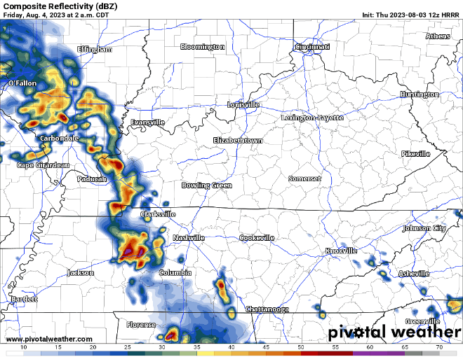
Not real concerned about any severe weather, but heavy rain, gusty winds and lightning are all possible. Similar to today, it looks like the rain should start to end as we get into the PM hours, leaving us with spotty showers the rest of the day.
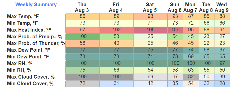
We not only have to deal with the rain, but just miserable dew points. Today thru Sunday (see top graphic) dewpoints will be in the mid to upper 70’s…
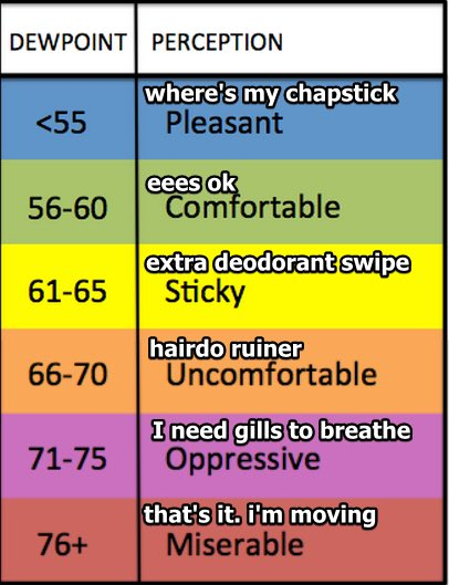
When it isn’t raining, particularly Sat. and Sunday, these dewpoints paired with temps in the 90’s will make it feel like an absolute sauna. The type of weather that you step outside and just immediately start to sweat profusely.

Saturday and Sunday don’t look like complete washouts. There will be rain-free periods, the question is when exactly those will be.
Currently, the best chance to see any rain/storms look like afternoon/evening. Timing still isn’t the most clear, so we’ll be watching. No severe weather expected, but a strong storm cannot be ruled out.
Humidity and rain chances relax a bit as we get into early next week.
Quick References:
Weather changes constantly.
Follow @NashSevereWx on Twitter for any changes to this forecast.
Live coverage during tornado and severe thunderstorm warnings:

Look good.
Support the mission.

We are 100% community supported. No ads. No subscription fees. Keep it free for everyone.


Categories: Forecast Blogs (Legacy)
You must be logged in to post a comment.