
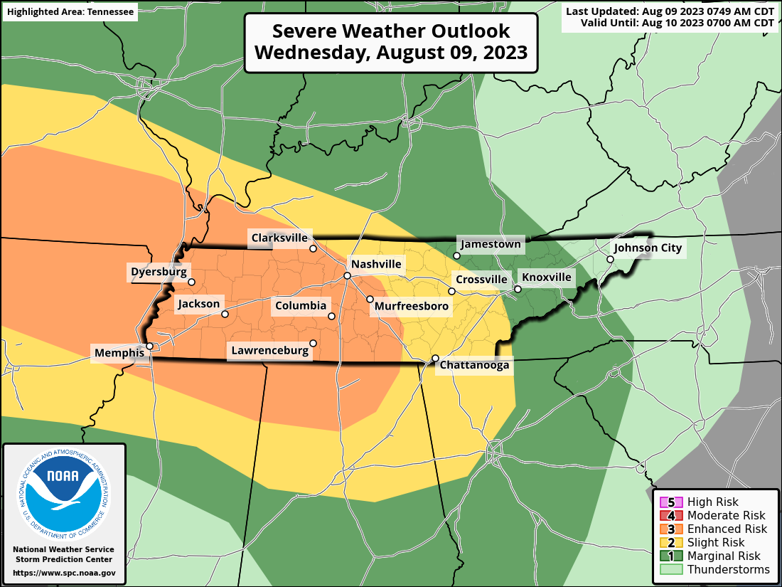
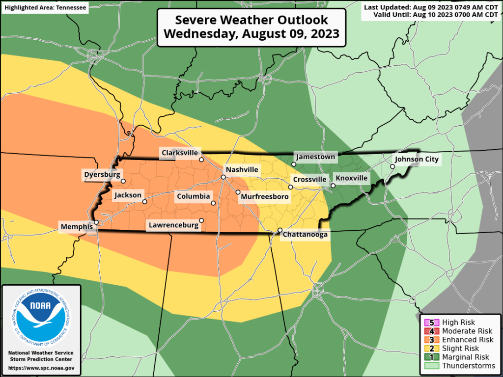
The convective outlook for today places most of Davidson and Williamson Counties in an area of enhanced risk. There is an enhanced risk for brief spinup tornadoes and damaging straight line wind. Let’s get into the details.
As of 8pm we’re capped at the surface. Meaning it’s warmer above us than at ground level. This is good. This phenomenon we call Warm nose Ned. Thanks Ned.
If Ned stays in place, life is pretty good for us tonight. If Ned hit’s the bricks, storms we see overnight could rise and create wind, hail and tornado problems.
One of the critical ingredients to Neds departure is warm coming up from the south. Because warm air is coming up from Alabama like it’s late October, it could be too little too late to meet the shortwave bringing the storms. If the warm air moves too slow the storms will pass by and severe weather will be limited.
The latest run of the HRRR model thinks the warm air will get here at 1am-3am and the heaviest weather will be limited to areas south of I-40.
Timing… Expect it to be here btw 12am-2am. Rain will last until the wee hours and by 8am it will be well to our east.
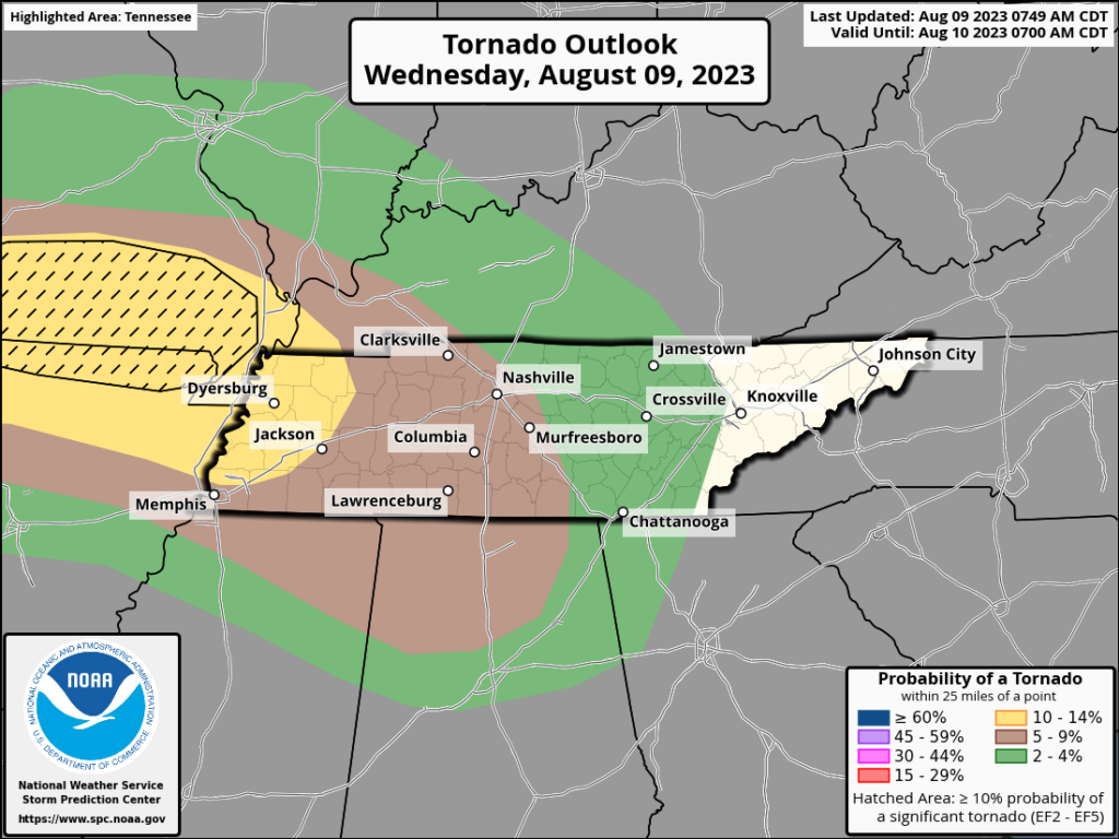
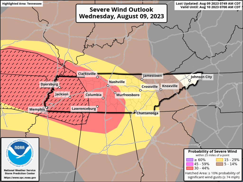
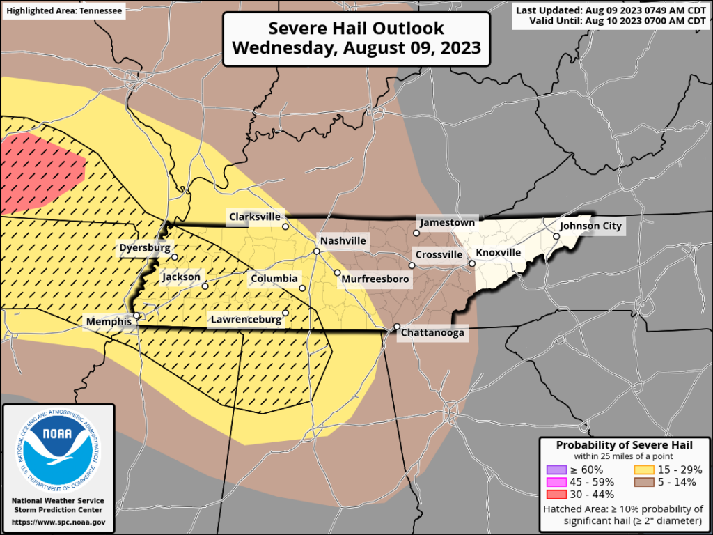
Here are some probabilities from SPC.
Tornado 5%
Damaging Wind 30%
Large Hail 15%
So… stay weather aware tonight. Make sure you have multiple reliable ways to get weather information. Charge your devices before going to bed and make sure you have a NOAA weather radio and/or a wake me up app like Stormwatch+ installed. We will go live on YouTube if we get a severe thunderstorm warning or a tornado warning so subscribe using the link below and turn on notifications.
Quick References:
Weather changes constantly.
Follow @NashSevereWx on Twitter for any changes to this forecast.
Live coverage during tornado and severe thunderstorm warnings:

Look good.
Support the mission.

We are 100% community supported. No ads. No subscription fees. Keep it free for everyone.


Categories: Forecast Blogs (Legacy)
You must be logged in to post a comment.