
We certainly have no lack of rain/storm chances this week.
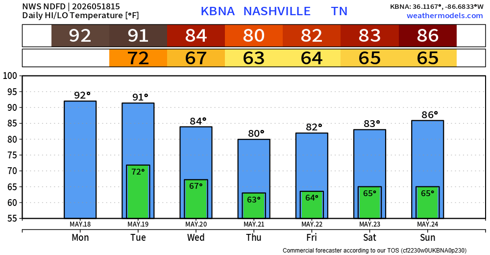
However, today [Monday] will be the lone exception to that. It’ll be hot, with highs in the low 90s – so if you need to do any yard work, right now or closer to dinner will be your best bet.
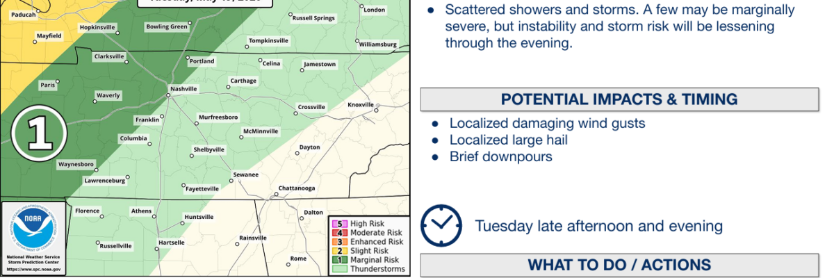
Tuesday begins our stretch of daily rain/storm chances.
The Storm Prediction Center has us right on the edge of a 5% risk of damaging straight-line and hail within 25 miles. We are not included in any probabilities for tornadoes.
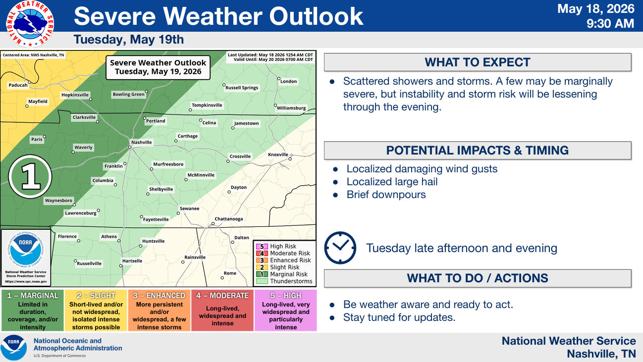
Timing wise, this looks like a late afternoon/evening ordeal.
The HRRR model gives us a guess, with scattered storms possible during this time.
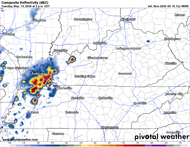
Note the weakening line just off to our W. Models are in pretty good agreement that the line does not make it here, but that’ll be something to watch – models are far from perfect.
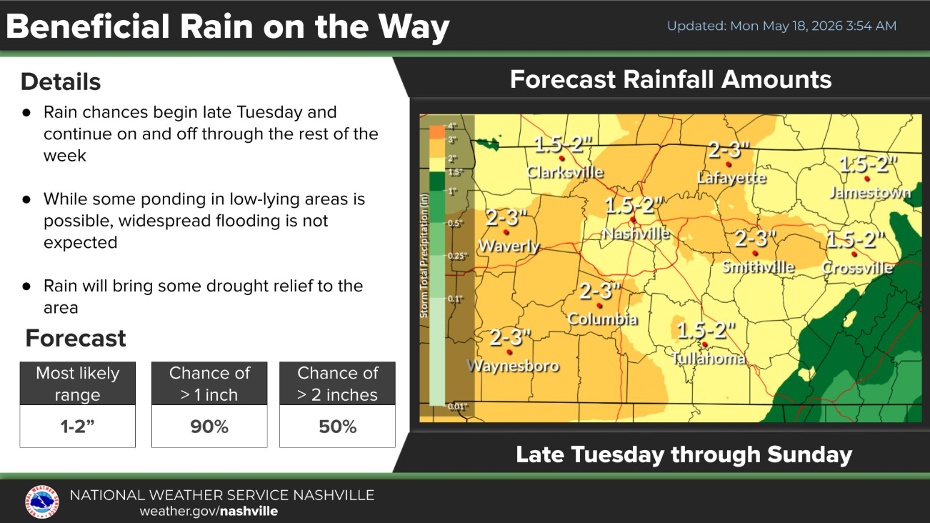
Medium to high rain/storm chances continue daily from Wednesday thru at least Saturday, mostly confined to the afternoons/evenings. It’s hard to get any more specific than that right now due to model disagreements, but they do all agree on us getting some beneficial rain throughout the week. 1.5 – 3″ of rain is expected by the end of this week.
The good news, besides our very-low end chances on Tuesday, we are not included in any additional severe outlooks.
I think it is too far out to start canceling any outdoor plans you may have this week, but having a backup plan than involves being inside is certainly a good idea. We’ll also be keeping an eye on Saturday evening for Mr. Stapleton’s performance at Nissan.

All the rain chances will keep our temperatures sub-90° after Tuesday, although we stay mild.
Categories: Featured Blog