
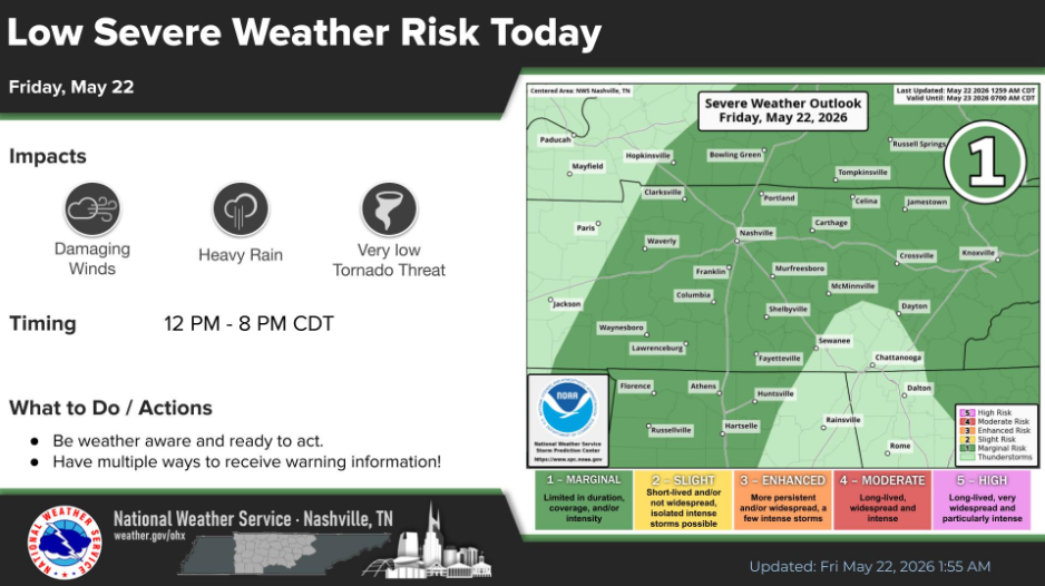
There will be a brief window for severe weather potential this afternoon.
Specifically, there is a 5% chance of damaging straight-line winds and a 2% chance of a tornado, both within 25 miles.
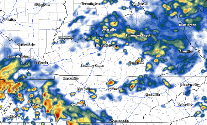
Scattered showers and storms will move in from the S/SW (a little different than usual), providing an opportunity for not only the needed rain but a very low-end severe weather threat.
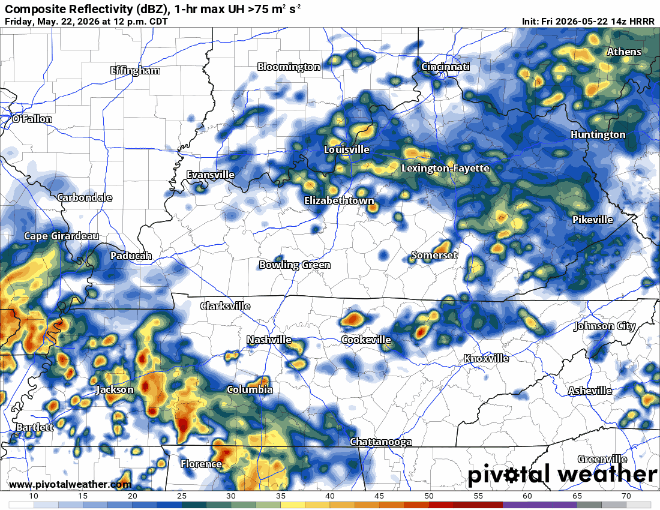
The HRRR model gives a guess, but not to be used as gospel:
We’ll be watching this all day and will post updates on all of our socials as needed. For those with outdoor plans today, you’ll need to not only stay connected but also have an indoor backup plan as well.
Things are starting to look up for Saturday. Although rain chances still do exist, they look fairly low, with scattered showers/storms being possible in the afternoon. I think most of us will get away with being dry. Great news for any outdoor plans, including those going to the Mr. Stapleton concert in Nissan.
We fall back into the routine of daily medium to high rain/storm chances on Sunday, lasting thru the middle of next week. Chances will be highest during the afternoon/evening, but possible outside of that range as well due to exact timing being fuzzy. With any Memorial Day weekend plans you may have, keeping an eye on the radar and having an indoor place to go if a storm rolls around is the best idea.
Expecting 2-3″ of additional rain between now and the end of next week, with locally higher amounts certainly possible. We should avoid any widespread flooding concerns, but ponding on the roads and low-lying areas not out of the question under any slow moving storm.
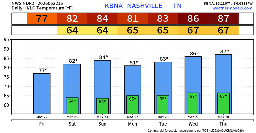
Temperatures stay mild and pretty consistent.
Categories: Featured Blog