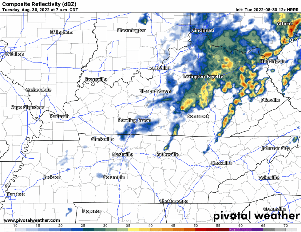
Cold + Dry For a Few Days

Front is in and out. Cold temps and REALLY dry air are what’s left. Highs this afternoon in the upper 30s, overnight lows in the upper teens. Won’t get too far above freezing tomorrow. Wind chills definitely won’t thanks to winds out of the north. read more

Friday: Frozen Precip?

Today will be the warmest day we will see for a while.

Us too Michael, us too.

After reaching the mid to upper 50’s today, we won’t see temps above the mid 40’s until Sunday. A cold front moves through early Tuesday morning bringing cooler temperatures. Overnight lows past Tuesday won’t get above freezing. read more

Few Flurries Possible Tuesday Morning, No Worries

A few flurries are possible Tuesday morning. You can see them at the end of the 12z HRRR model run.

I’ll tweet the 18z run when it comes out in a few hours. Think these will be inconsequential if they happen at all — the precip isn’t on other models. Surface temps should be at least 3° (probably more) above freezing. Splat:Melt. No party, no worries. read more

Today The King Returns, When Will The Rain?

This cold weather may have you feeling like Josh Norman.

Regular Season No GIF by NFL

And these temps aren’t going anywhere, anytime soon.

However, besides the cold temps, today is a great day for some Titans football.

No rain or frozen precipitation today. Besides for maybe a few cirrus clouds streaming in, the sun will be out today which should help to make it not feel so cold. read more

Cold but Dry Weekend

It is definitely going to feel like winter out there today. Grab your hats, scarves, fuzzy socks, and gloves cause it is capital C Cold today. Temps will be in the 20s and 30s. This combines with the wind coming from the north, giving us some wind chill values in the teens. Here’s what that looks like on the HRRR. Blue is very cold, purple is very very cold. read more

Chilly and Dry Weekend Ahead

All the wintry stuff is well east of us by the time you are reading this. Now we are just left with the cold.

It is COLD out. The high temp today is expected to get up to freezing. If you take wind chill into account it’ll feel like it’s in the teens. The extremely blue and purple image below better illustrates this. read more

Showers Today, Wintery Mix Possible Tonight

A line of rain has arrived. No severe weather/flooding concerns. Can’t rule out an isolated thunderstorm here or there, but most will see just showers.

Showers transition into a wintry mix late tonight as temps dip to at/below freezing. Models are in pretty good agreement as far as precip type/accumulation goes. Not much more than a dusting expected for our area (less than a half inch). read more

Freezing Fog Advisory till 9; Wintery Mix Wednesday? Maybe

Freezing fog has already formed early this morning. A dense freezing fog advisory is in effect until 9am this morning. Some extra time for your morning commute may be needed. Patchy black ice is still a road hazard to look out for this morning. Overpasses, areas of elevation and neighborhood/back roads can have hazards stay around longer due to slower melting. Temps get up to the high 40’s today so significant melting is on the way as we go throughout the day. read more

Rain to Snow System Wednesday.

Temps get up to the mid 30’s today. Melting will be slow. Expect a refreeze tonight as temps dive into the low 20’s. This may continue dangerous road conditions into the morning commute tomorrow, especially in elevated areas and on secondary/neighborhood roads. Highs tomorrow in the upper 40’s will bring significant melting. read more

Transition to Snow, Variable Accumulation, Freezing/Travel Hazards Tonight/Overnight

Snow should, this afternoon, fall atop the rainy, slushy, mixyfrizzy precip we got this morning. Will Co got way more of the frozen stuff than Nashville. Will Co was colder at the surface and aloft, and Will Co got the heaviest precip bands. read more