

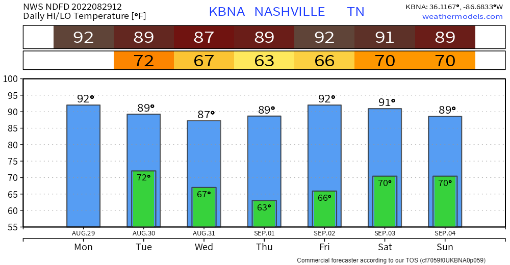
Typical Awwgust temperatures and humidity today with high’s in the low 90’s and dewpoints in the low 70’s. This will let the heat index get up into the upper 90’s. (Relief is coming as September rolls around).
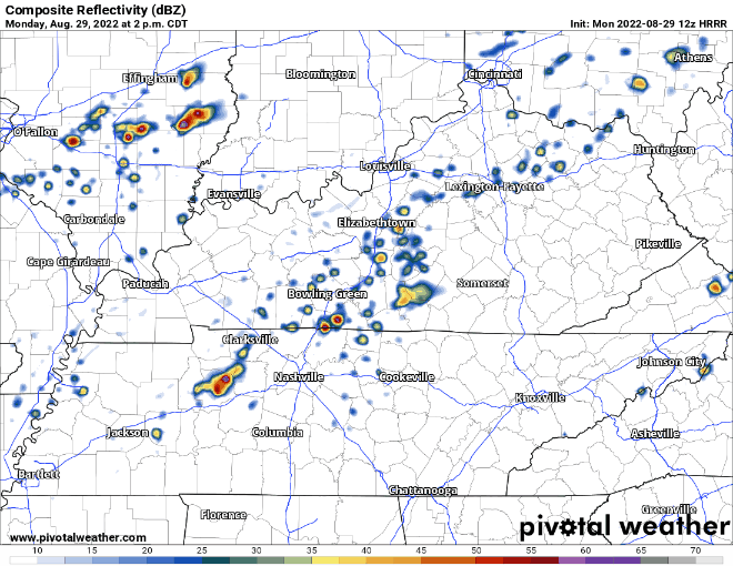
Wattery style showers/lightningstorms (shown below) look possible this afternoon and into the evening. We look to steer clear of any severe weather but a few of them could have some strong winds and heavy rain that makes you feel like turning on your hazards.
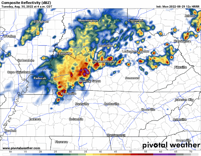
The aforementioned I-24 “special” looks to hold off until daybreak on Tuesday, leaving us plenty of time to catch needed Zzzz’s. It also looks to lose it’s steam and fall apart for the most part before arrival, leaving us with just some AM commute showers, shown below.
However these are known to be wild cards and have overperformed in the past, so we’ll have eyes on it.
HRRR model thinks a few showers/lightningstorms redevelop on us later during the day Tuesday, but not as much coverage as previously thought.
Wednesday and Thursday looks clear and more comfortable as dewpoints dip to the mid 50’s, temps will still be around 90°, but you’ll feel a noticeable difference.
Rain chances return Friday and continue throughout the weekend. Doesn’t look like a washout, but if you’re going somewhere like Live on the Green, you’ll want to keep an eye on the radar.
Quick References:
Weather changes constantly.
Follow @NashSevereWx on Twitter for any changes to this forecast.
Live coverage during tornado and severe thunderstorm warnings.

Look good.
Support the mission.

We are 100% community supported. No ads. No subscription fees. Keep it free for everyone.


Categories: Forecast Blogs (Legacy)
You must be logged in to post a comment.