
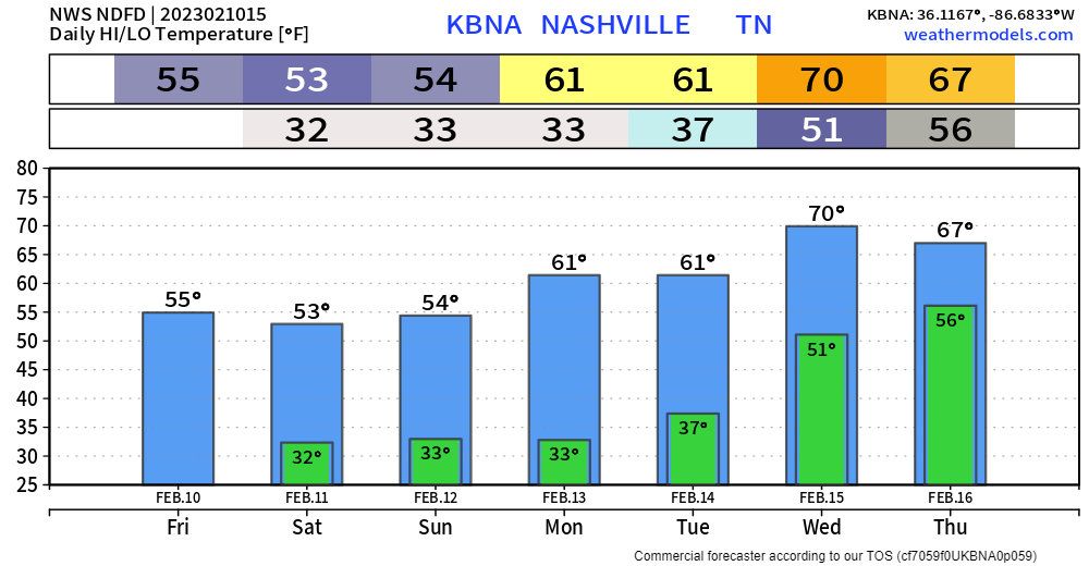
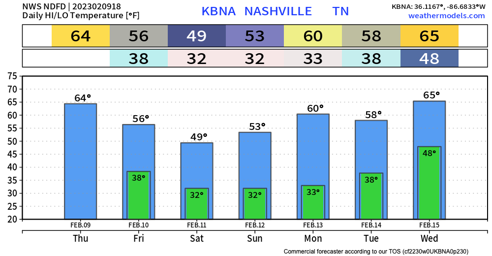
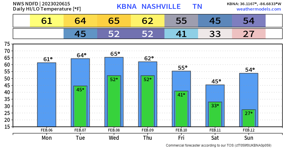
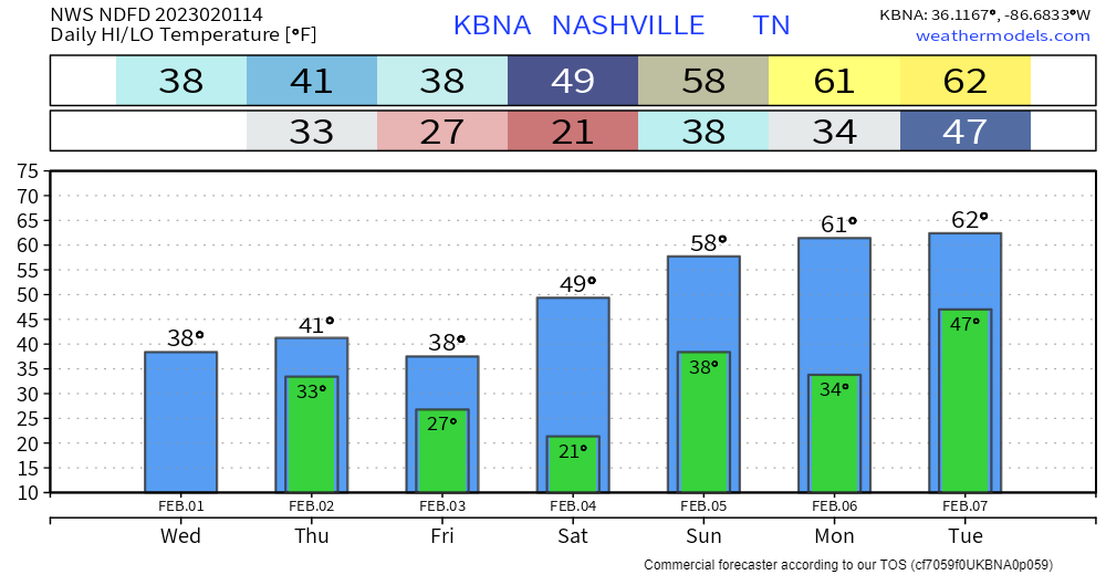
Looks fairly nice until Saturday night. Cool temps, but we’ll be dry.
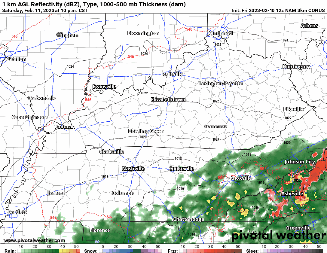
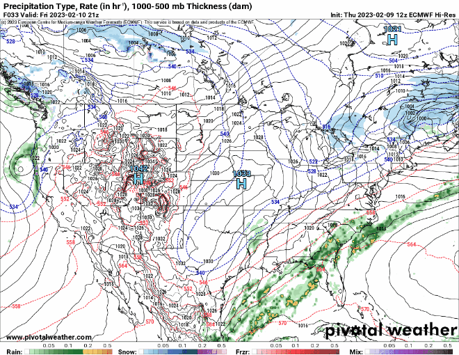
NAM3k model shows maybe some showers moving in late Saturday into Sunday morning, but nothing serious. We may see a few flurries mix in, but we are expected to stay above freezing, so no impacts are expected. Rain should move out by lunch Sunday – Super Bowl parties look to be rain free.


You must be logged in to post a comment.