
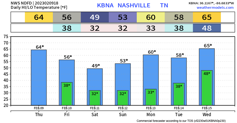
The wind advisory has now expired, the (very meh) severe threat has passed, and the sun is back. Looks like a nice afternoon. Winds peaked at 46 mph at BNA early this morning.
Our next weather system is a low pressure system we think will dive down toward the Gulf Coast and ride up the Atlantic coastal states this weekend into Monday.
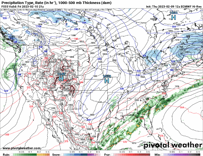
12z Euro Model from this morning:
12z GFS Model:
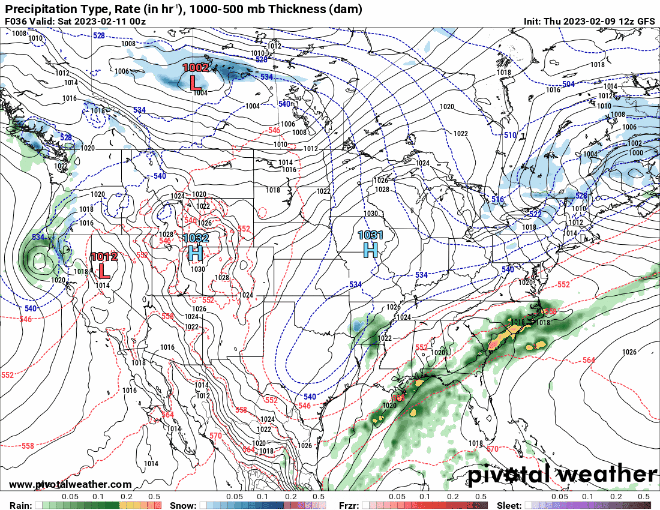
Both generally agree on the track of the low pressure system AND that most of the precip will stay just to the east of us. We’ll watch it through. For the time being, a small 20% chance of showers is in the forecast for Sunday, but not enough to ruin Super Bowl party plans.
Quick Look at Next Week
Storm chances could return on Tuesday night or Wednesday. We’ll be watching for any chance these could turn strong. Additional rain/storms look possible on Thursday.
Quick References:
Weather changes constantly.
Follow @NashSevereWx on Twitter for any changes to this forecast.
Live coverage during tornado and severe thunderstorm warnings.

Look good.
Support the mission.

We are 100% community supported. No ads. No subscription fees. Keep it free for everyone.


Categories: Forecast Blogs (Legacy)
You must be logged in to post a comment.