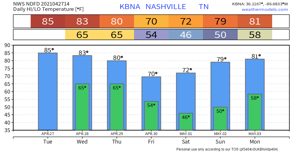
I hope your air conditioning works.
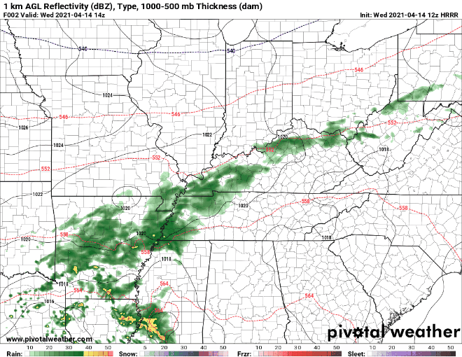
Rain is possible Wednesday afternoon. The HRRR shows a few showers popping up, but most of them develop east of us. So chances are real, but low.
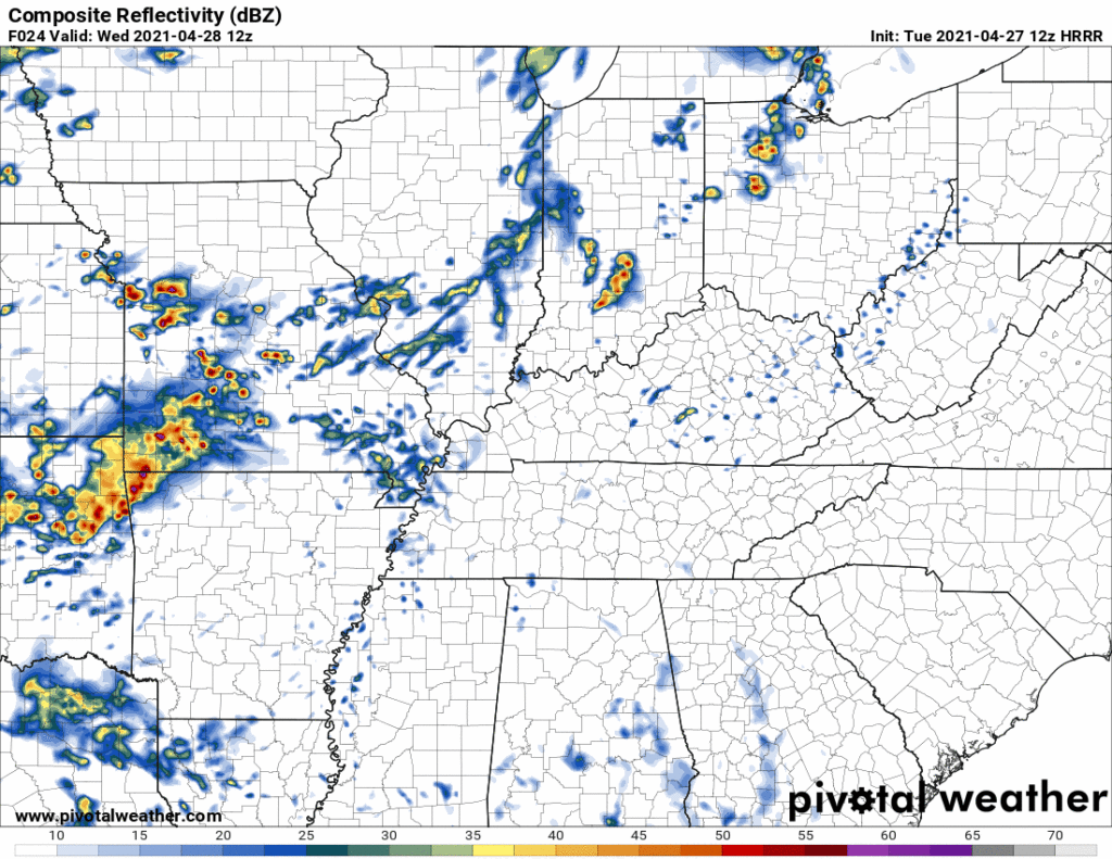
More rain may develop closer to midnight Wednesday night.

I hope your air conditioning works.
Rain is possible Wednesday afternoon. The HRRR shows a few showers popping up, but most of them develop east of us. So chances are real, but low.
More rain may develop closer to midnight Wednesday night.
Overnight rain has already affected some outdoor sporting events today:
The HRRR shows a large portion of the rain moving out around 3 pm. Showers will still linger into the evening hours, but our area should be clear before 9 pm.
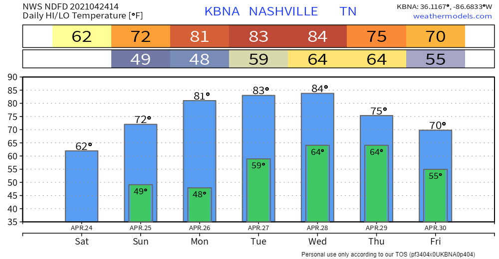
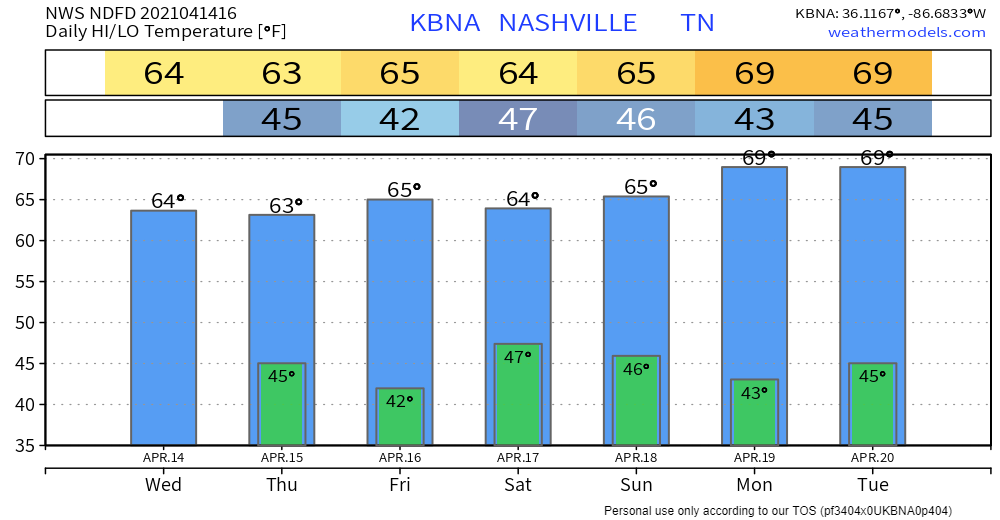
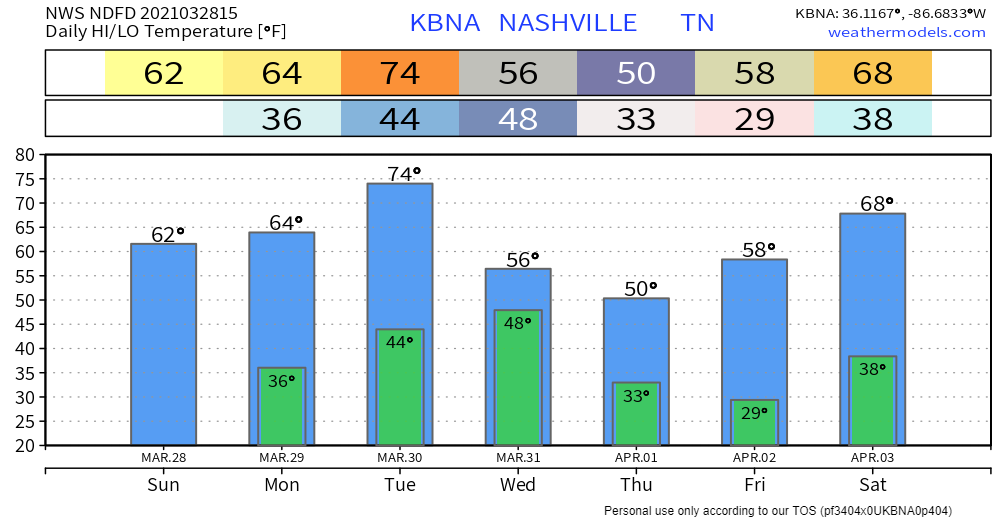
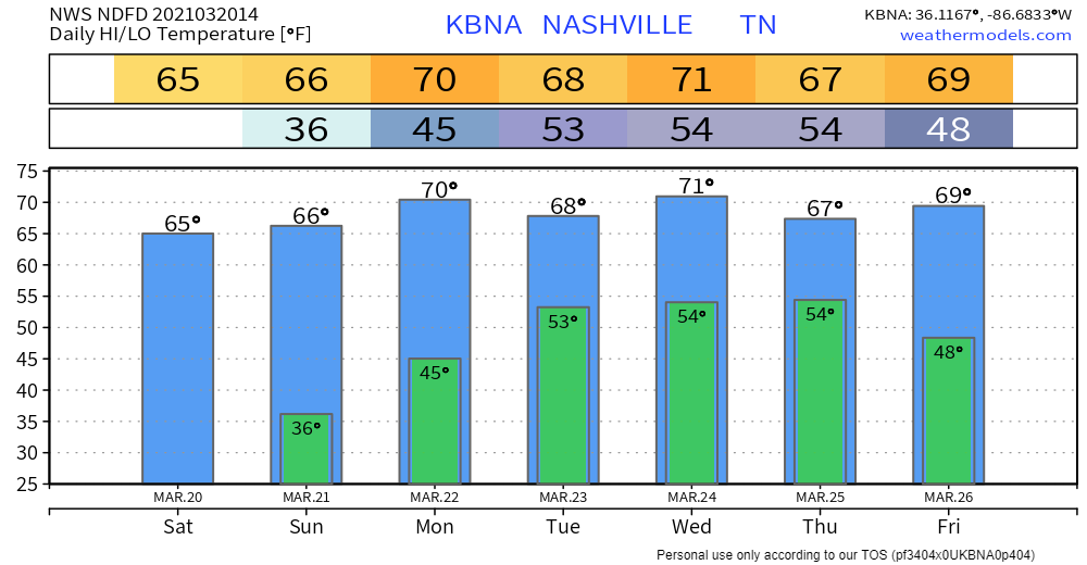
Not much to report on for today and Tuesday: mild temps and plenty of sunshine.

This is due to a cold front coming through the area.
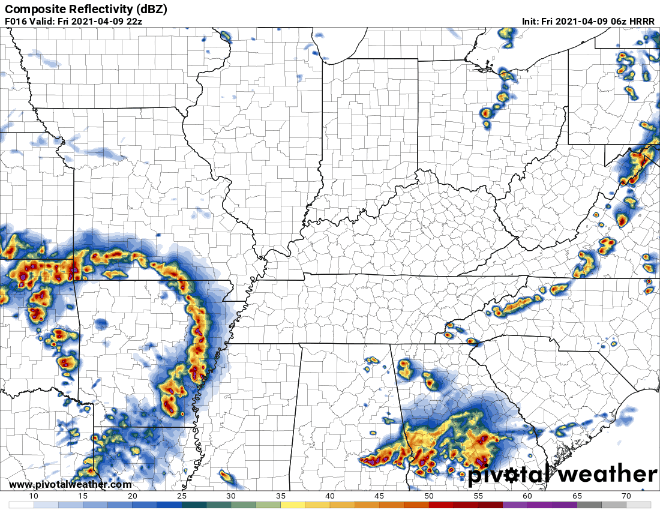
Models show showers beginning around midnight. Here’s the Euro:
Some areas may have already seen some rain this morning.
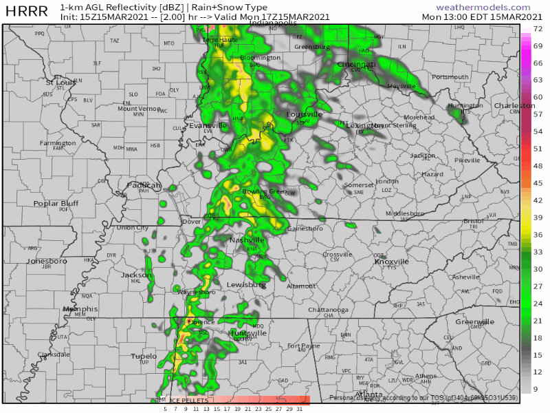
The HRRR shows showers entering the area by lunch.
Spotty showers will continue into the evening hours. This doesn’t look to be a washout, but:
Will they be severe? Will they cause damage? It’s doubtful… But let’s dive in
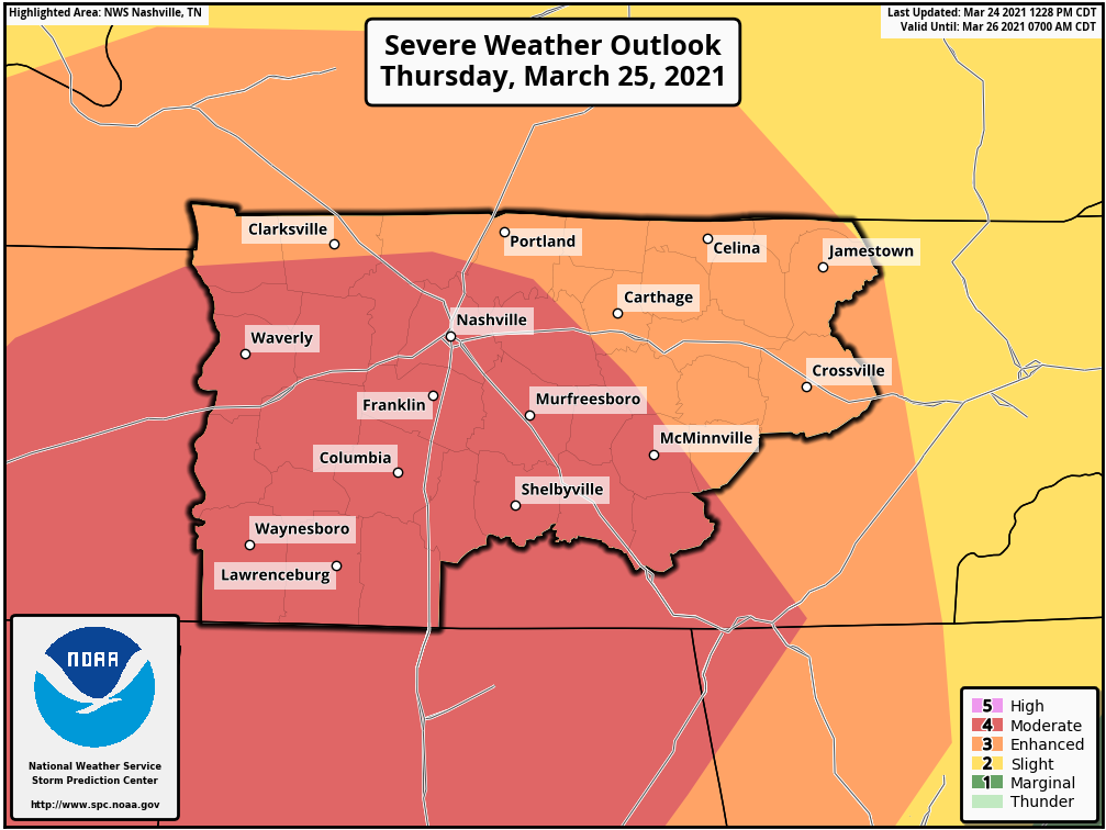
The Storm Prediction Center has put us under a marginal risk of severe storms (level 1 out of 5) for late tonight through early Saturday.

Nothing much to talk about today and Tuesday – plenty of sun and warmer temps.
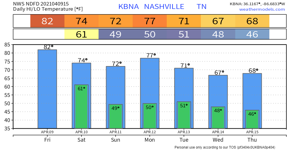
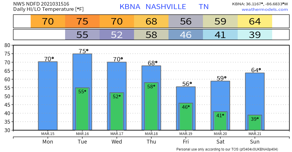
We could see a couple showers Wednesday afternoon, but the main event will come through late Wednesday night into early Thursday morning.
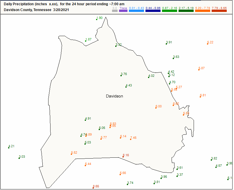
24 hour rain fall totals from various observers in Nashville:
Williamson County:
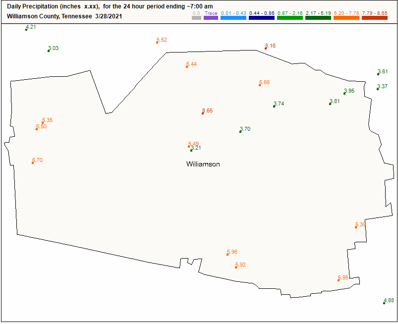
The rainfall was historic:
Editor’s Note: We lost 4 people in this flood, at least that’s how many we know about as of noon Sunday. Each immeasurably valuable. The Mayor held a noon press conference and promised thorough investigation to understand the circumstances of each person having lost their life due to flash flooding. Investigations improve future messaging. But right now I do not want to reduce the lives of each of these four people into a lesson we expect to be taught later. Nothing is more important than a life. When we lose one it seems to me the community should mourn the person and surround his and her loved ones with love, kindness, and support, regardless of circumstances. Same is true for those who woke up with water in their home, businesses, and cars. Donate, give, love.
Our current thinking is that storms will come in two rounds. HRRR below shows round 1. We’ll see rain begin to move into the area around 8 am. Although this will not be the severe weather event, we will begin to see high rain totals. Do not mistake this for the main event.
March 20 marks the first day of spring in the Northern Hemisphere! Satellites caught something pretty cool this morning:
Editor’s Note:

Clouds will continue to move out this afternoon, giving way to beautiful skies.
Lunchtime rain is moving out. Should be clearing this afternoon.
This will all depend on two things: morning rain and where a high pressure is:
The Storm Prediction Center has put Nashville and Will Co under a 5% chance of seeing a severe storm within 25 miles of a point. The southwestern half of Williamson County is under a 15% probability, but I would not pay too much attention to that — the risk isn’t 10% higher in Franklin vs Brentwood, or the rest of our area.
You must be logged in to post a comment.