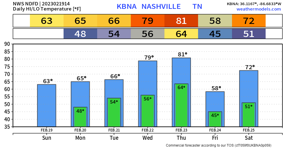
During the day today, it will be quite lovely. High temps will try to hit the 80° mark, attempting to get to the daily record high of 81°. Then the end of the nice weather will begin with round one tonight.

During the day today, it will be quite lovely. High temps will try to hit the 80° mark, attempting to get to the daily record high of 81°. Then the end of the nice weather will begin with round one tonight.
First things first, today will be beautiful. Whole lot of sun, high temps in the low 70’s, won’t feel like the last day of February.
The majority of Wednesday will be really nice. We’ll make a run at the record high of 81° during the day. Clouds will gradually increase throughout the day.

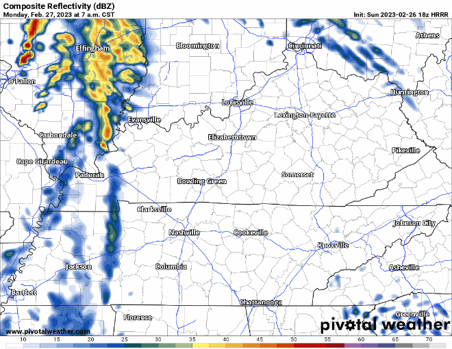
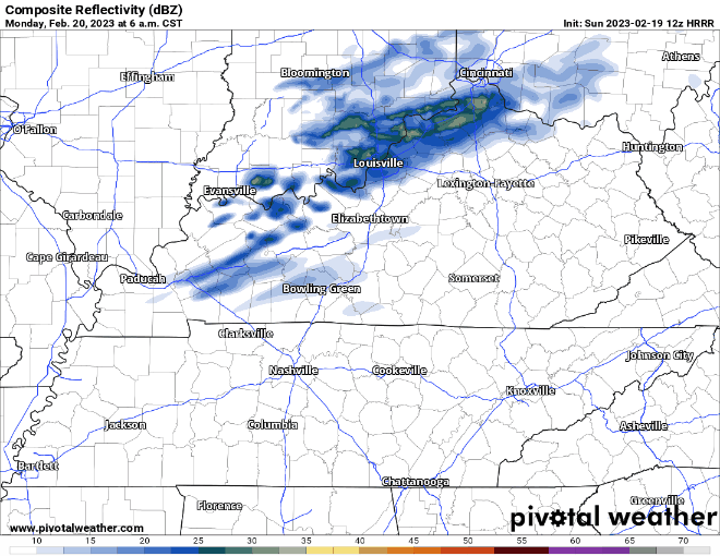
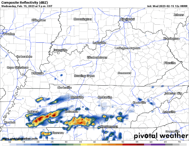
On and off showers will continue for just a few more hours, clearing out around noon or so. You can always check the radar on our website here: Radar – Nashville Severe Weather
We’re still under a Wind Advisory until 6pm today. Sustained winds of 20-30mph, with gusts up to 45mph will be possible. Secure any outdoor decorations/furniture that you care about.
Rain has moved out from this morning, but clouds will stick around for the rest of the day.
Rain will creep back in Monday morning, not worried about severe weather, just some quick-hitting rain.
On Monday there is also a Wind Advisory from 6am – 6pm. Sustained winds of 20-25mph are expected with gusts up to 40mph possible. Batten down any outdoor furniture.
We’re hanging out at Severe Weather Awareness Day, come stop by and say hi. More details here: Severe Weather Awareness Day 2023
Starting off Saturday with some rain. WillCo. even got some lightning strikes earlier. I think thunder chances are mostly gone, leaving us with just a couple more hours of rain. WillCo. will get the majority of the rain. We’ll dry out this afternoon and evening, setting up for a dry, but cool home opener at GEODIS.
Generally speaking; it’ll be a warm and dry next two days. Only rain in the next 48 hours may be some light and quick showers Monday morning.
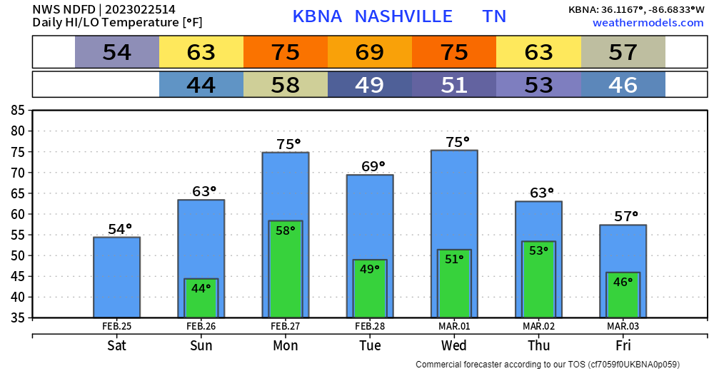
The remainder of the week will still be warm, dare I say borderline hot Wednesday and Thursday, with high temperatures pushing the low 80’s – but pretty wet. Rain chances exists Tuesday – Saturday.
Started off cold this morning, but temps are slowly getting up to a somewhat tolerable level. High today should be around 50°.
Maybe some light rain moving in tonight around 10 or 11pm. These will be light and quick, and depending on your sleep schedule, you may not even notice them.
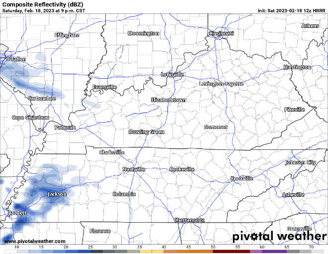
Round One is good as gone.
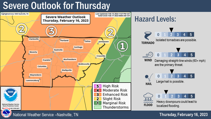
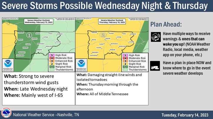
For days we have been talking about this “break” in-between rounds. We didn’t know what it would look like. Models are now in good agreement, along with support from current observations, that the break will be long enough for the atmosphere to sufficiently “recharge.”
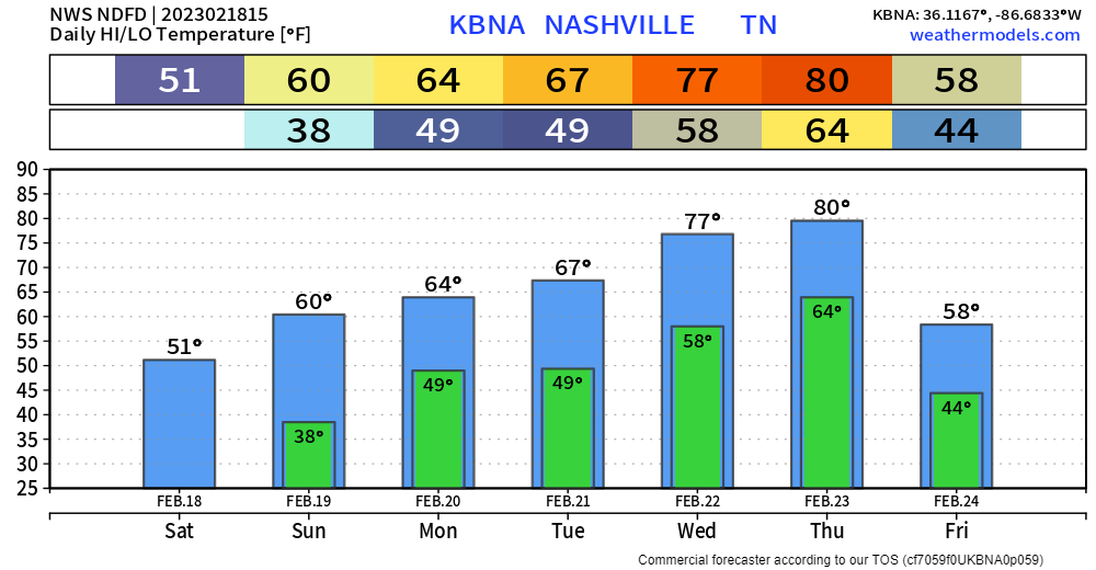
Warm day today, with the high temperature expected to get near 75°. Record high for 2/15 is 77°, we might’ve gotten there if we had some more help from the sun, but we won’t see too much of it today.
Love is in the air, but bad air quality isn’t. Crap apps were showing bad air quality yesterday, when our air was and is totally okay. Nothing from Ohio is blowing down here.
Today will be warm, but windy. A Wind Advisory will be in effect from 3pm today – 3am Wednesday. Sustained winds of 20-30mph, with gusts up to 45mph possible.
You must be logged in to post a comment.