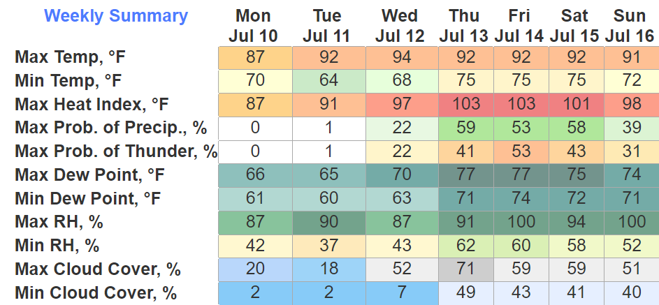
One, probably two more dry days ahead of us. Rain chances return Wednesday but most of the activity looks to stay to our west. The humidity goes up tomorrow so if you have anything outside you need to get done, today is your day.

One, probably two more dry days ahead of us. Rain chances return Wednesday but most of the activity looks to stay to our west. The humidity goes up tomorrow so if you have anything outside you need to get done, today is your day.
Not too often you get a big donut for rain chances in July, but today and tomorrow (ok I know it’s 1% but close enough) are examples of it.
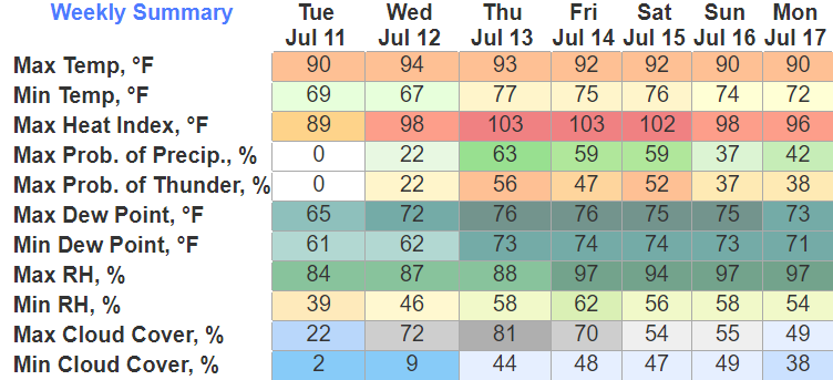
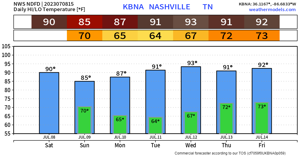
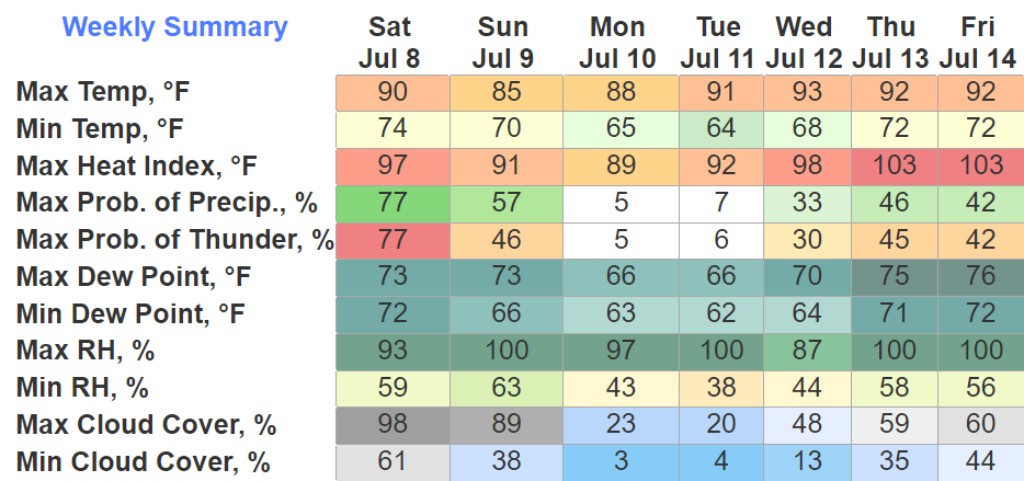
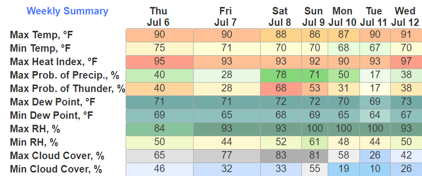
Our dry streak will be short-lived as rain chances return Wednesday and stick with us the rest of the week. Along with rain chances returning, the humidity will also return as heat index values climb into the 100’s.
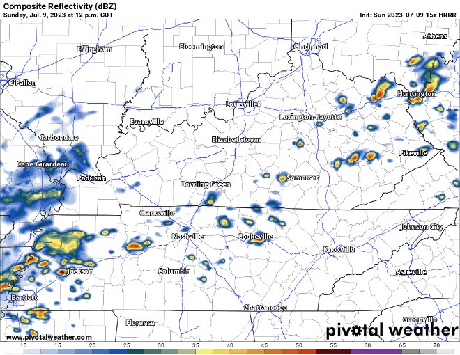
HRRR model (below) thinks showers/storms will pop-up and move through this afternoon and evening.
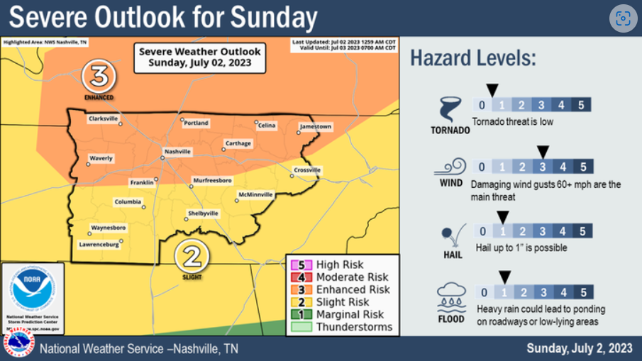
Similar to yesterday, storms could initially be strong, a storm or two could reach severe limits with some damaging straight-line winds, along with heavy downpours and frequent lightning. When thunder roars, go indoors. Rain could linger for a few hours this evening.
Fairly pronounced rain chances today and tomorrow, that come with a chance of damaging straight-line winds.
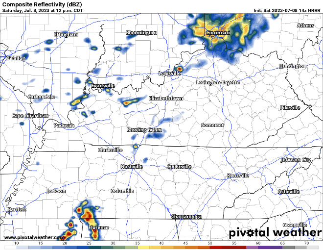
Scattered showers/storms are possible throughout the day, then a line of storms moves through this evening. HRRR model (above) thinks said line moves through around 7-8pm. This ETA could be off, or the line could not even exist. The beauty of weather.

wattery was purposely not capitalized today, as the chances won’t be as pronounced.

HRRR model (above) shows coverage fairly scattered. Probably not too many winners today, but those that do win could see some heavy rain, gusty winds and lightning.
The Wattery is a funny game. Everyone plays, but not everyone will win. Also unlike the lottery, which if you win, you are happy. If you “win” the Wattery, some people may not be so happy.
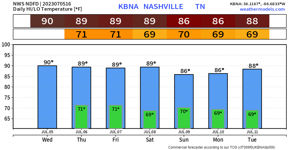
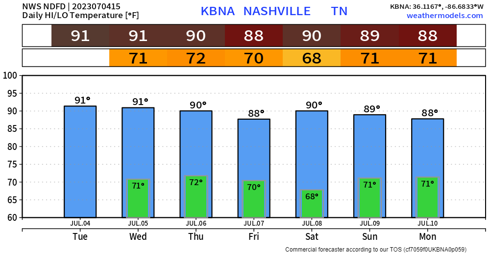
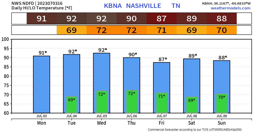
For about the next week we’re looking at your basic summertime pattern.

Storm Prediction Center has removed us from severe probabilities today, Wattery chances still possible, although low chances.

Wish I had a better forecast to share for the 4th, but unfortunately that’s not the case.
Before Wattery chances pick up, it’ll be hot. Not last week hot, but still hot. Heat index values will near 100°.
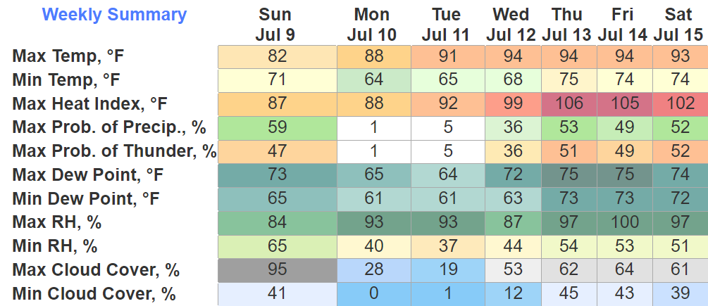
We finally are not outlooked for severe weather today. We should stay dry. Much needed and well deserved. Heat index only in the mid 90’s, also improvement.
Anddd that won’t last long, as the Wattery returns for the 4th.
There’s a chance of severe weather today, which means getting information will be vital. If you reach your “rate limit exceeded”, here are some alternative ways to receive new information. This is based off my personal experience and some ways may not work for everybody.
You must be logged in to post a comment.