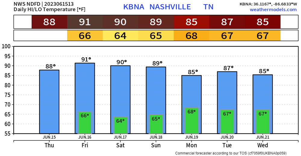
Typical middle of June day, the same can be said for Friday and Saturday. Wattery and hot. Sunday is a little different, we’ll touch on that later.
Refresher on the term “Wattery”. It’s complex but tell your friends and they’ll be sooo impressed. A four-sided pun? Who wouldn’t just be flabbergasted about your vast knowledge.
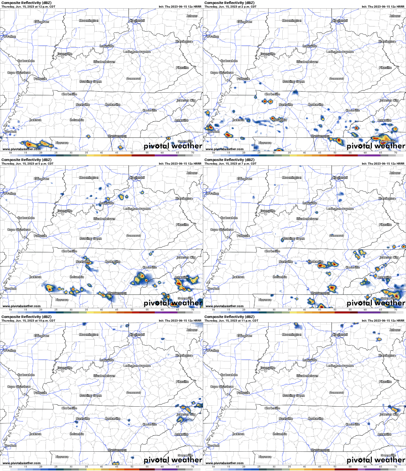
HRRR model (above) thinks your best shot of winning will be this afternoon. No severe weather expected, but lightning, gusty winds, and heavy rain all possible. When thunder roars, go indoors.
Friday will be similar to today, coverage of rain/storms will be less tho. See HRRR model below.
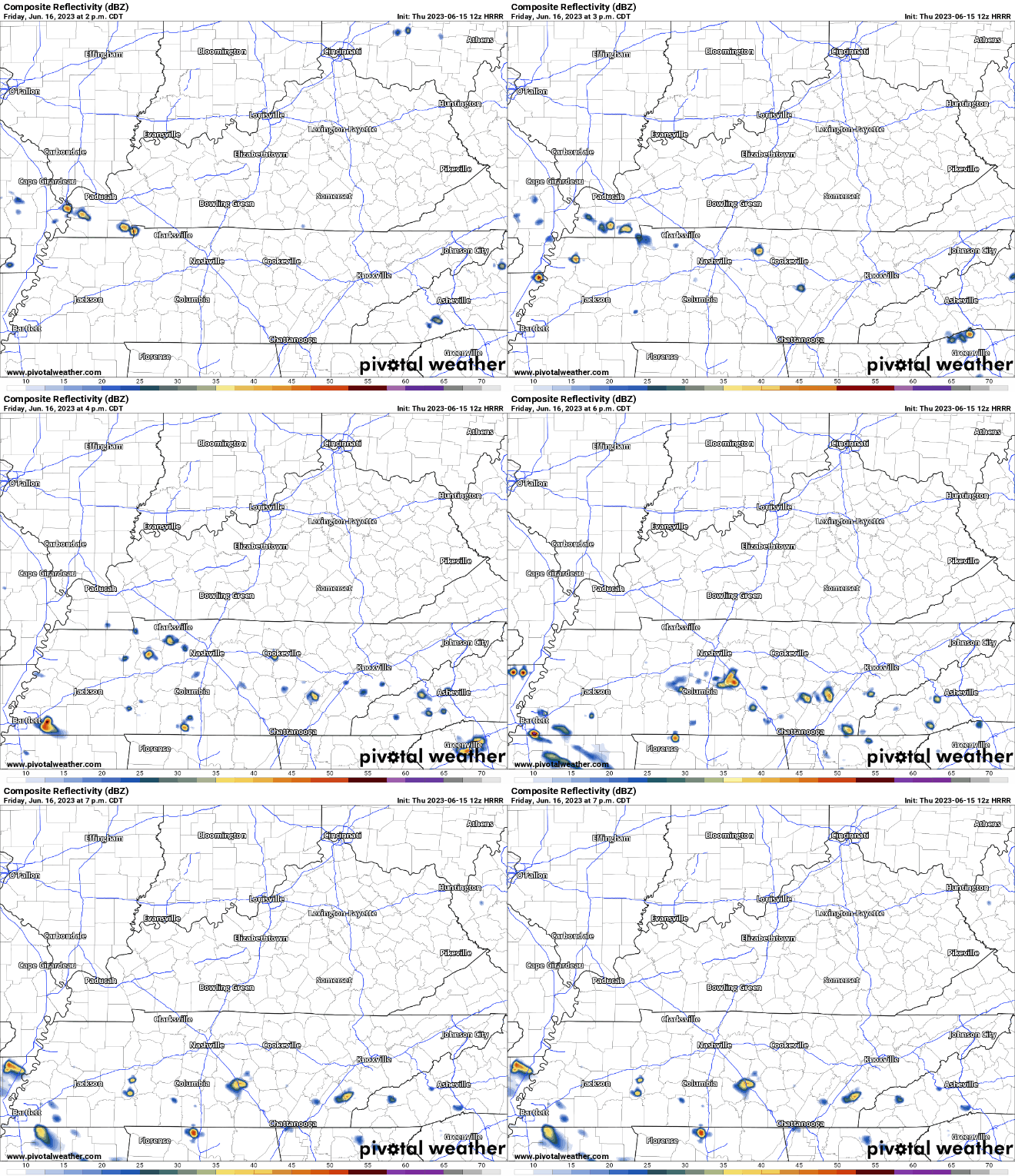
Andddd Saturday will also have Wattery chances, but if you win, you’d be pretty unlucky (or lucky if u are parched grass), chances will be lowww.

Update on Sunday
Yesterday, portions of Williamson County were outlooked with a 15% chance of severe weather within 25 miles. Today, the Storm Prediction Center has shifted the outlooked area, and we aren’t included anymore (with the exception of people who live on the border of Will. Co. and Maury.
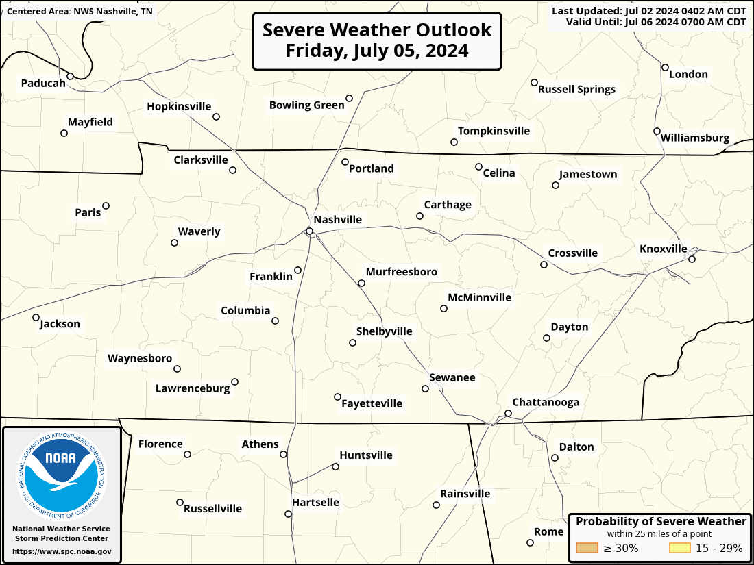
Still 4 days out, so it could easily shift right back. But the SW shift is encouraging. Sunday still looks wet, and strong storms cannot be ruled out. Timing and other specifics are still fuzzy with it being 4 days out.
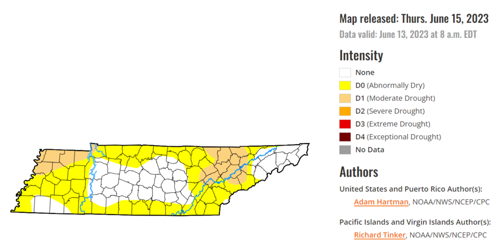
Beginning of next week looks wet, solid rain chances thru at least Wednesday. This should help to knock out the ‘Abnormally Dry’ conditions in Davidson Co. Grass everywhere has their blades crossed.
Quick References:
Weather changes constantly.
Follow @NashSevereWx on Twitter for any changes to this forecast.
We are 100% community supported. No ads. No subscription fees. Keep it free for everyone.
Categories: Forecast Blogs (Legacy)




You must be logged in to post a comment.