
The dry streak can only last so long, and it looks to come to an end today.
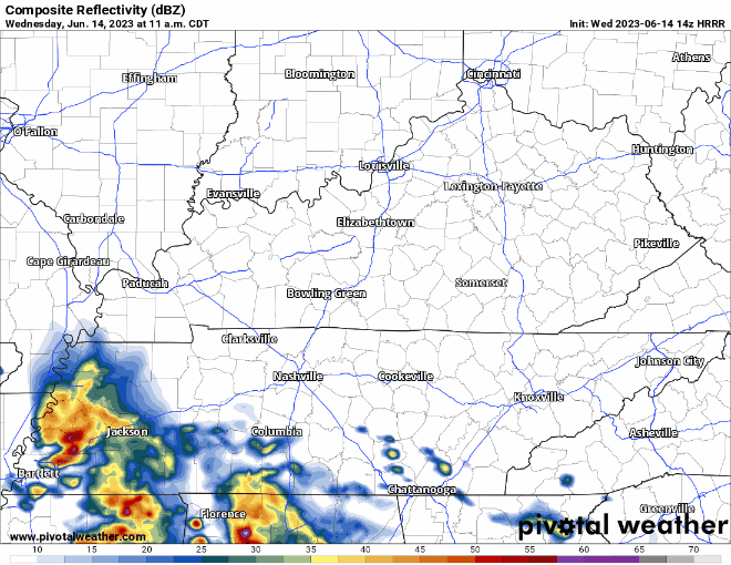
HRRR model (above) thinks our best chance of seeing rain/a storm will be this afternoon and evening. Additional showers/storms are possible around sunset. No severe weather expected, but lightning, gusty winds, and heavy downpours all possible.
Although we are not included in any severe weather chances, the same cannot be said about our neighbors to the south. If you are traveling through this area, or know anyone that is, give them a heads up. Significant severe weather is possible down there today.
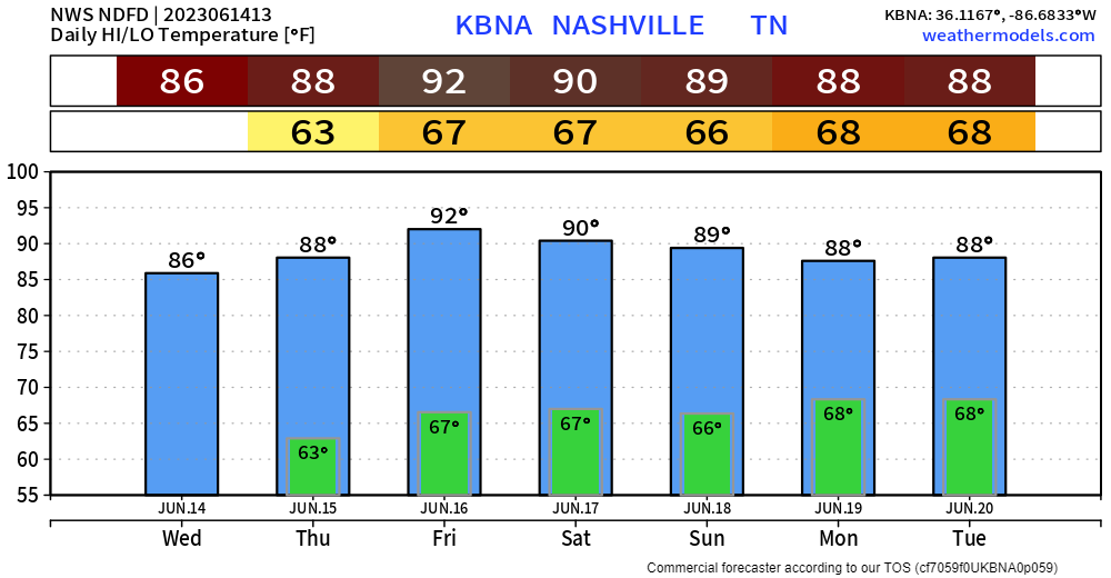
Thursday thru Saturday will be very similar to one another.
- Wattery chances exist, especially during the afternoon/evening
- No severe weather expected, but the usual package that comes with the Wattery possible
- Getting to that time of the year when we go from using “warm” to “hot”, high temps in the low 90’s with heat index values a few degrees higher
Severe Weather Sunday?
We turn our eyes to Sunday, portions of Will. Co. have already been outlined with a 15% chance of severe weather within 25 miles.
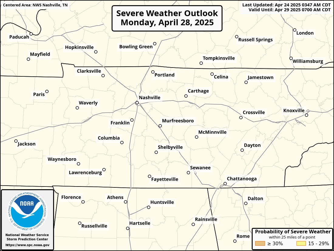
This is five days out, so a lot will change between now and then, but just something to keep in mind when planning anything Sunday. Details are still fuzzy, we’ll know more as we get closer.
Unsettled pattern seems to continue into the beginning of next week as well. Rainfall totals thru Tuesday look to range from 1.5″ – 3″. Luckily it should be spread out enough, so we avoid most flooding problems.

Quick References:
Weather changes constantly.
Follow @NashSevereWx on Twitter for any changes to this forecast.
Live coverage during tornado and severe thunderstorm warnings:

Look good.
Support the mission.

We are 100% community supported. No ads. No subscription fees. Keep it free for everyone.


Categories: Forecast Blogs (Legacy)
You must be logged in to post a comment.