The sun set at 4:36pm today, that’s quite sad. Thankfully, the sun will set later in the day from now on.
Winter will officially begin at 9:27pm, when the Winter Solstice occurs. However, based on the forecast, it sure doesn’t feel that way.
Tomorrow, we embark on a temperature roller coaster.

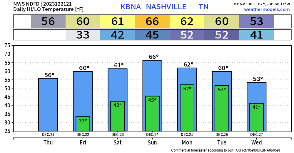
Sunrise temperatures will be around 33°. That’s cold.
Afternoon temperatures will get all the way up to 60°. That is…dare I say warm?
High temperatures thru Tuesday will be in the low to mid 60s. Not near any records, but several degrees above average for this time of year.
Rain Chances Return
Models continue to show low rain chances Friday – Christmas Eve. I think Saturday has the “best” chance of you seeing a shower out of those three days, although those chances are still low. Timing for this is difficult to nail down, as there isn’t a very clear timeframe. If you do see a shower, it wouldn’t be much and would move on quickly. No severe weather is in the forecast.
Christmas Day continues to look quite wet and mild.
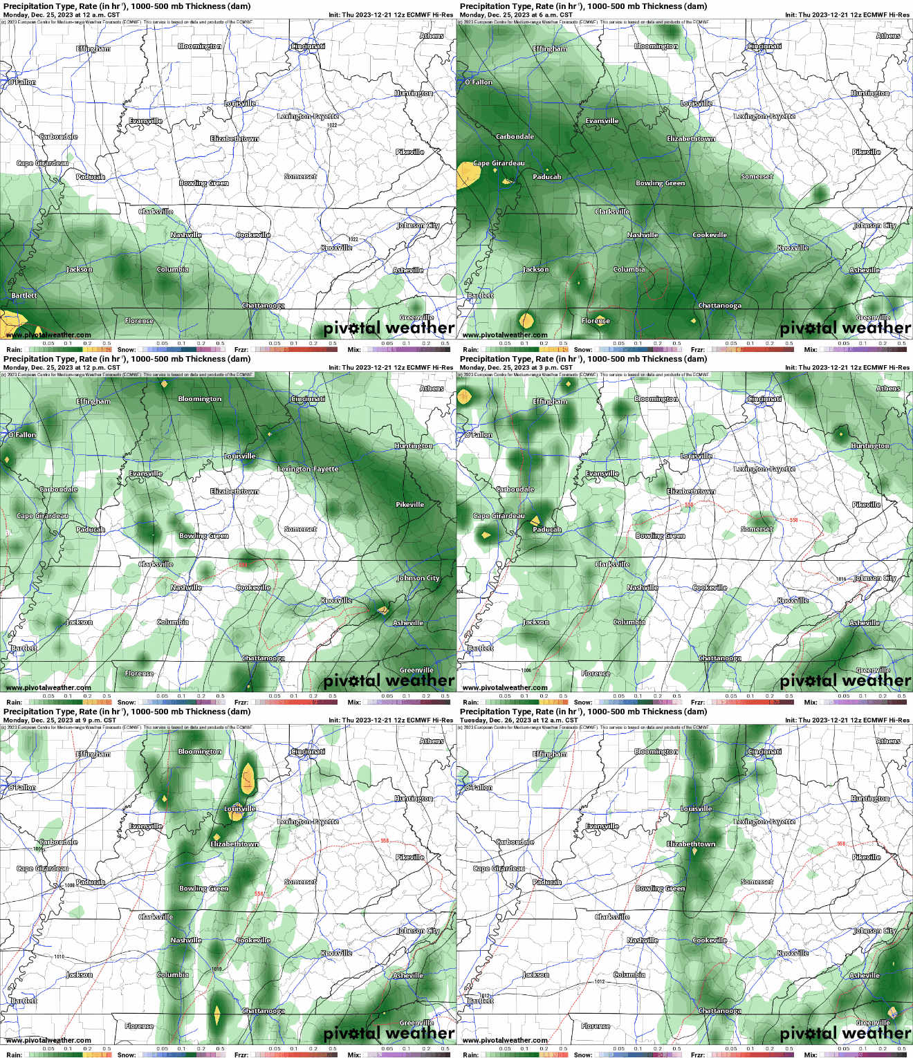
High-res models aren’t quite in range, but the EURO (above) shows a good soaking in the AM hours, with maybe some breaks mid-day, then some more rain in the evening. Timing could change as we get closer. No severe weather is expected, although a rumble of thunder cannot be totally ruled out.
Rainfall totals of around 0.5″ – 1″ will help with our ongoing drought. Which speaking of…
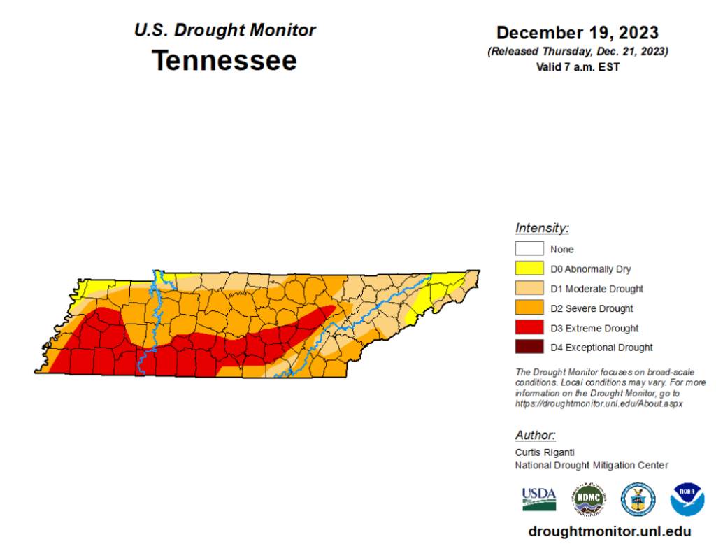
…the drought monitor was updated today and has both of our counties in a Severe Drought. So, although the timing of the upcoming rain isn’t the best, we sure do need it.
Rain chances diminish Tuesday.
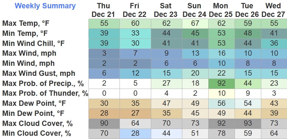
Quick References:
Weather changes constantly.
Follow @NashSevereWx on Twitter for any changes to this forecast.
We are 100% community supported. No ads. No subscription fees. Keep it free for everyone.
Categories: Forecast Blogs (Legacy)




You must be logged in to post a comment.