
Rumors of sNOw have been flying around; however, our time for accumulating snowfall is not in the forecast.
Air aloft will be cold enough to support some snow falling from the sky, but our surface temperatures will be too warm for any of it to stick. You may see a few snowflakes, but they’d melt on contact with the ground.
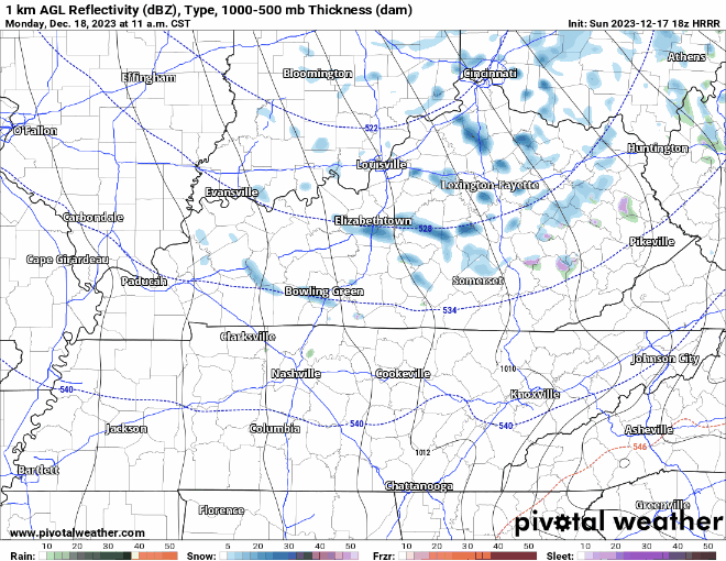
HRRR model (above) shows if you want to see some snow, head to north KY or East TN.
Gusty Winds Monday
Other than seeing a few flurries, the other headline for Monday will be some gusty winds.
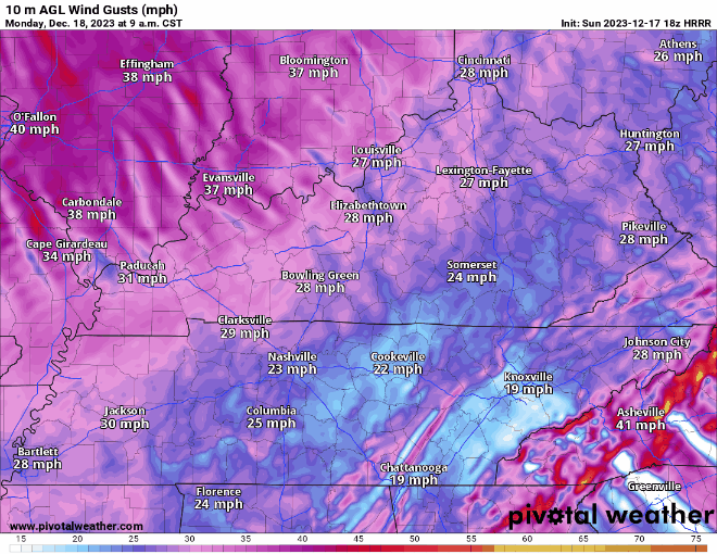
Gusts up to 30-35 mph will be possible from mid-morning thru the afternoon hours. Secure outdoor furniture, trashcans, Xmas decorations. The jerk wind from the NW will make it feel like we are stuck in the 30s all day.
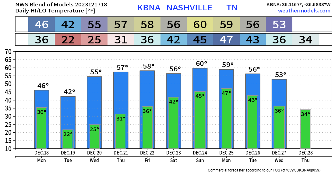
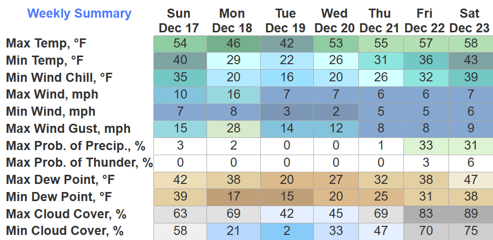
Tuesday AM will have some of the coldest temps we’ve experienced so far this “winter.” Waking up to temps in the low 20s, some places could reach the upper teens.
We’ll be dry, with a warming trend throughout the work week.
Rain Chances Return…Next Weekend
Like clockwork, our rain chances will return next weekend. Still really far out, but long-range models are hinting at some wet weather for Santa. Temperatures during this time look to be several degrees above average. A lot could, and probably will change between now and then. We’ll be watching.
Quick References:
Weather changes constantly.
Follow @NashSevereWx on Twitter for any changes to this forecast.
Live coverage during tornado and severe thunderstorm warnings:

Look good.
Support the mission.

We are 100% community supported. No ads. No subscription fees. Keep it free for everyone.


Categories: Forecast Blogs (Legacy)
You must be logged in to post a comment.