
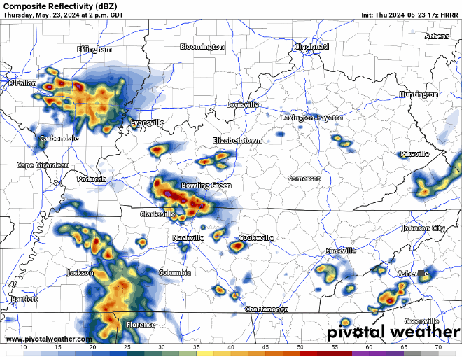
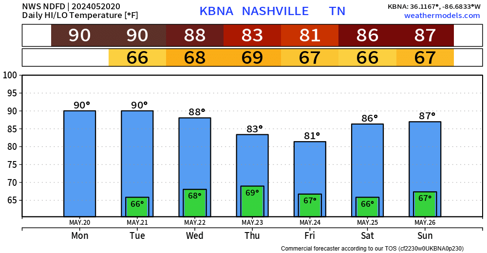
Not a whole lot going on today, an outside chance of a quick shower/non-severe storm, but the overwhelming majority of us will stay dry today.
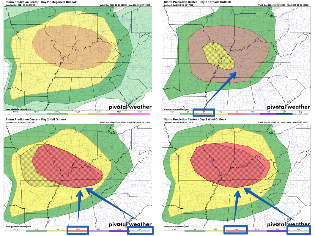
All eyes are on Sunday.
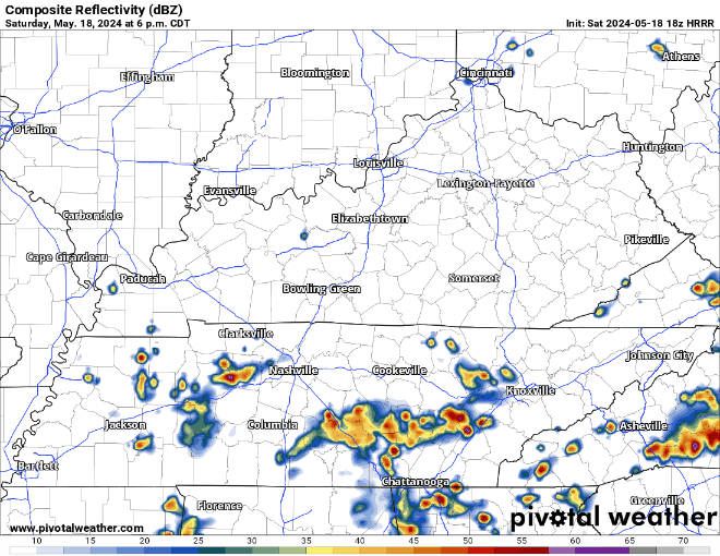
Both of our counties are outlooked with “x” probability occurring within a 25 miles radius of you:


You must be logged in to post a comment.